Rätikon High Route - Schesaplana and Schweizersteig
Our Circuit on the Rätikon High Trail
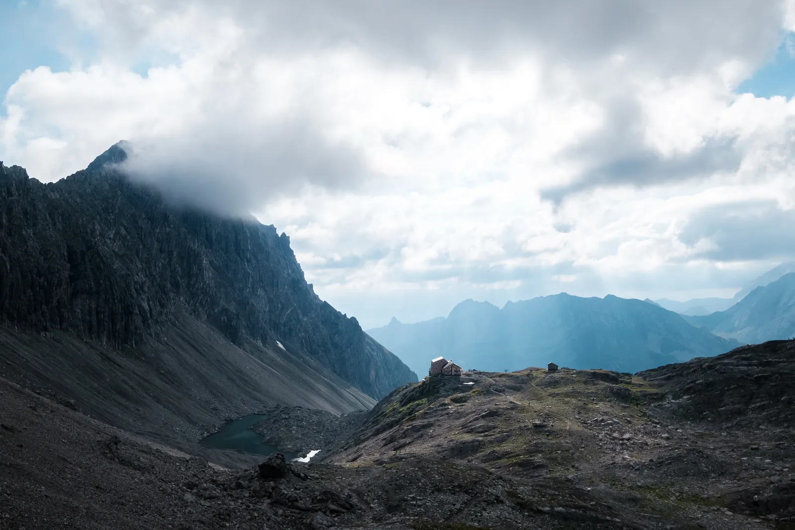
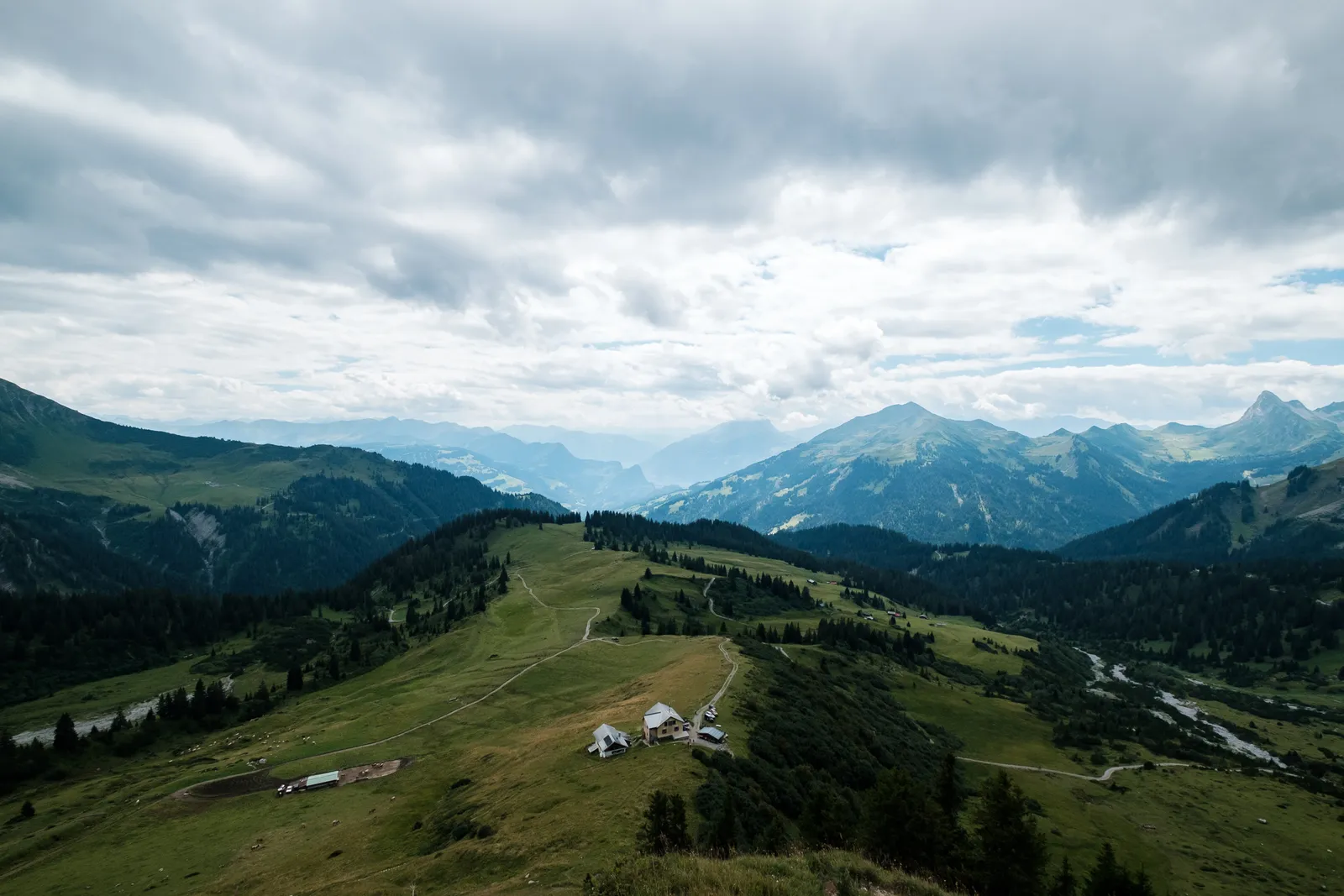
Start and End of our Circuit in the Rätikon Mountains was the Lünersee in the austrian Montafon. We started our hike there with a climb to the Totalphütte, continuing across the Schesaplana peak to the Schesaplana-Hut. From there we walked along the Prättigau Höhenweg towards the Carschina Hut. A shortcut brought us to the Tilisuna Hut, where we stayed two nights, before embarking on our last two trail days, of which the first brought us to the Lindauer Hut before we spent our last day walking back to the Lünersee.
- Section 1 - Climb to the Totalphut
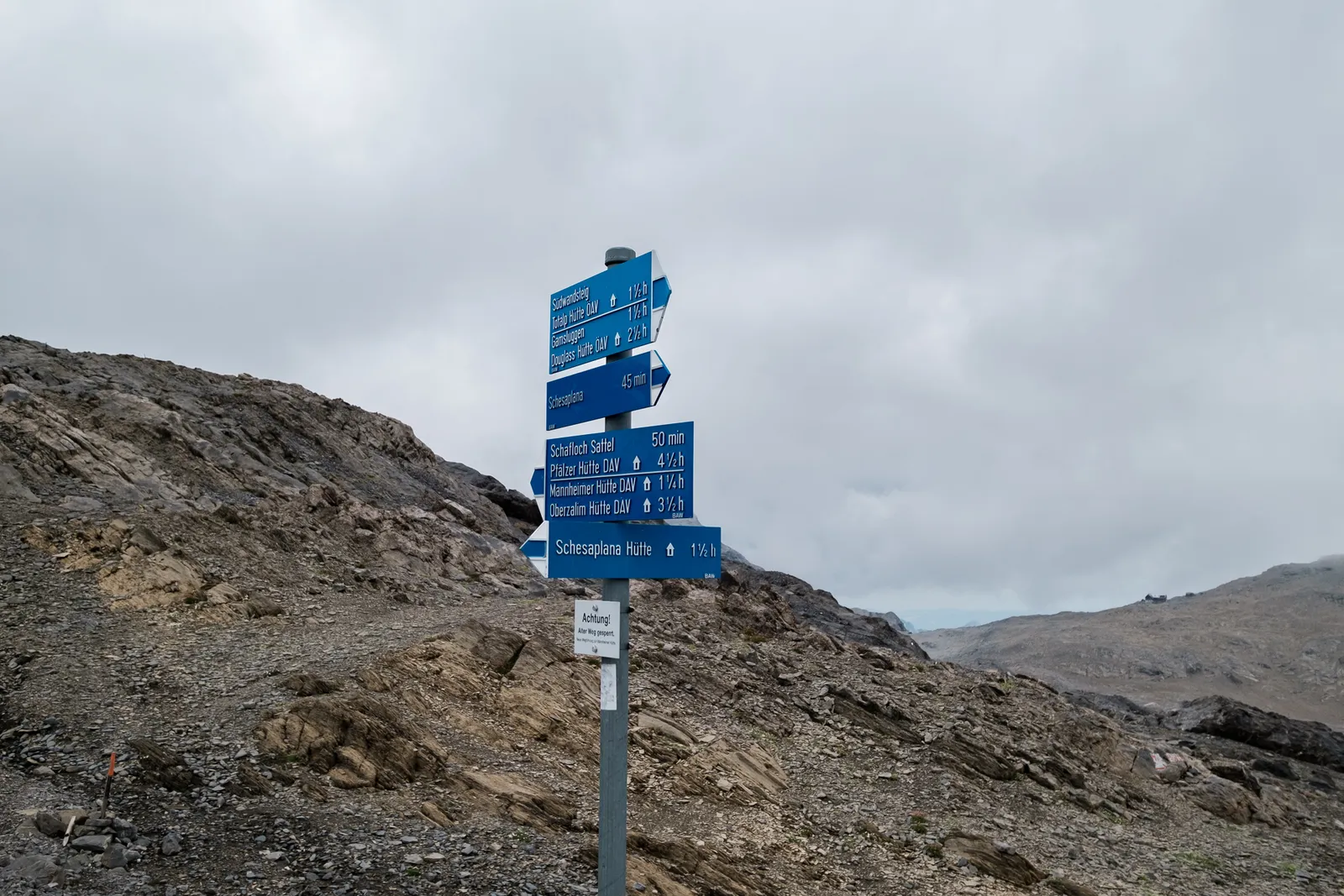
- Section 2 - Crossing the Schesaplana towards the Schesaplanahut
- Section 3 - Walking the Prättigau Höhenweg to Carschina-Hut
- Section 4 - Shortcut from Carschina- to Tilisunahut
- Section 5 - Walking from the Tilisunahut to the Lindauer Hut
- Section 6 - Back to the Lünersee
Our alarm woke us at 6:30, so we got out of bed and packed our bagst before venturing into the common room to have breakfast. The hut breakfast is such a feast compared to the self-sufficient hikes we have done in the last years and we do have to say that we enjoy the luxury quite a bit. Especially since we don't have carry it around...
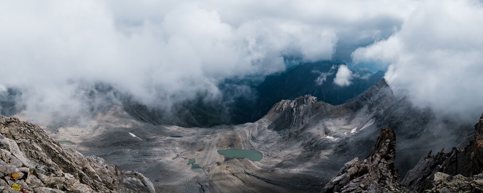
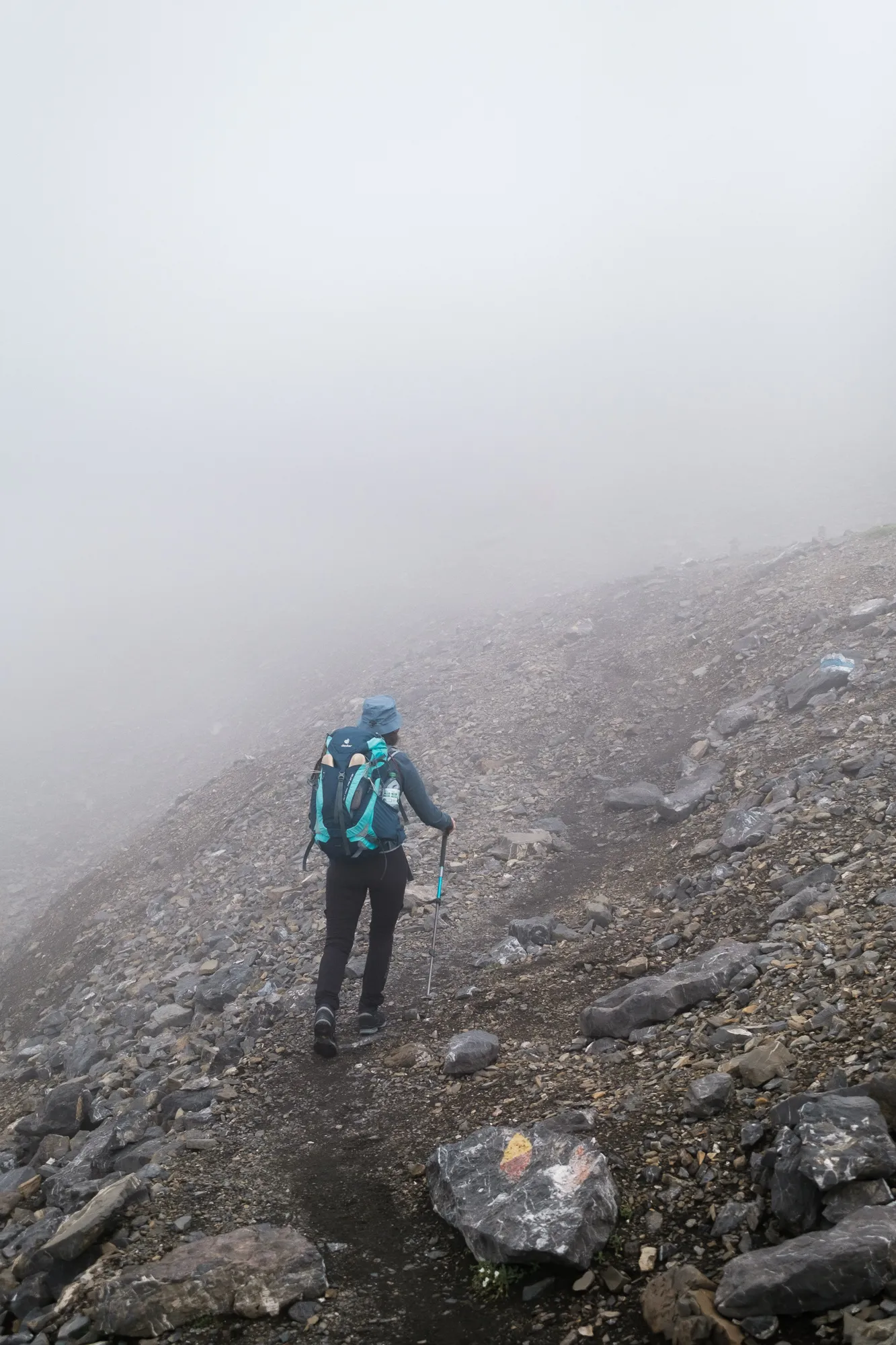
Todays walk was not a far distance but a demanding hike up to the peak of the Schesaplana, the highest peak of the Rätikon, and back down into the valley on the other side. The weather was pretty dark but it made a nice atmosphere with the sun just shining through the thick clouds. Especially when we had a nice view back onto the Totalphütte sitting on its little rocky pleateau.
Ascent to the Schesaplana
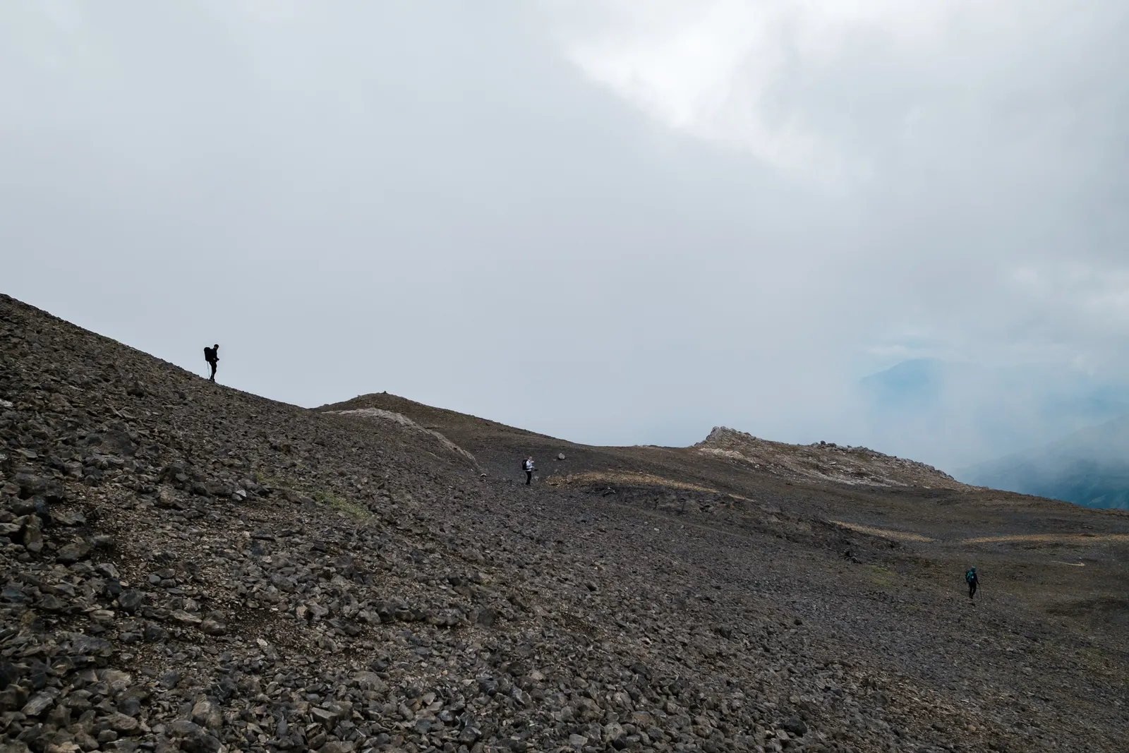
From the hut its only about 500m to ascent until reaching the peak. After a few flat meters we started the ascent through rocks and scree at the end of the valley, hiking up fairly steep before reaching another pleateau. Here the trail split into two routes, one of which we had put in our notes as a bad-weather-alternative that would have led us over the Gamsluggen-Pass on the other side of the basin, before descending down into the valley to the Schesaplana Hut. That route is not quite as steep but considerably longer, and of course, it leaves out the Schesaplana peak.
While it was cool and dark but nevertheless nice, so we followed the route we had originally planned towards the peak. After a short time we reached a second crossroads, where we could have taken a path on the western flank, also bypassing the peak. Once again we stuck to the original route and kept ascending.
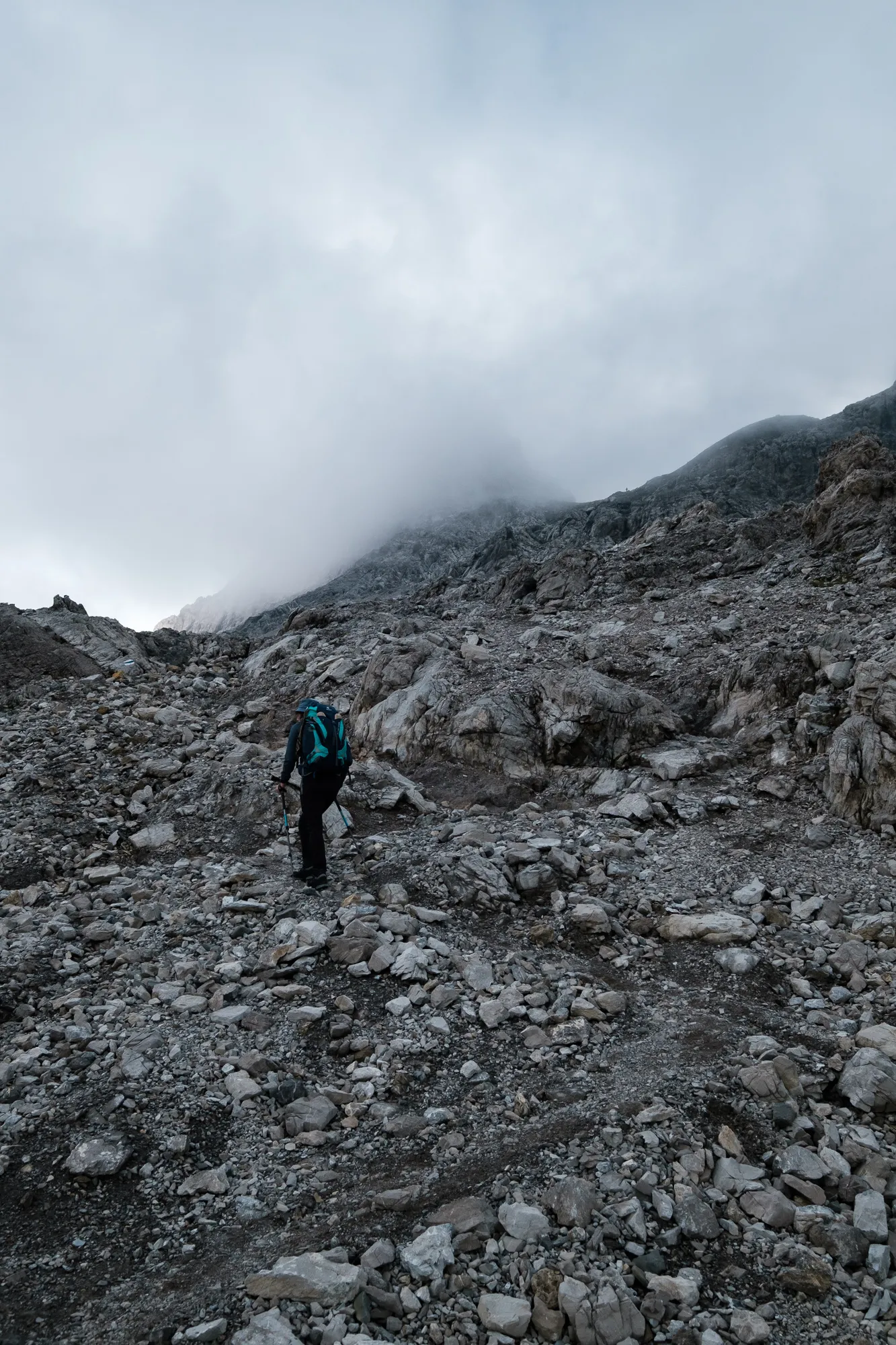
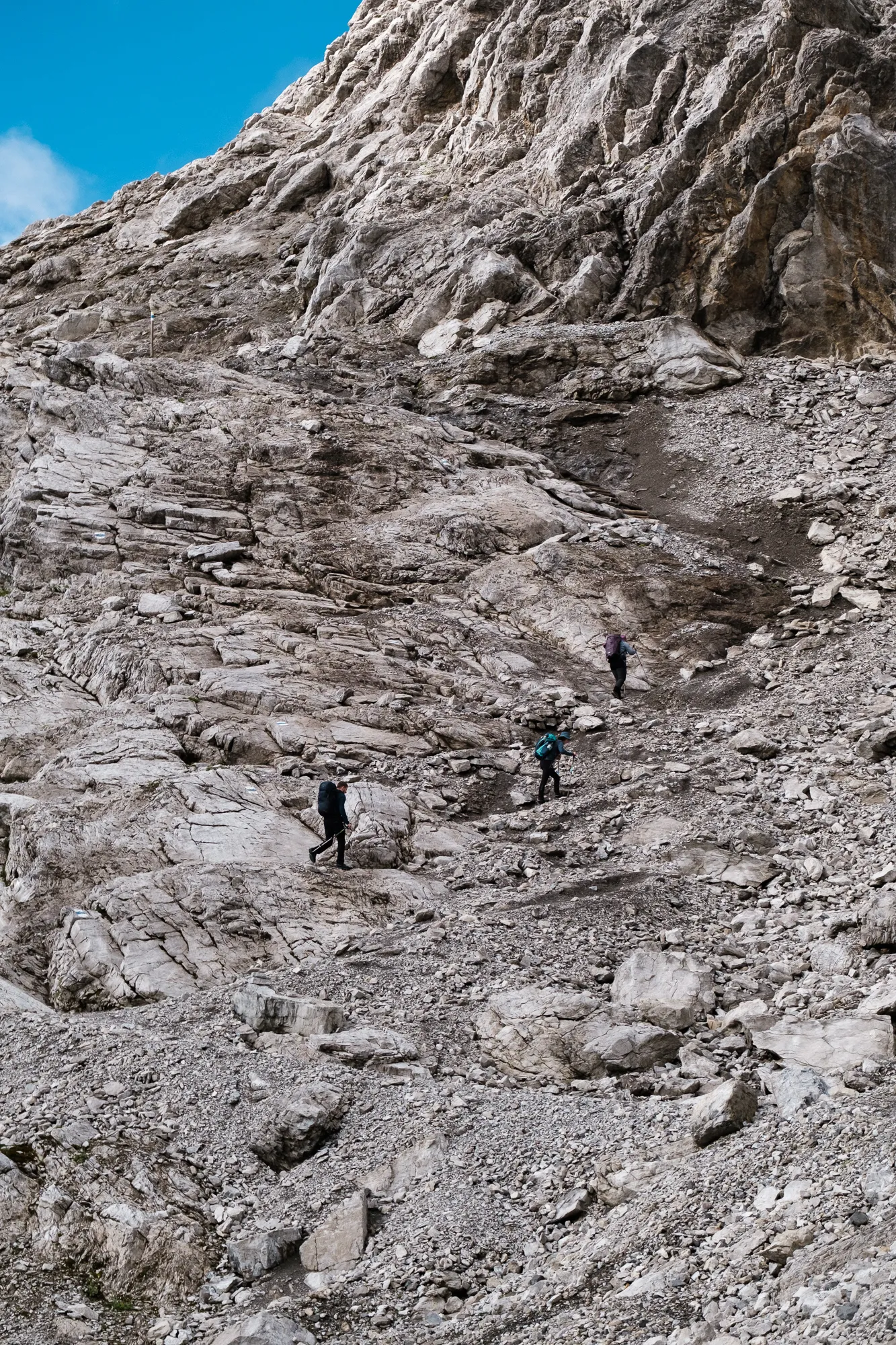
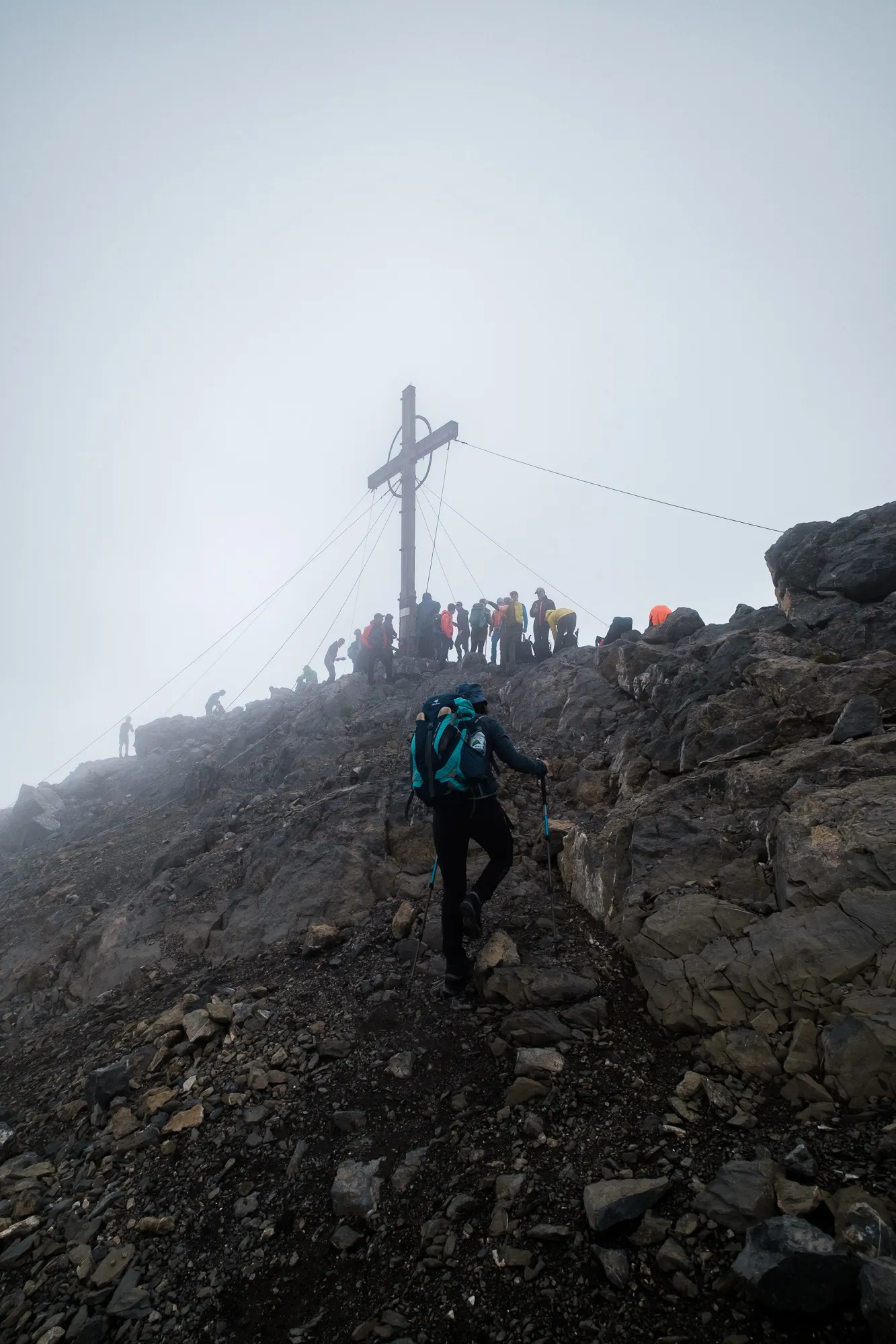
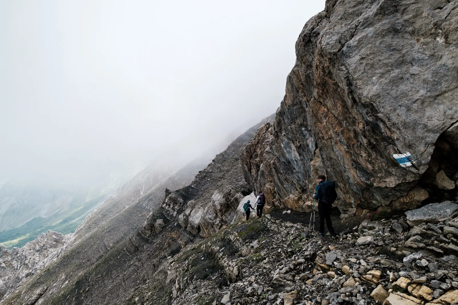
The path grew steeper and in some places steel ropes were placed for safety. As we ascended, the clouds grew thicker and soon we were in the middle of of the wet, gray fog. The trail was clearly marked and it was still easy enough to follow, so we continued on. Once we had climbed up a steep rock face and reached another small pleateau though, the clouds first became very thick, and then cleared up a little bit so that we could kind of see the silhouette of the peak in front of us, as well as a chain of colored dots that were the other hikers making their way up.
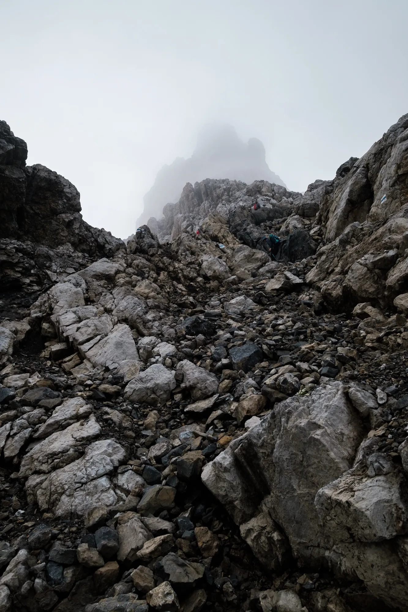

After the pleateu followed a bit of rocky terrain with weird grooves, that made it hard to walk in places and slowed us, as well as the groups in front of us, quite a bit. We carefully walked through the deep grooves so as not to sprain our ankles, and then were almost surprised to have almost reached the peak once we got out of that area.
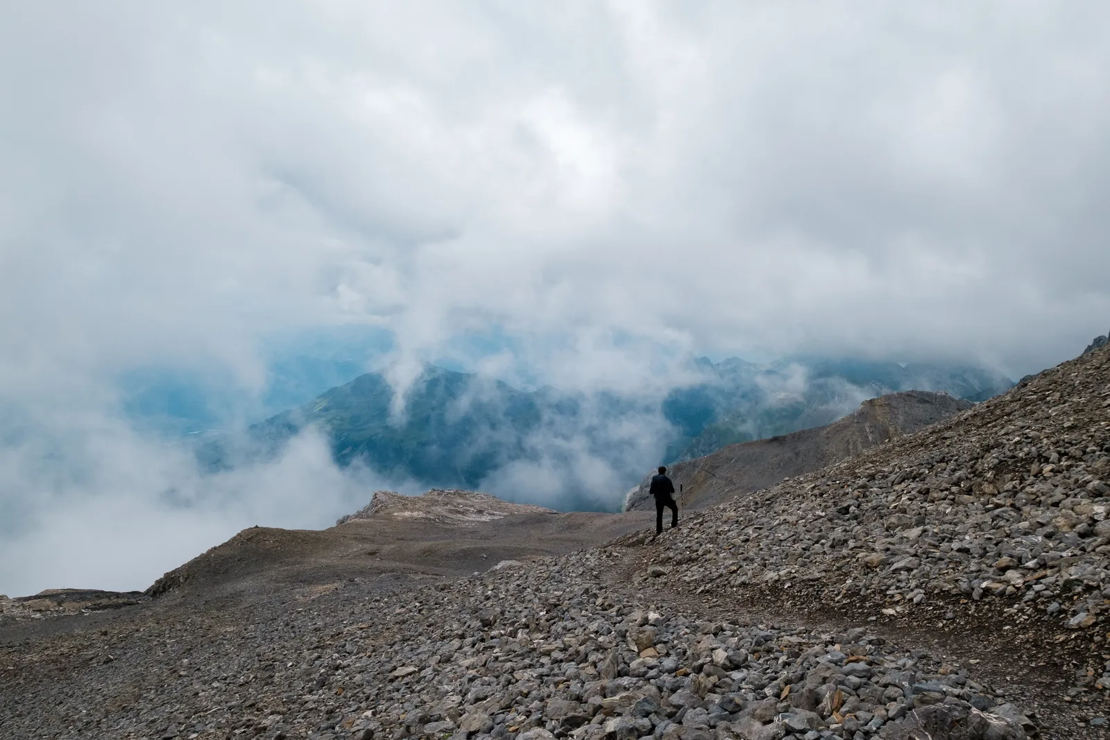
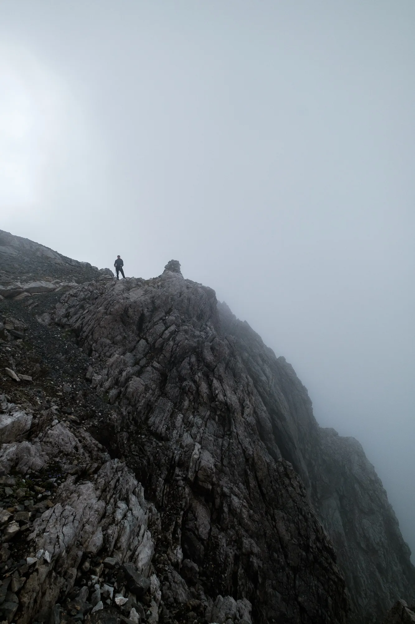
Here was a sign proclaiming that this was the border between Austria and Switzerland, and the peak was only a few meters away. Once we got closer, the cross marking the peak emerged from the fog - and with it a whole crowd of people. We scrambled around, looking for a place to take short break and snack, hoping that maybe the thick clouds would lift a little bit while we waited. And they did, but never all the way. Instead we got little "holes" to peek through every now and then into all directions. We had hoped for a clearer view, but where happy with what we got nevertheless.
Descent on the swiss side of the Schesaplana
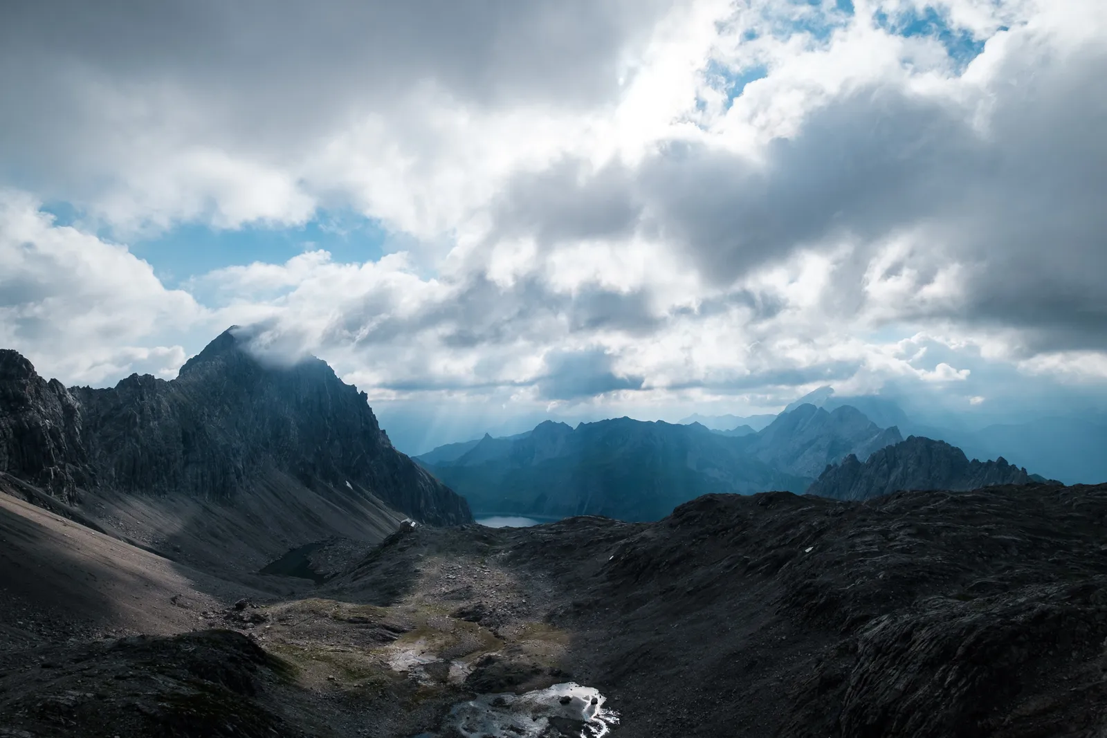
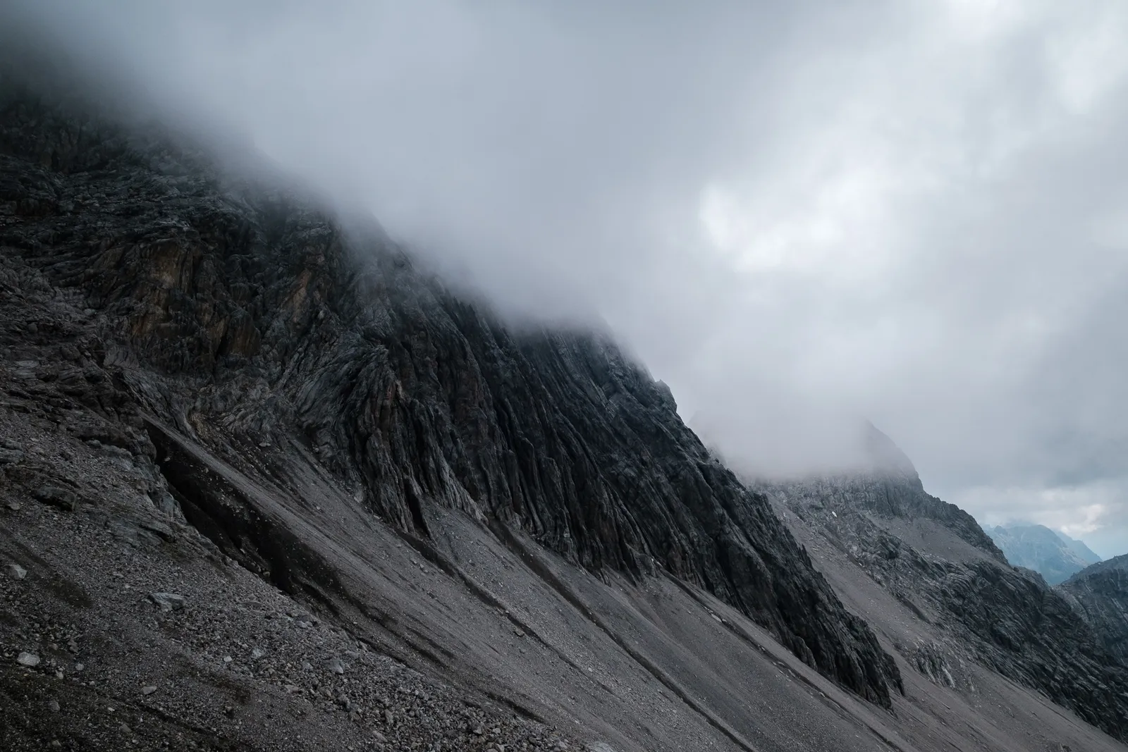
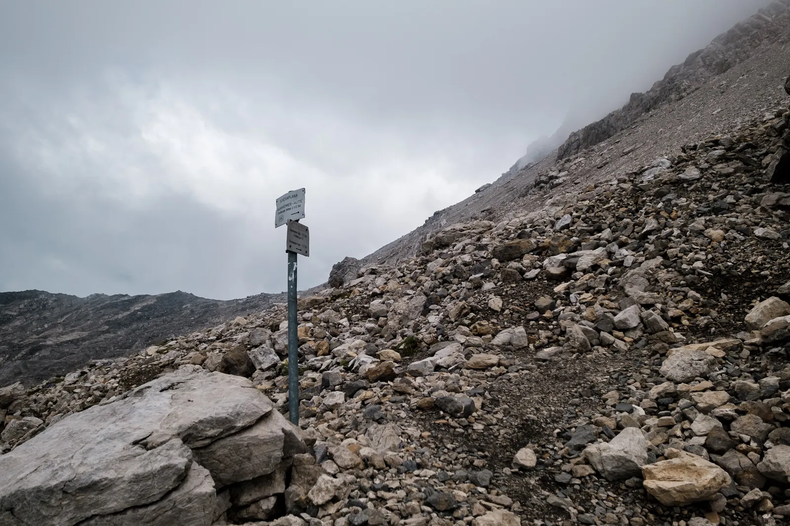
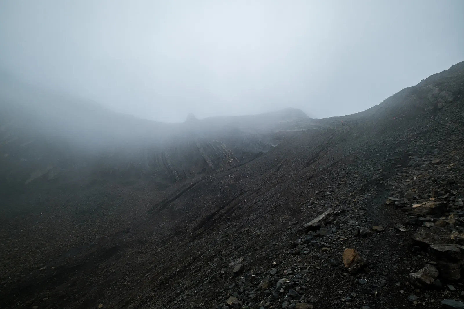
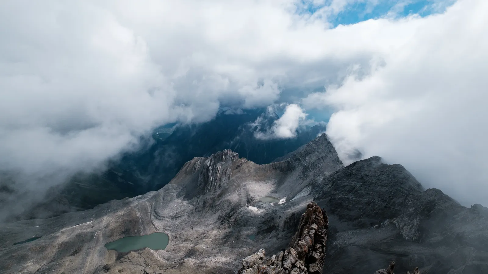
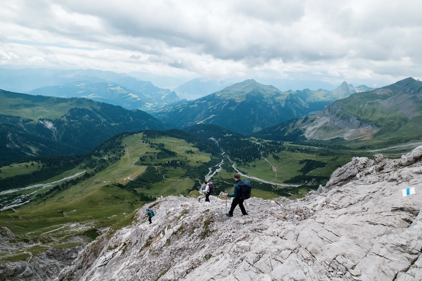
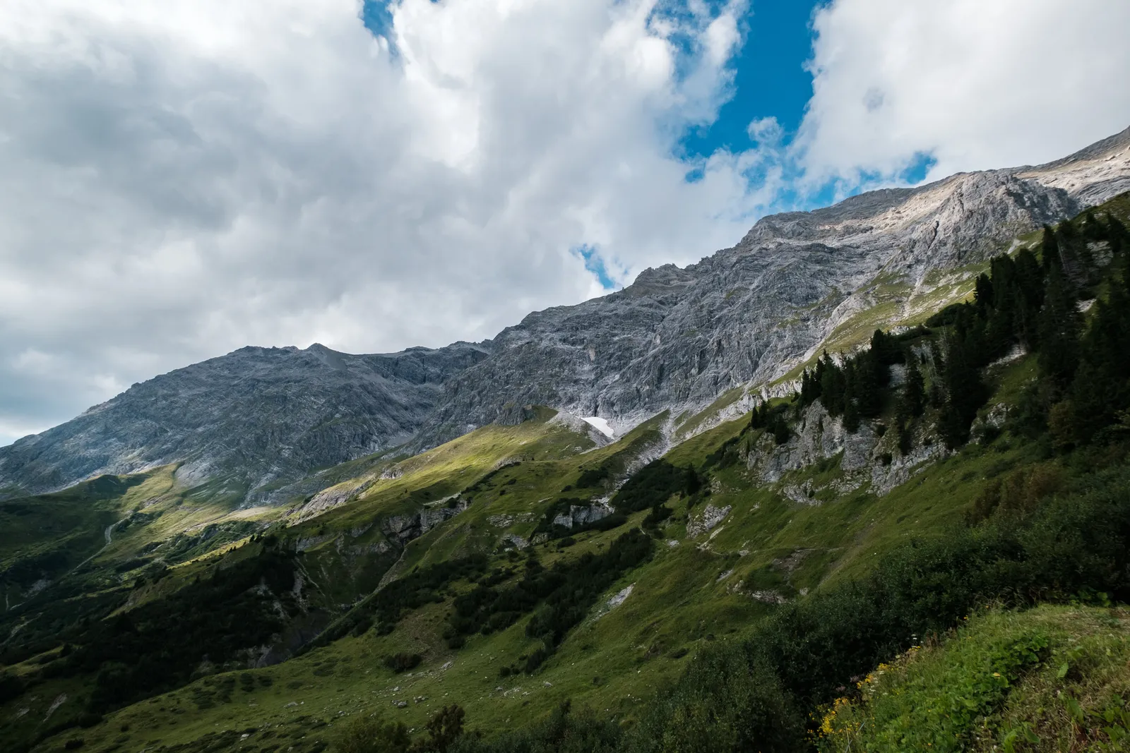
After a short rest we continued on our way, starting our descent towards the Schesaplana Hut. While we had only had to walk up 500m of height, we now had more than 1000 to go down. The trail we had chosen was called the "Schweizer Steig" and the hiking guidebook we had found the route in, called it "knee-eating" which sounded, well, not so nice. Before reaching the steep part we first walked down a long field of scree and through a gray rocky section that felt like a lunar landscape. Every now and then we got a short view onto the Bandner Glacier and the "Mannheimer Hütte", bevore our way led us down from the pleateau and onto the Schweizer Steig.
The Schweizersteig
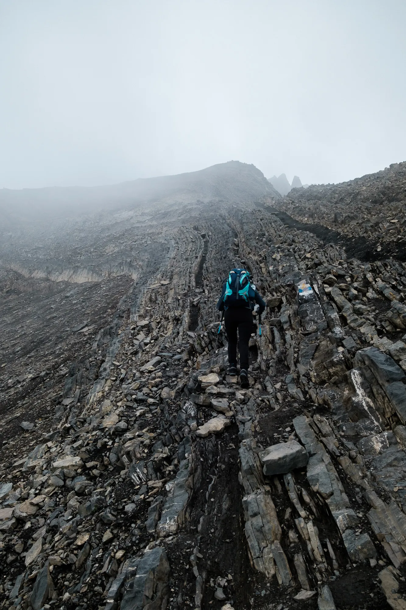
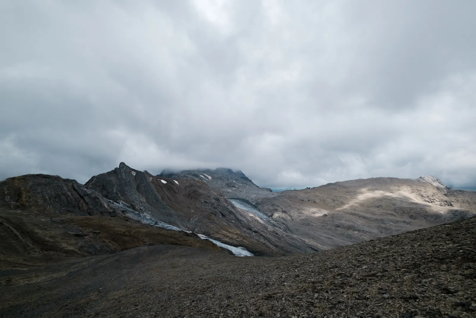
And the "Schweizersteig" did indeed turn out as a quite demanding, adventurous route. The first bit led along the flank of the mountain, dropping steeply to our left. The terrain had the same weird grooves we had already experienced on the other side, which made for slow walking because we wanted to make sure to tread safely. Also to make sure our knees would not take to much of a beating. This once again was a route where we were glad we had brought our hiking poles, as they were invaluable in helping to taking some of the weight of our knees, and also stabilizing.
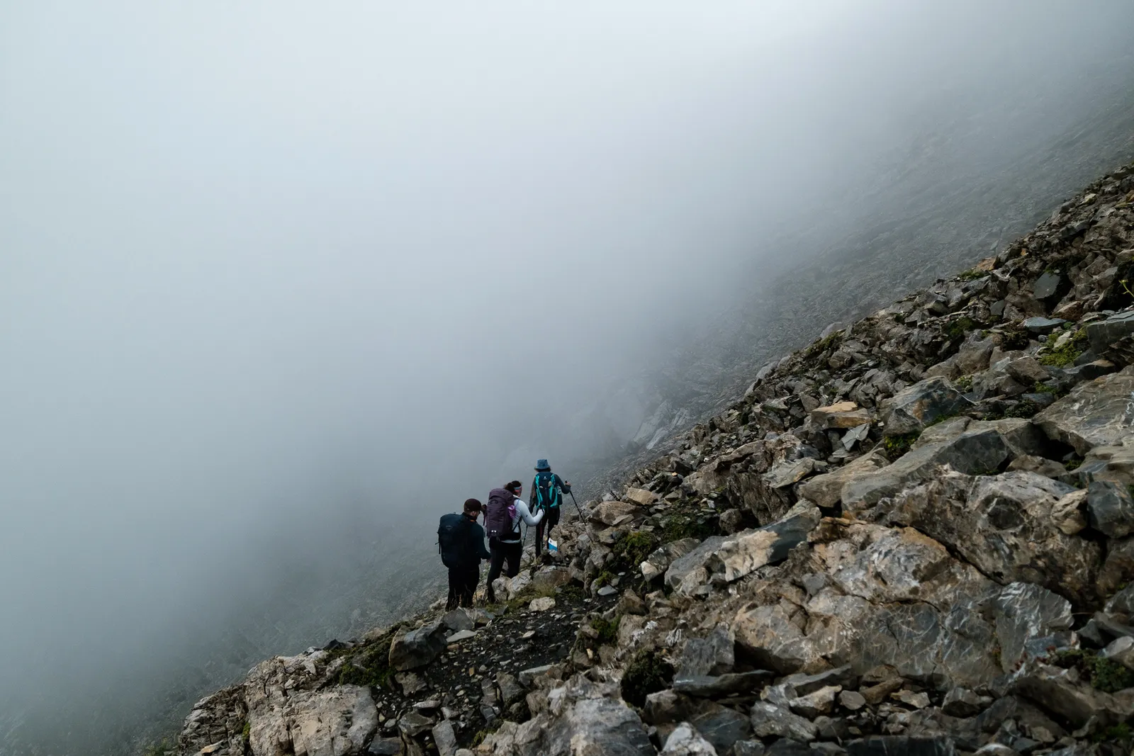


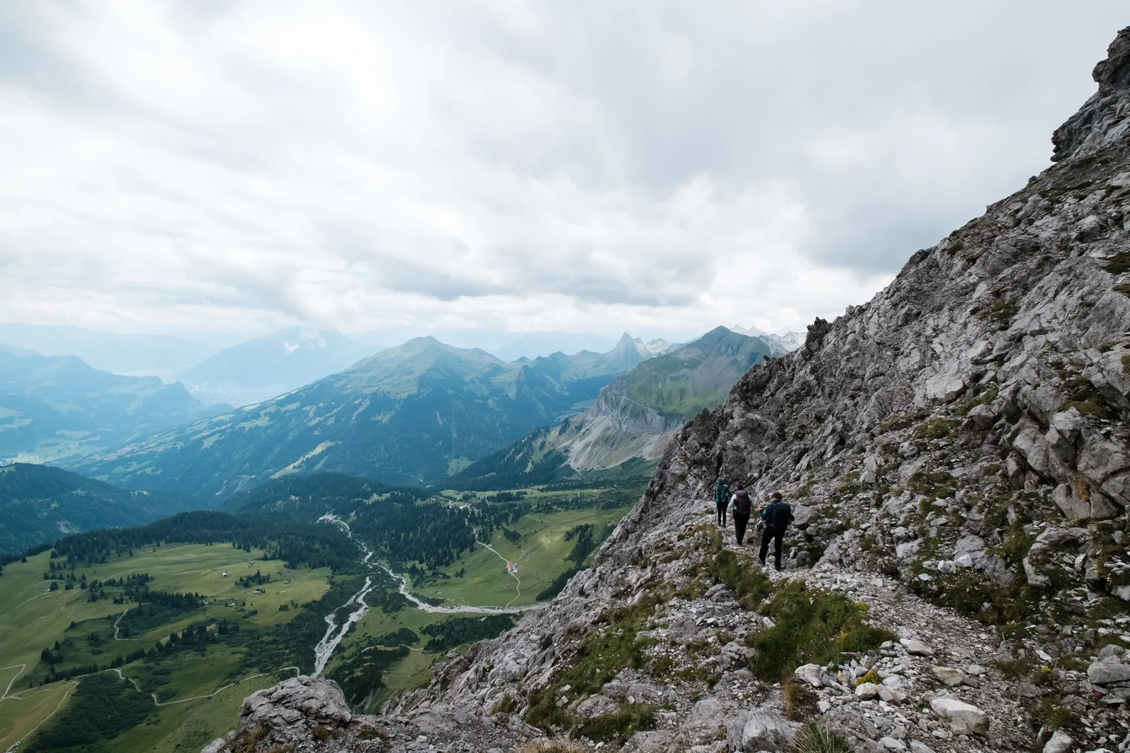
At some point we noticed a change in the color of the mountain in front of us, turning from a dark brownish gray to a much lighter gray. We figured that this might end our traverse along the flank of the mountain – and we were good night. Here we finally started a real steep descent. Many big steps and some steel pins in the mountains led us down the mountain and it was more like some light climbing than actual hiking. The trail was very well marked and smartly placed but only few bits were secured with rops or steel pins, so it's not advisable for people that are insecure.
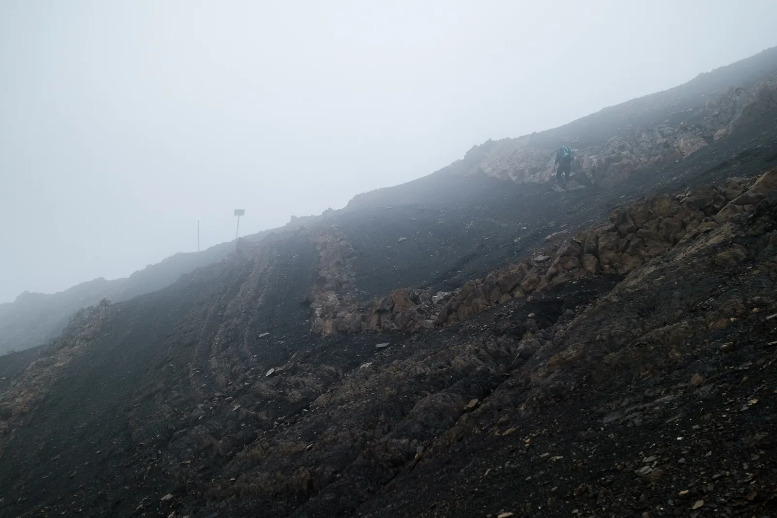
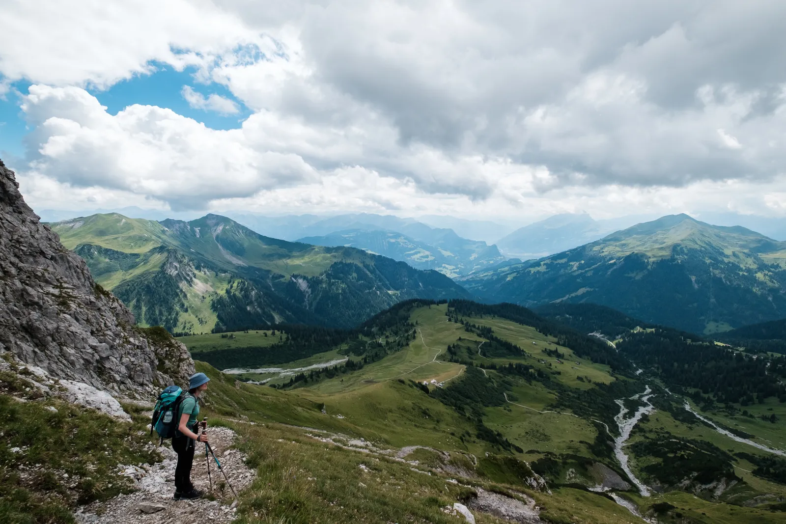
The steep, rocky bits alternated with short stretches of easy walking across grassy sections in serpentines. Right at the end of the track there was a crossing through a rock face that looked very adventurous from far away, but ended up a lot easier once we actually got there.

The last bit of the trail had us walk down through cow pastures in big curves down to the hut. Shortly before we arrived it we reached a little sign that marked a "bad weather descent" down to the hut. It seemed like a joke, because nobody should have come down this way to that point in bad weather - the worst part of the bit was definitely not the few meters down to the hut. We would definitely not recommend walking the "Schweizersteig" in bad weather unless you really know what you're doing because it is quite exposed and is probably slippery and dangerous e.g. in wet conditions.

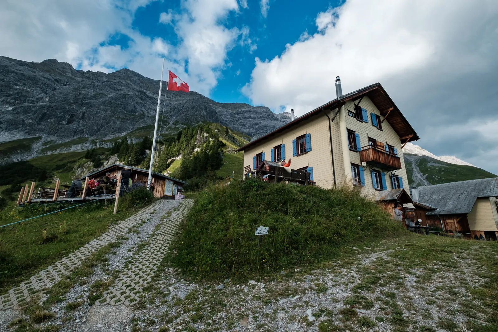
We arrived at the hut in the early afternoon, safe and without any problems. There we freshened up a little bit before going down to the "Gastraum" to enjoy a well-deserved coffe.
Most of the evening we spent on one of the jigsaw puzzles that we found in the hut and of course the very tasty dinner.
Our conclusion
Even thought the descent down the Schweizersteig took a lot of concentration and made us fear a bit for our knees, it was an incredibly beautiful trail that was absolutely worth walking. We do think only people that have some experience hiking in the alps should use it, and they should definitely be free from giddiness and sure footed. The track should ideally only be used in good weather conditions.
Leave a comment