TourNatur - 3 hiking areas near Bad Kreuznach combined
The Nahetal near Bad Kreuznach is a beautiful area for long walks or hikes. Therefore quite a few tracks have been marked and are actively advertised for visitors to the area. The „3x3 Salinental“ is a network of hiking trails that contains three well marked trails in each of the regions of the Rotenfels, Rheingrafenstein and Ebernburg. The „IntroTour“ is always the shortest and easiest of the walks and is somewhere around 3-5km long, while the „ClassicTour“ spans most of the interesting sights and is about 10km. The longest, and also a bit more difficult tracks in each of the three areas are called „VitalTour“, and are around 15km in length, showcasing the nature reserves in all detail.
Besides the „3x3“ Tracks, there is also the „TourNatur“ which combines the the most interesting parts of the 3x3 tracks into one long trail through the valley, always with a focus on the diverse nature and landscape of the area. It is also the tour we chose for our first day in Bad Kreuznach. The trail is marked with a tree leaf, symbolic for the dry climate of the Nahetal, that is considered rare within germany.

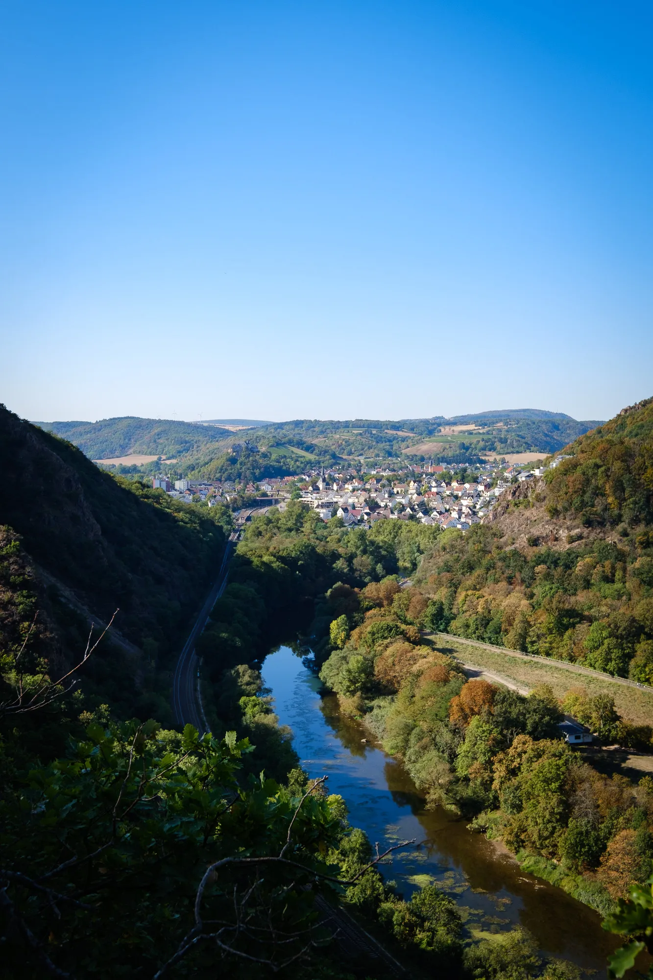
From Bad Kreuznach over the viewpoint Gans towards the ruin Rheingrafenstein
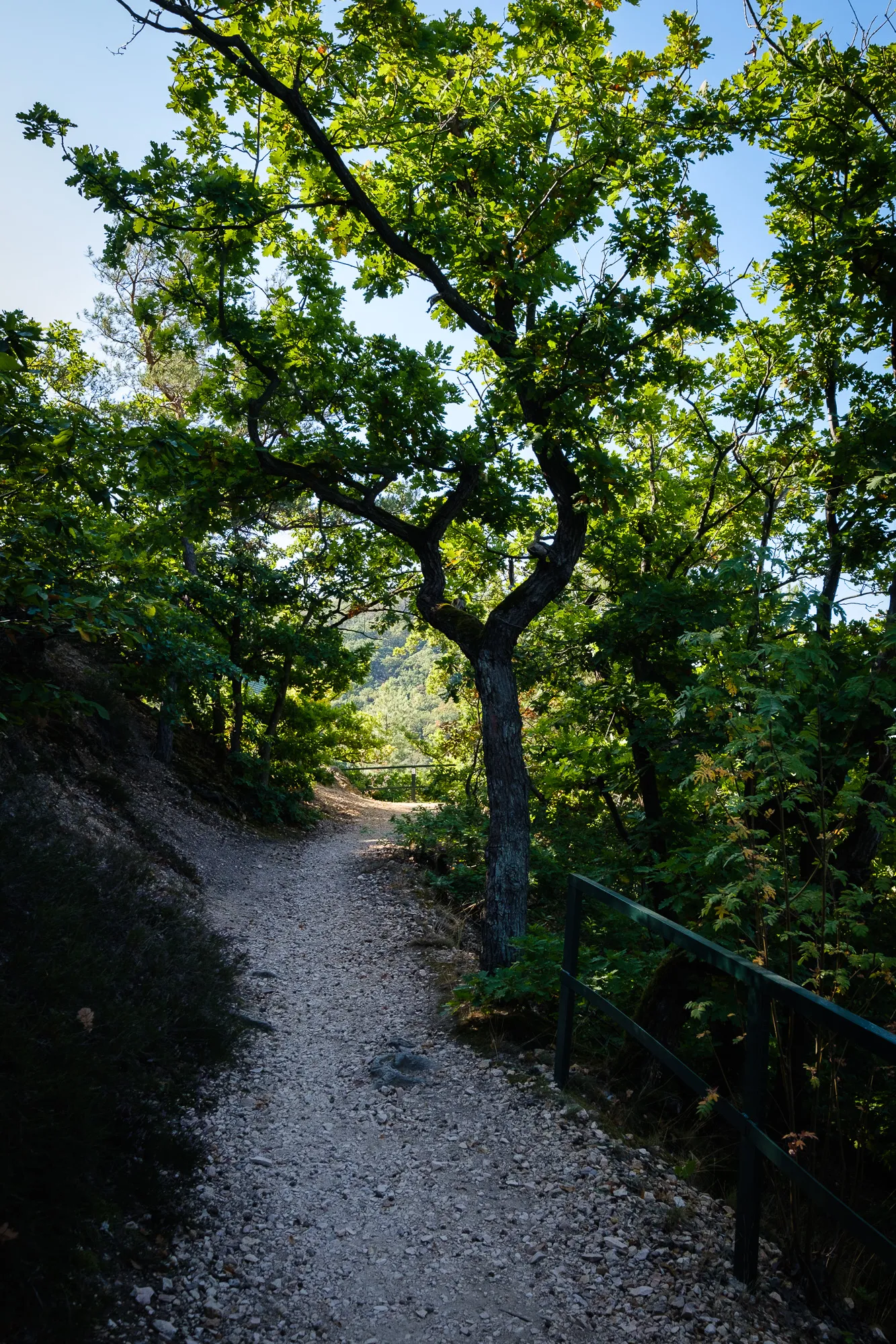
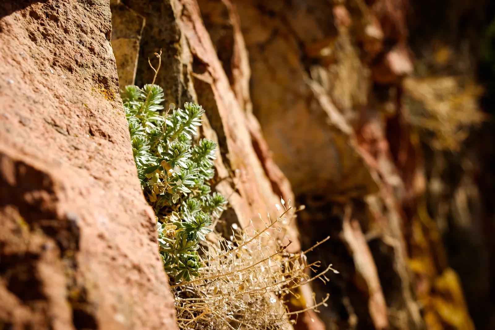
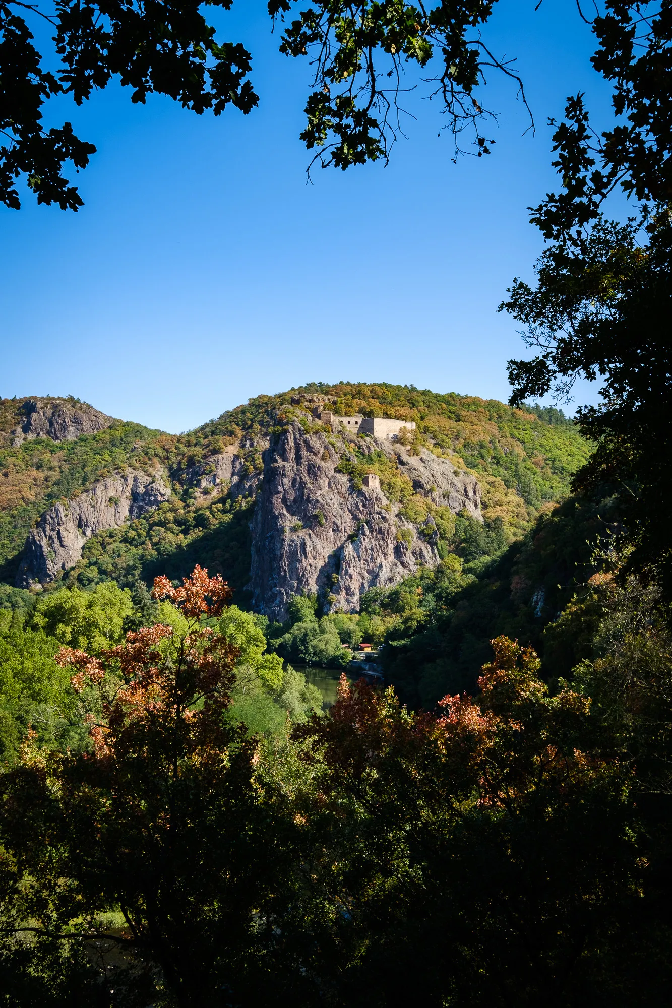
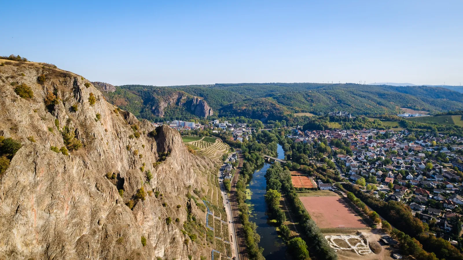
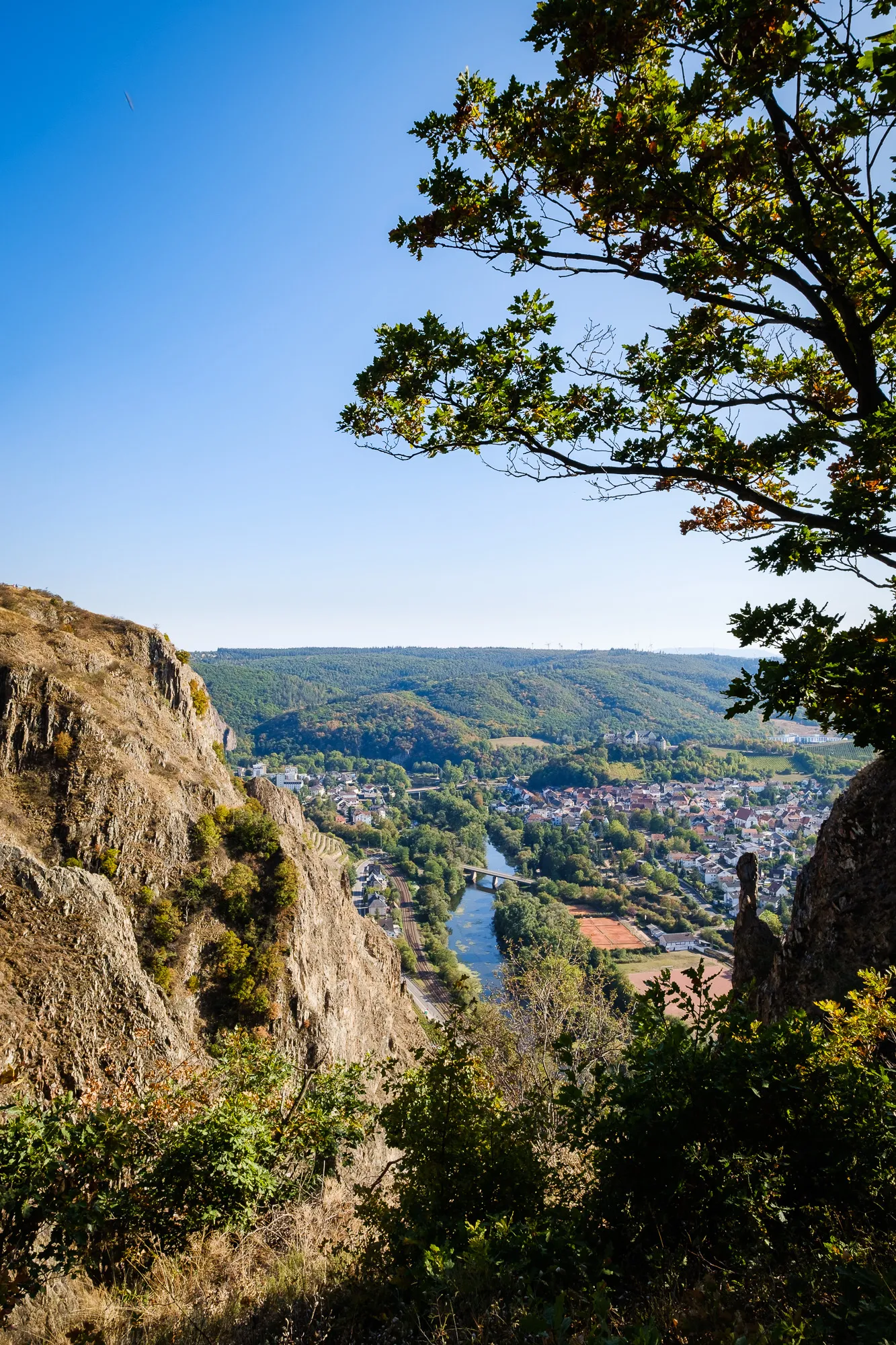
Starting at the outskirts of Bad Kreuznach at the Karlshalle the first thing we saw was one of the graduation works that the town is famous for. From there the trail first leads along the edge of town, before turning onto a path following the bluff. Here the vegetation changes between small patches of pines and larger forests of small, stunted oak trees clinging to the sheer rock that dominates the overall picture. Due to the very dry and hot climate on the rock face only well adapted plants can thrive here. Continually climbing the route soon reaches the hiking area & viewpoint "Gans". Along the rocky edge of the cliffs the path allows for spectacular views into the valley and towards the ruins of castle Rheingrafenstein, which is part of the trail later on. The trail itself is well graded and secured with banisters in all the important places, so it is safe to walk even for people that might not feel very comfortable with steep drop-offs.
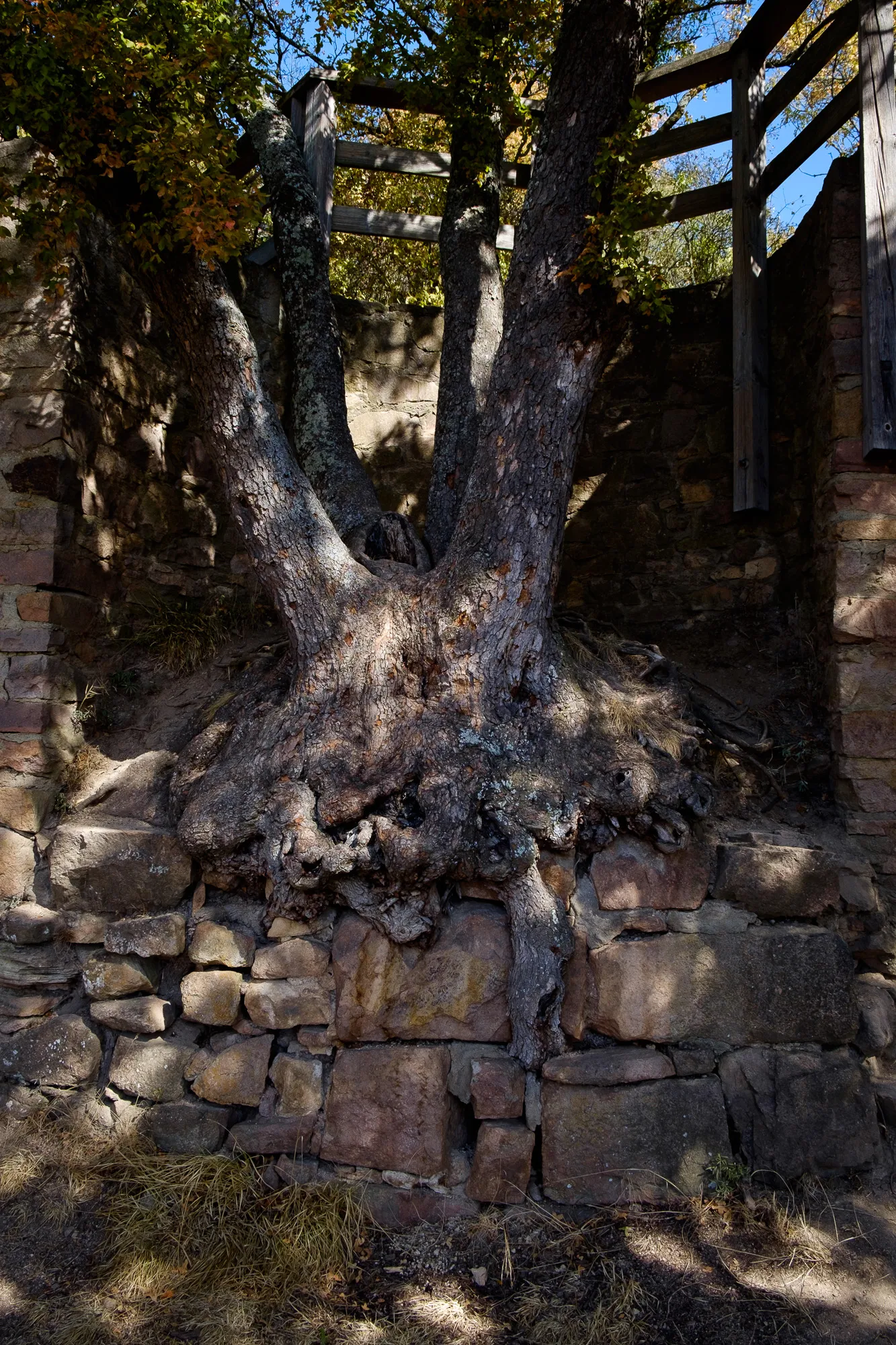
Before reaching the castle ruins our trail first turns away from the bluff, passing a television tower and then the Castle Rheingrafenstein. (Yes, it's named exactly the same as the ruins we're tryin to reach!) Then after a sharp right towards the Observatory the trail finally descends towards the ruins of the old castle. Here we had quite some fun exploring the different chambers, nooks and crannies of the ruins and enjoying the amazing view from the remains of the keep. It's quire impressive that people really managed to build a castle up here, and some parts are carved right from the rocks.
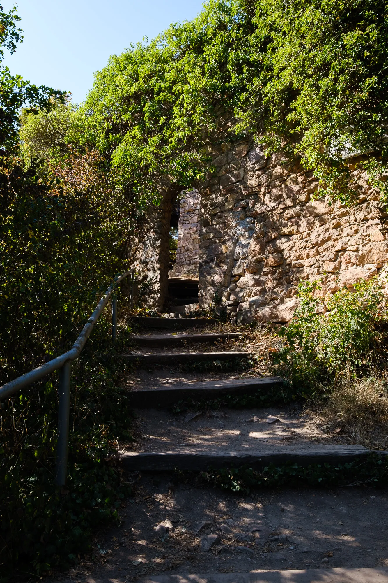

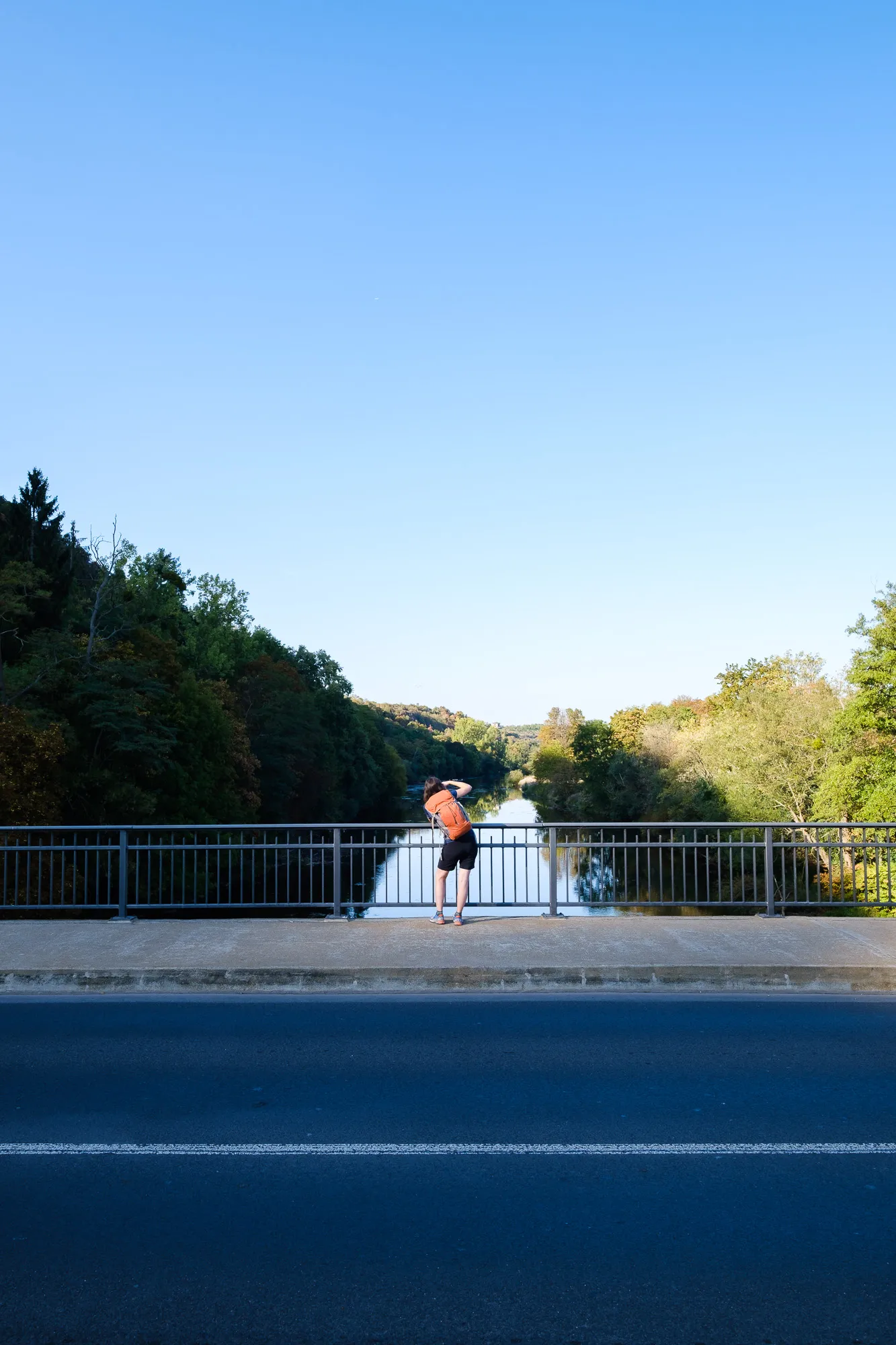
After a while of exploring the castle we returned on our trail, which now zigzagged down into the so-called Huttental and led right up the banks of the Nahe river. Here normally a hand-pulled ferry transports hikers from one side of the river to the other, but unfortunately it was not running today. So we turn back, walk a few meters on the trail we had just walked down, and then turn right to walk a detour of about 2 km to get to the closest bridge. Although for us the detour was not a problem, we did find it a bit annoying that there was no information about ferry times put up near the trail.
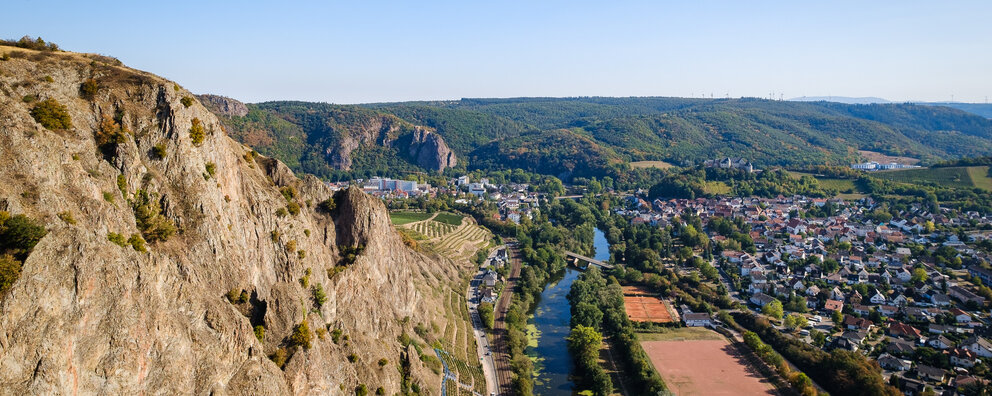
First views towards the Rotenfels massif near Bad Münster am Stein
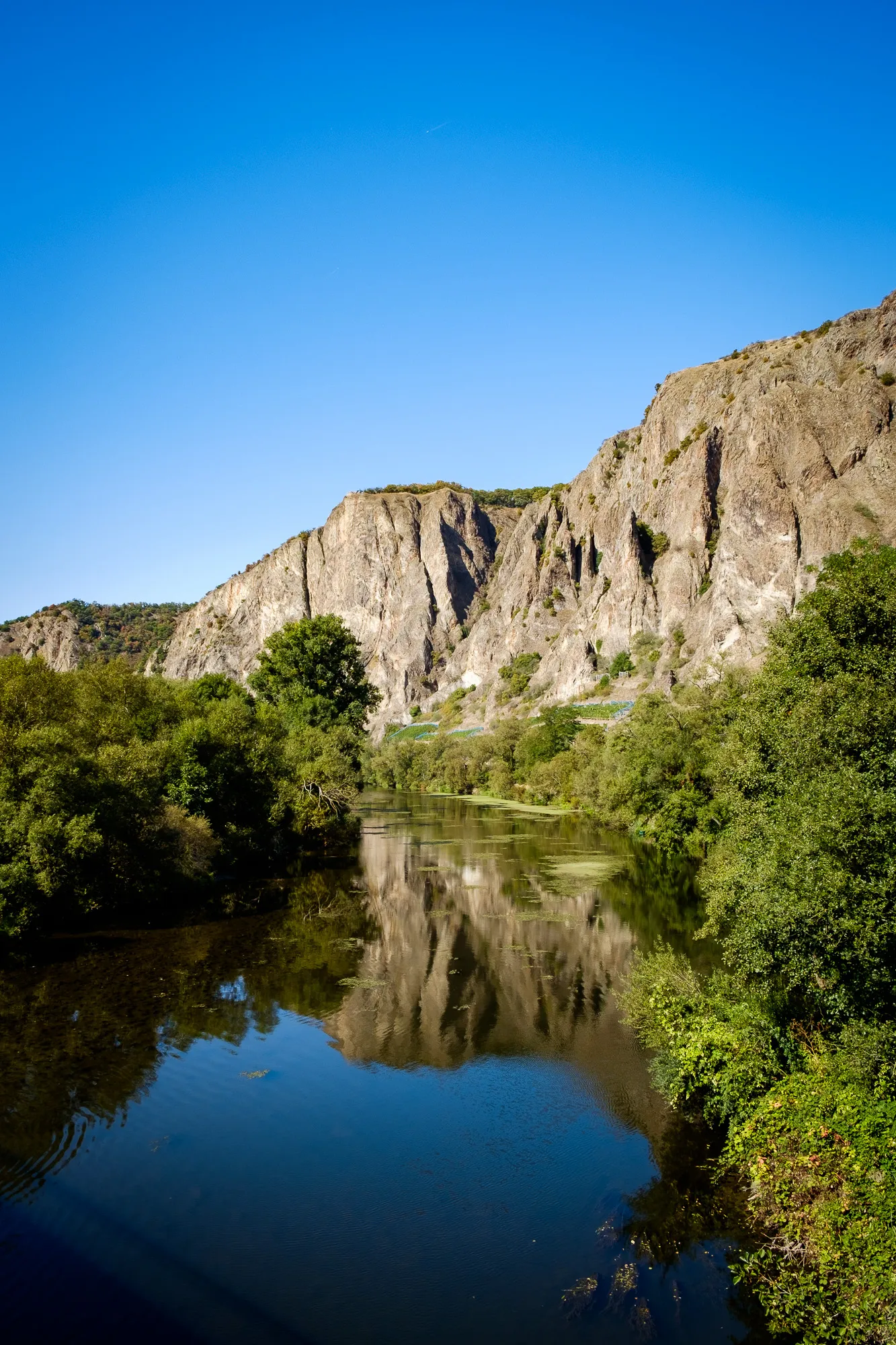
Once we caught back up to the original trail, it led us along the Nahe river past the town of some sport fields just out of Bad Münster with amazing views towards the Rotenfels, probably the greatest attraction on the trail. About 200m high it rises up from the river valley below and is said to be the highest drop-off between the Alps and Scandinavia.
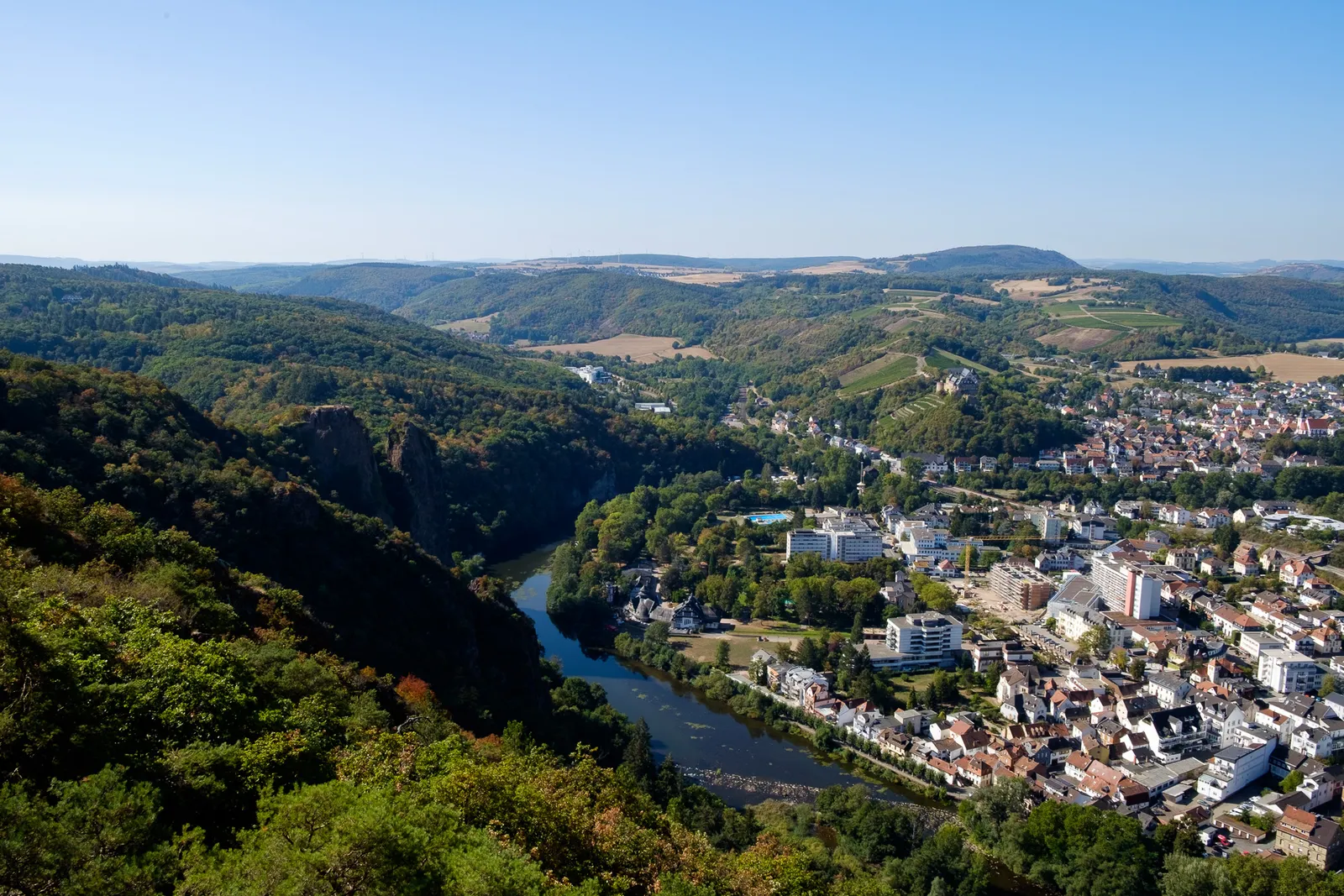
Climbing up to the viewpoint Bastei
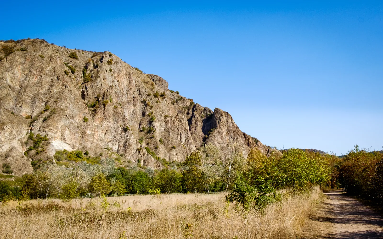
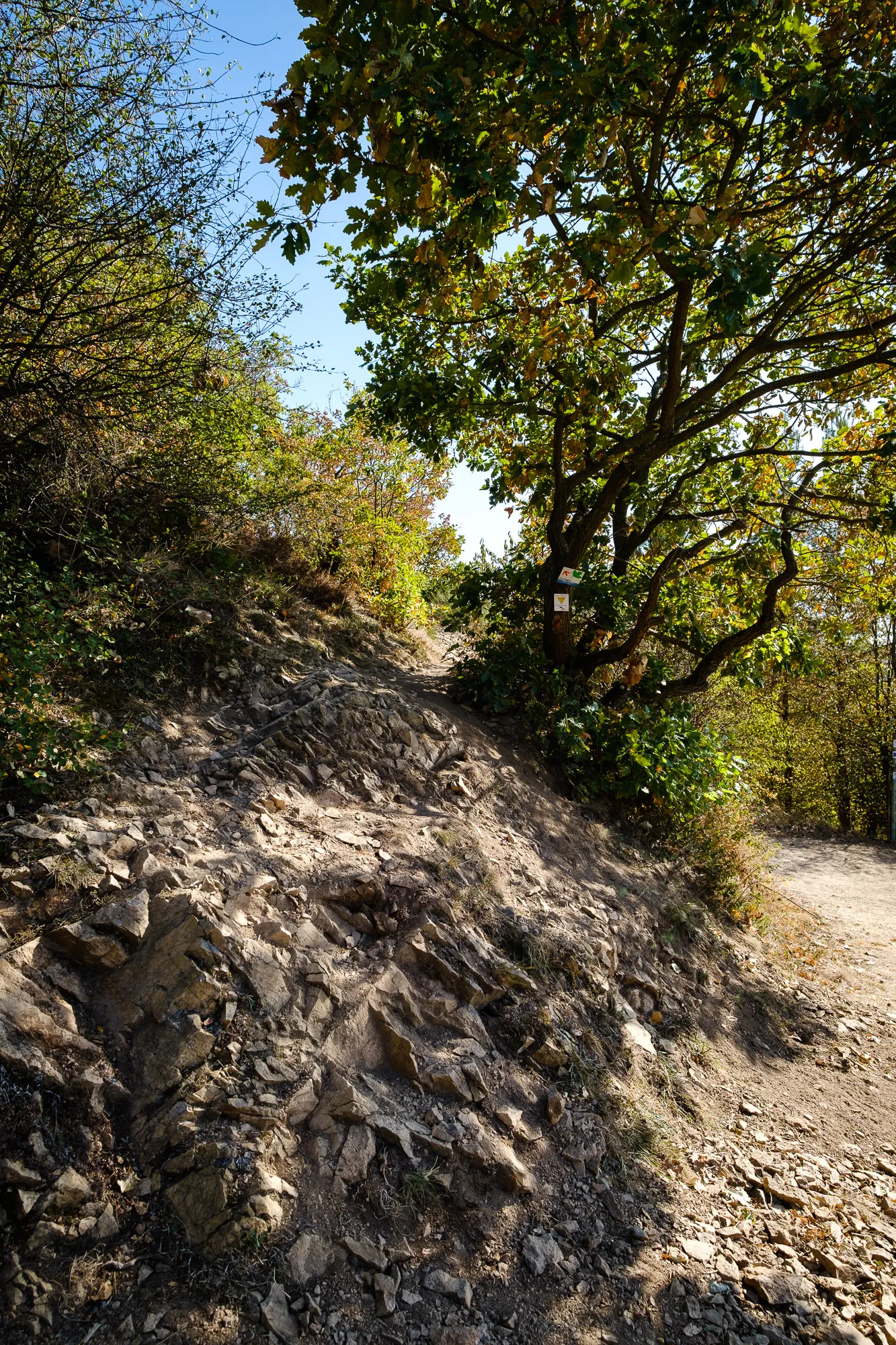
Following the river for a few kilometers we reached a bridge, crossed again and then started towards the top of the rock massif we had just looked upon with awe. In the beginning the path follows a broad concrete road but soon turns right into the vineyards. Here the track gradually gets steeper and very narrow - turned out to be the most exhausting part of todays hike. This section of the trail has little shade and with the sun burning down we really broke a sweat. Luckily the steep part is only a few hundred meters, and soon we reached the plateau. Through a sparse forest of cripple oaks we reached the „Bastei“ - a lookout onto Bad Münster - Ebernburg and back towards the ruins of Rheingrafenstein - where we had stood just a few hours before.

Way back to Bad Kreuznach
Along the drop-off the trail showcases the panorama views into the Nahetal, then turns back onto the plateau and ultimately doubles back towards Bad Kreuznach. Through dense forests of chestnut trees and past several small huts and shelters the trail leads down into the valley in wide serpentines. Soon we reached the valley floor, crossed the Salinenbrücke and were back at the Karlshalle, where we had started.
All in all, with our little detour, we walked about 18km, with about 600m ascent and descent. It took us pretty much a whole day - roughly 6.5 hours to return to the car park. We would suggest to plan between 5-6 hours, even though it can be done significantly faster. We did stop many times for pictures and to watch birds and wildlife - but that is what it is all about, and the trail is likely only half as beautiful, if walked in a hurry.

Leave a comment