Fantastic views: Deneck
The Deneck is right at the end of the Großsölktal, where the Wölzer Tauern start. At 2433m of height it's hard to overlook. The path starting at the Kaltenbachalm, past the two Kaltenbach-Lakes to the peak of the Deneck takes about two to three hours to hike.
We chose the tour onto the Deneck because the nice lakes along the way. Nice little milestones to keep us motivated on the way up. The weather forecast told us the temperatures of the day would be well above 30°, so we started at seven in the morning - to be back down the mountain before the real heat.
Unterer Kaltenbachsee
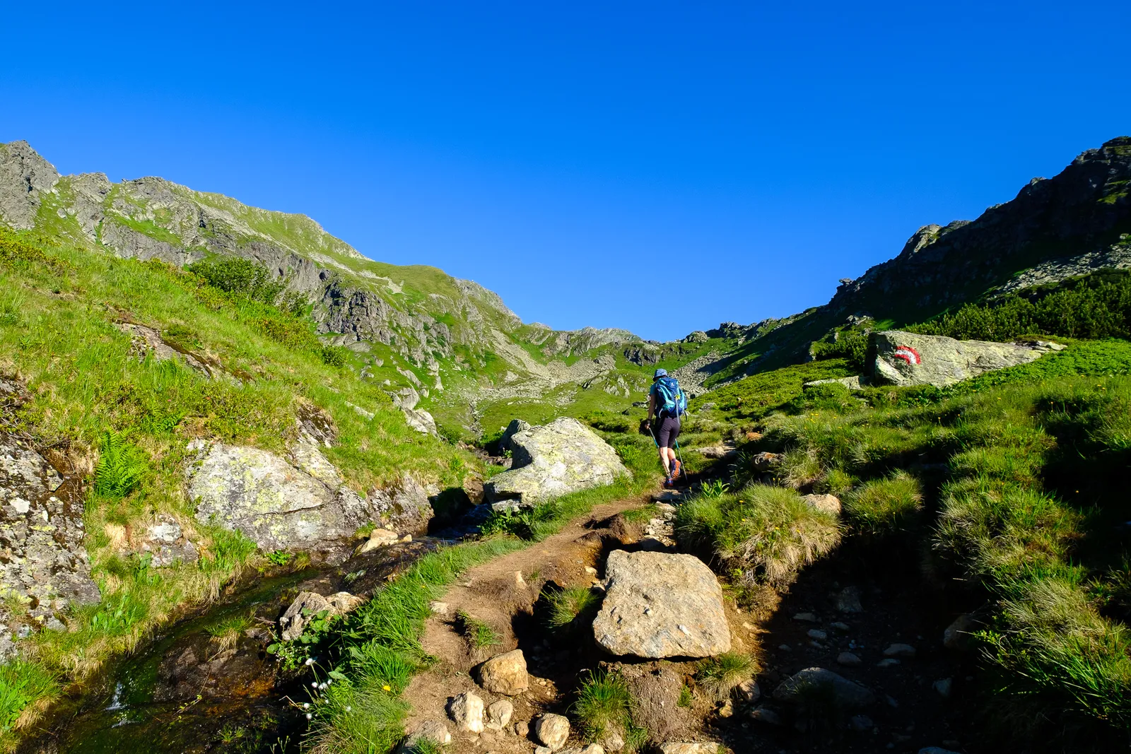
The ascent to the "Unterer Kaltenbachsee" (Lower Lake Kaltenbach) starts across a grassy slope with few trees and bushes. After about thirty minutes the first lake is visible to the left of the path. A small path leads down to a bench overlooking the lake. Here we stopped for a moment to watch the cows by the side of the lake. Then we continued up the path up the hillside on the righthand side of the lake.
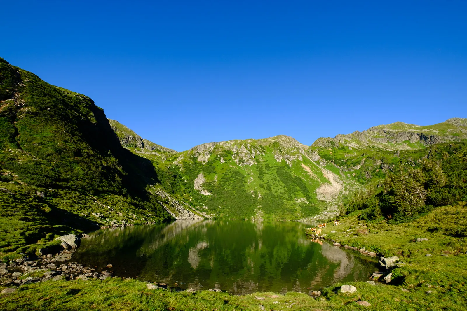
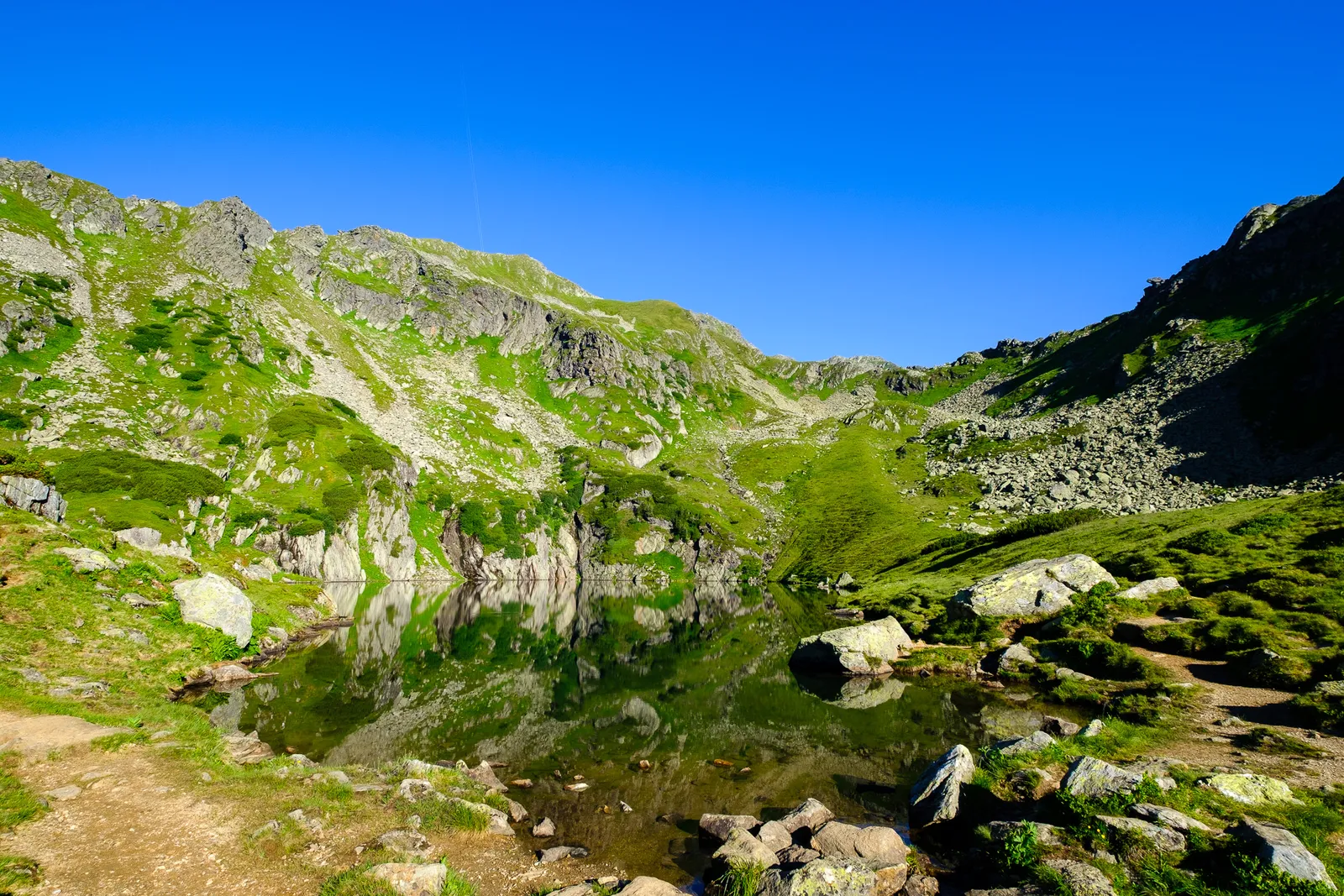
Oberer Kaltenbachsee
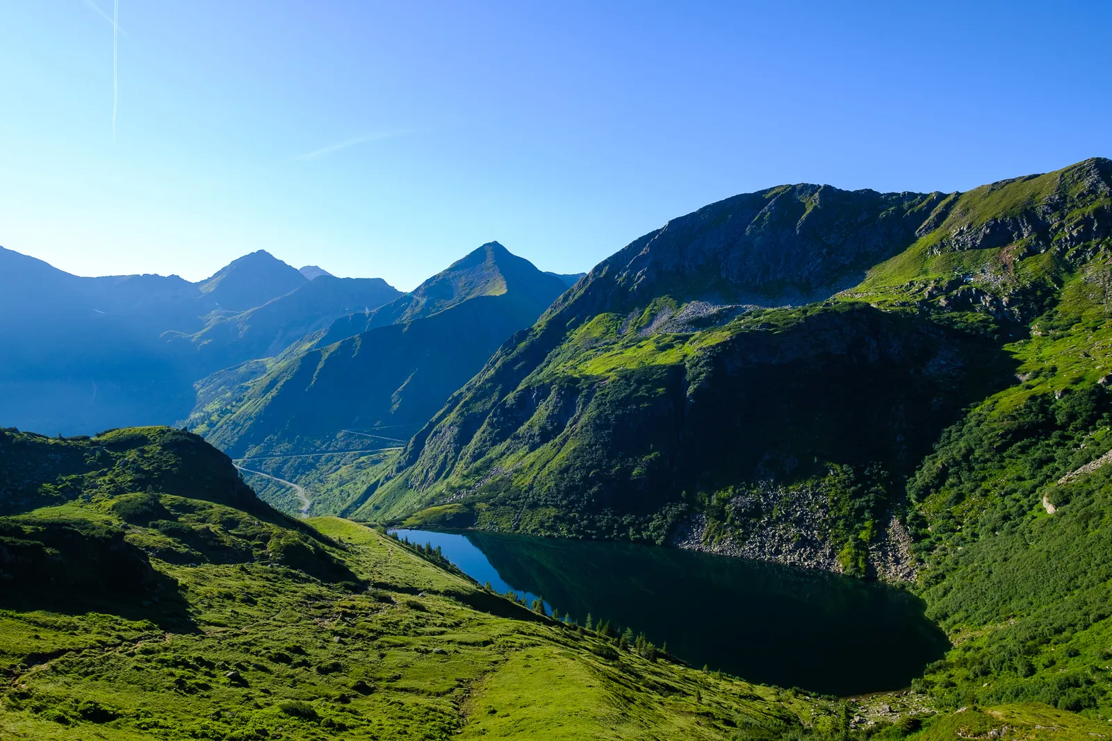
With even fewer shade and despite the early start it grew hotter every minute. For another thirty minutes we climbed up the hillside through grassy and rocky patches, without much higher vegetation. Then we reached the Oberer Kaltenbachsee (Upper Lake Kaltenbach). With pretty much no wind the lake lay before us perfectly still, and the reflection of the surrounding mountains was almost surreal - in some of the pictures it is at first hard to see that there is actually a lake in the middle of the photograph.

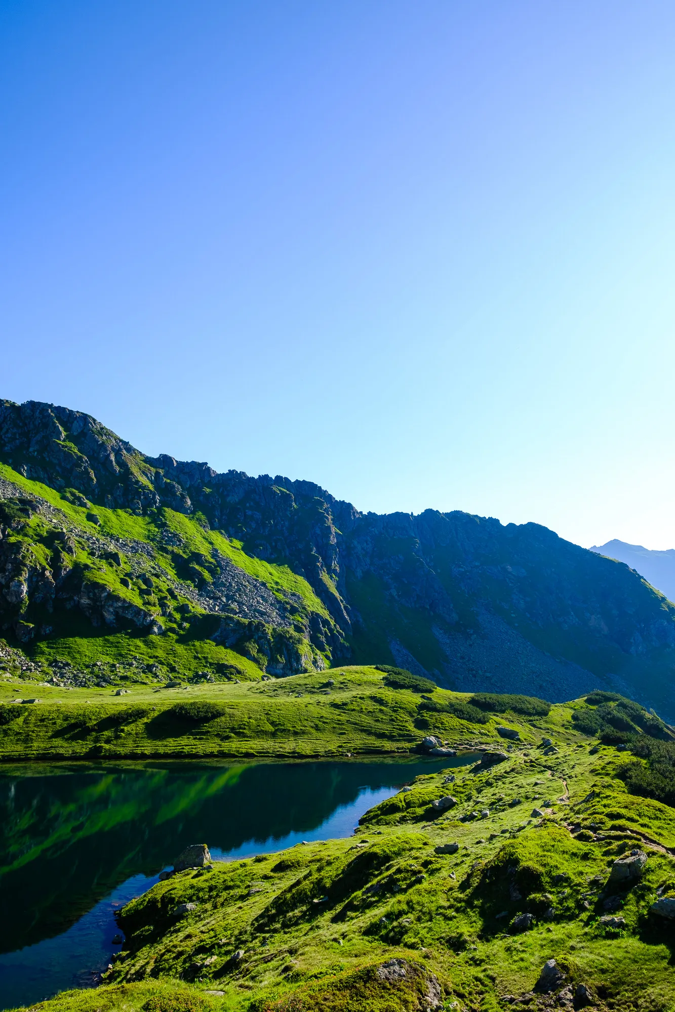
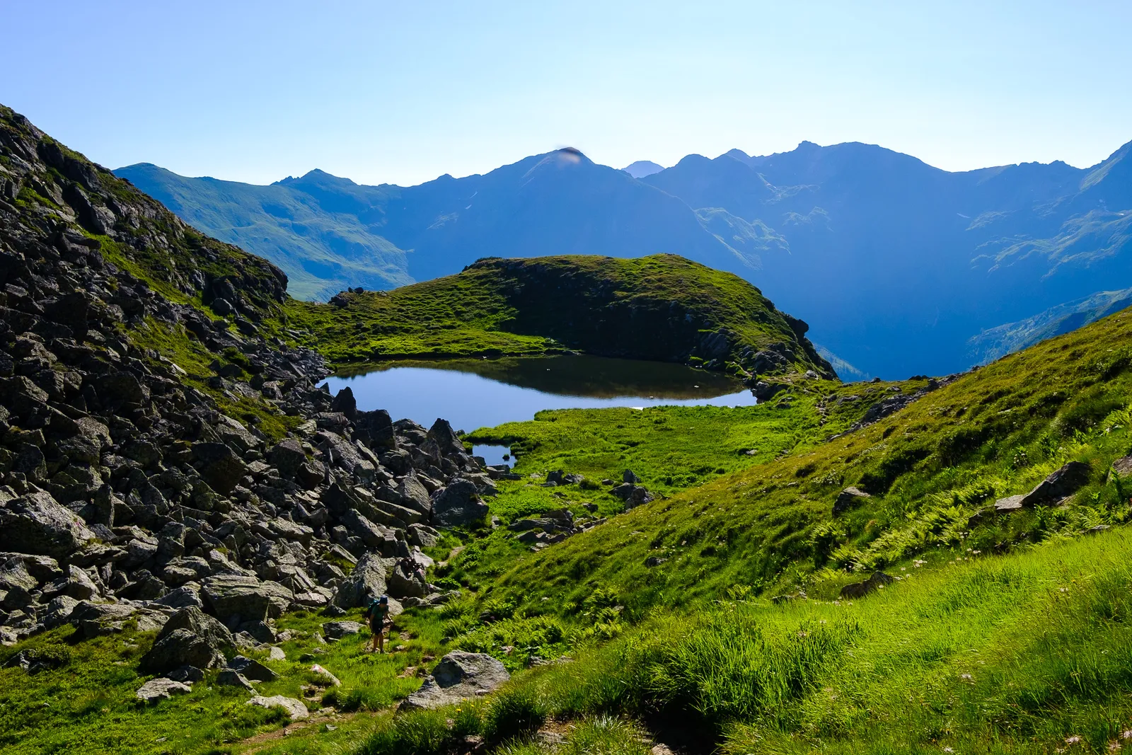
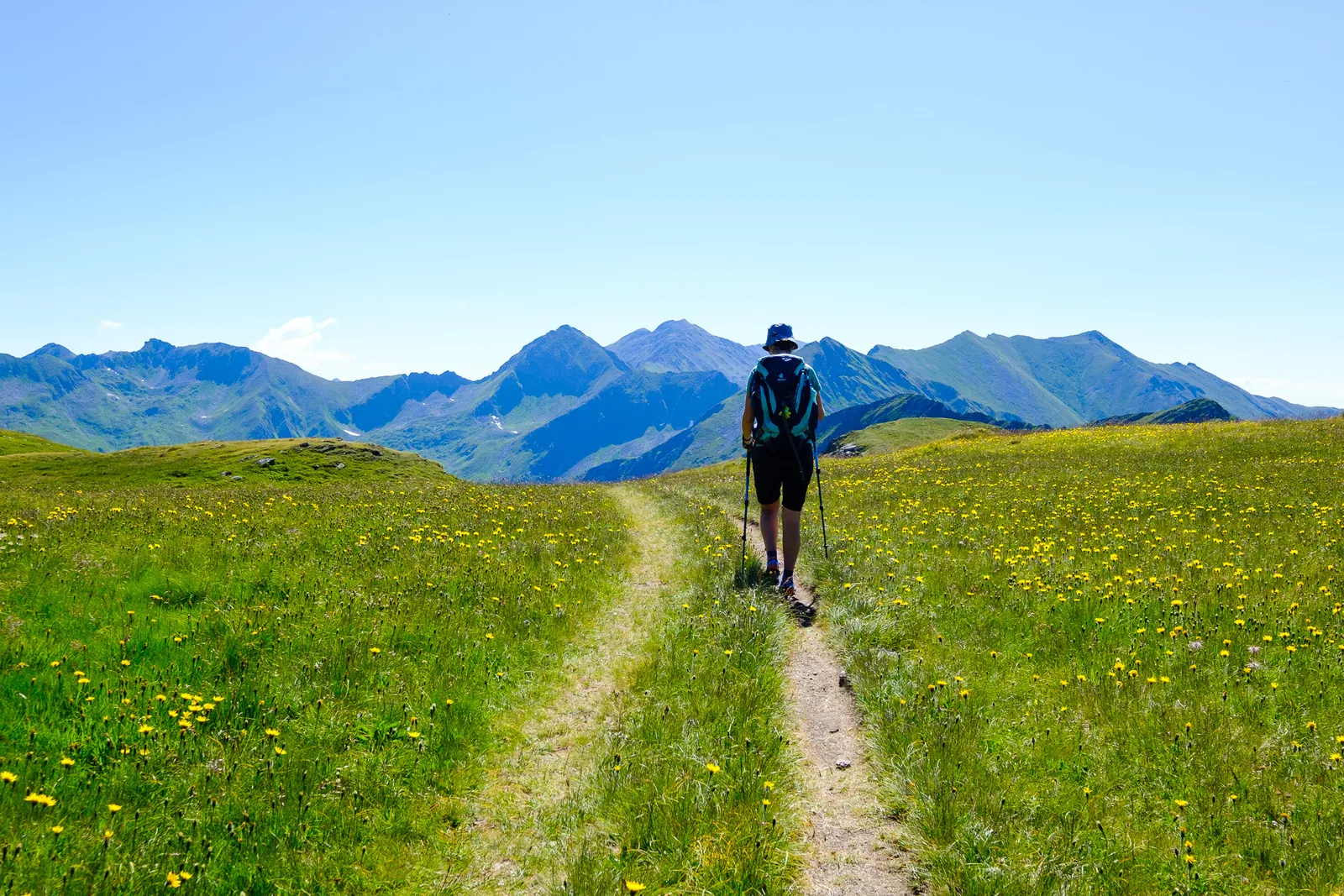
After another short break to drink some water and take some pictures we continued our hike on the slope left of the lake. It climbs very steeply up until a short indentation in the ridge, from where it leads down a few meters on the other side of the hill. There is another very small lake. The path leads around it and then up another few meters before reaching a plateau called the "Ertrachböden". It was in full bloom with many wild flowers and really beautiful.
Here the path splits in two - a steeper section that leads across the rocky ridge of the mountain, first up to the Schafspitze, before reuniting with the lower path that leads across the plateau, and then finally climbs up to the peak of the Deneck. We decided to take the route to along the ridge.
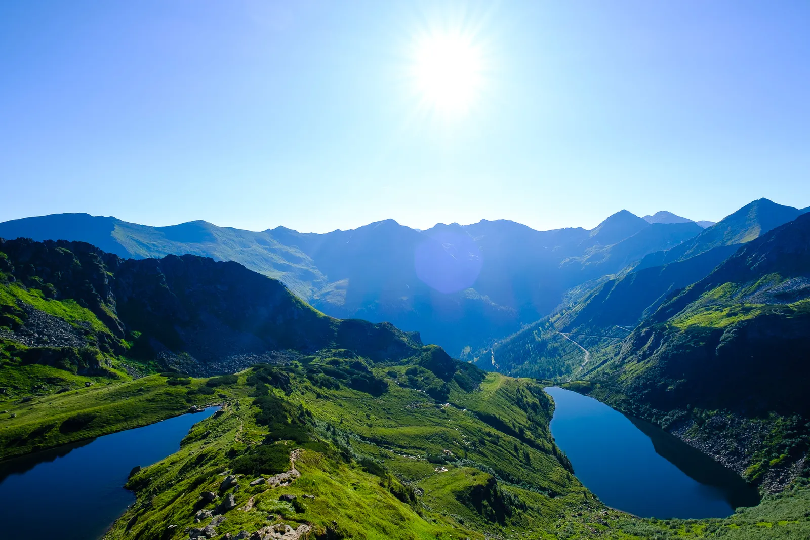
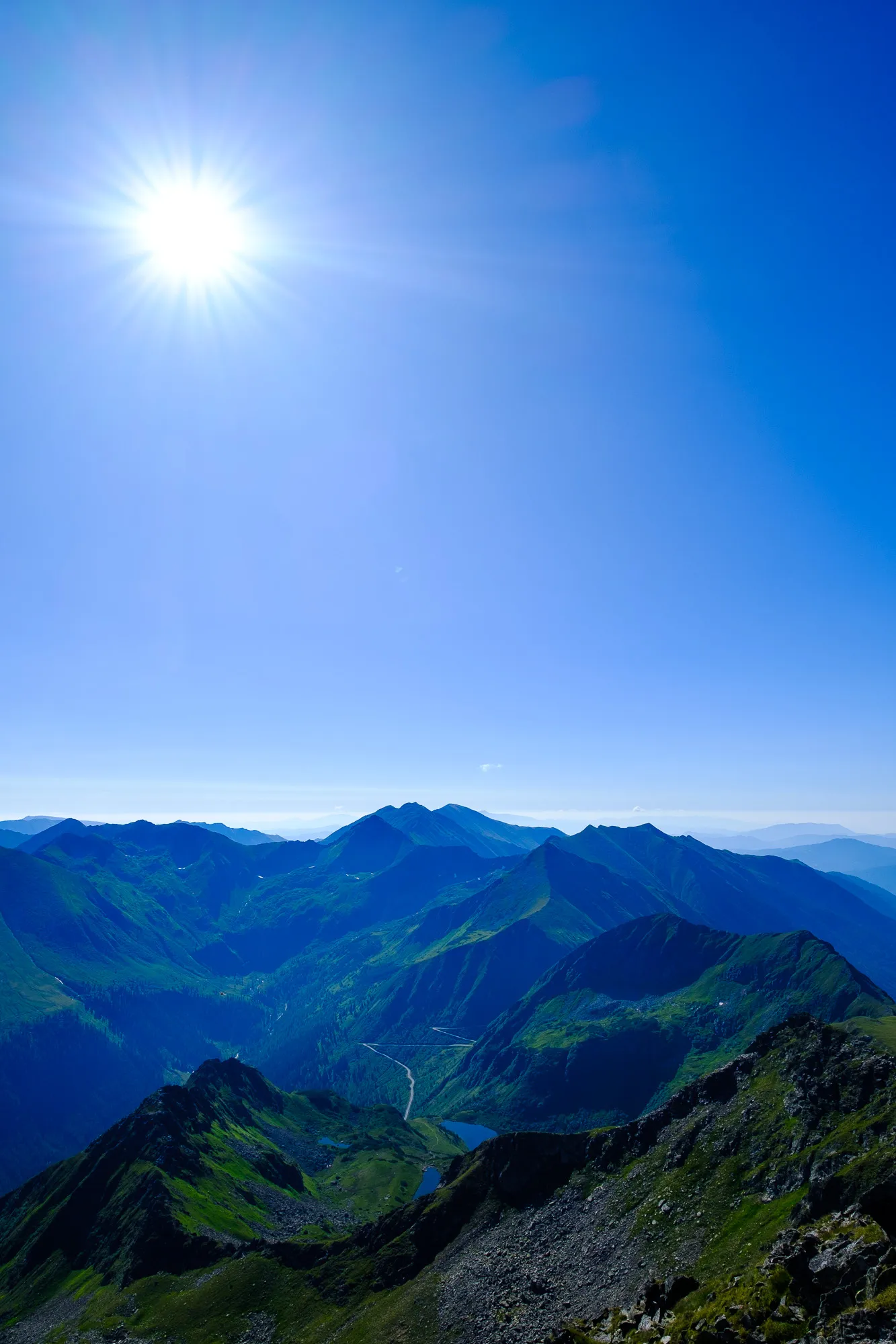
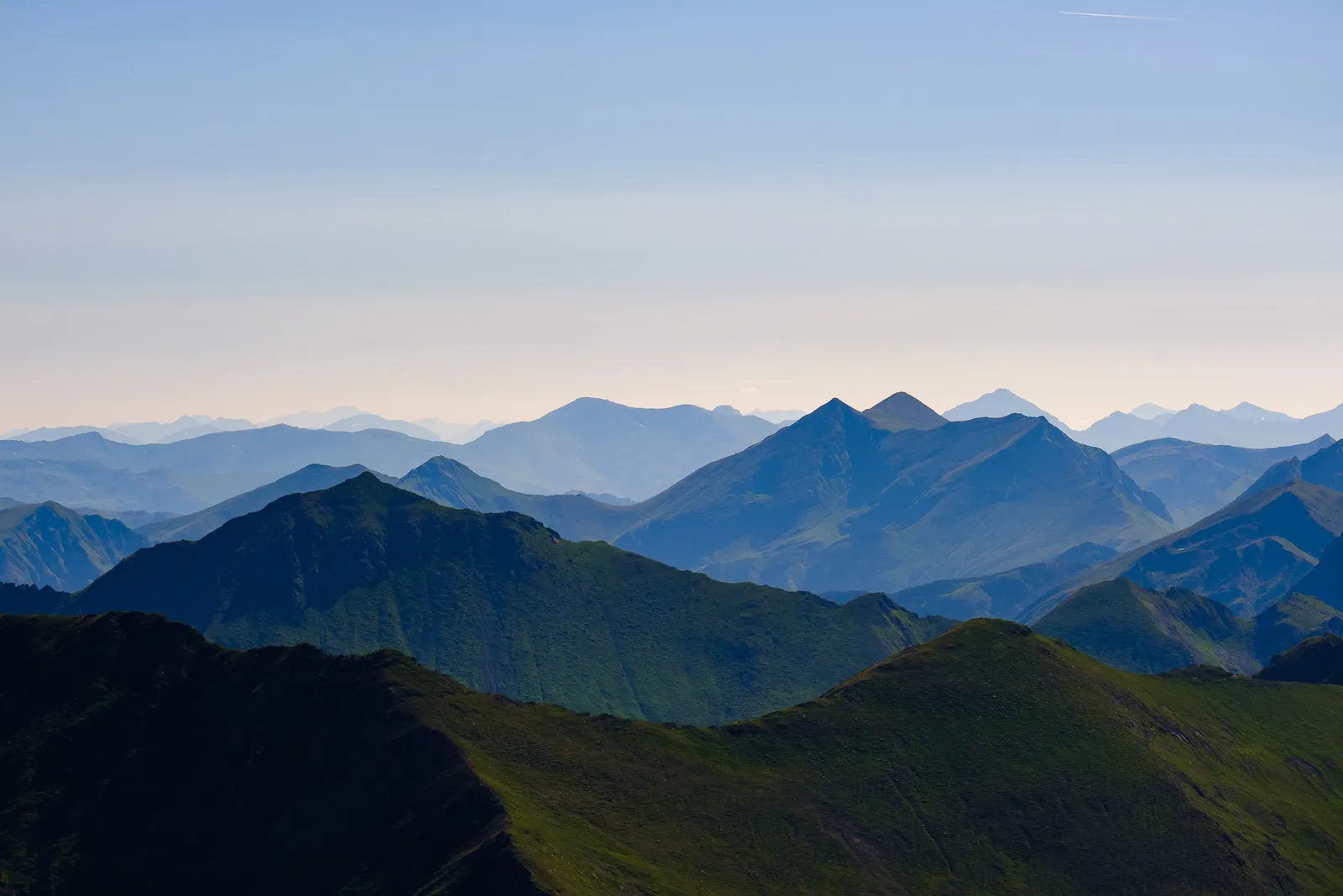
The path is fairly exposed and rocky and in some places requires a bit of scrambling. Our trekking poles were a bit of a hindrance in those places where we had to use our hands. But that trail has wonderful views down to the Kaltenbach-Lakes and across the valley to the peak of the Deneck (and of course in the other directions too), and is absolutely worth it.

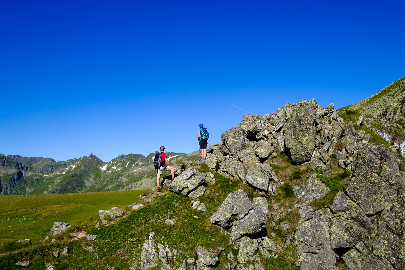
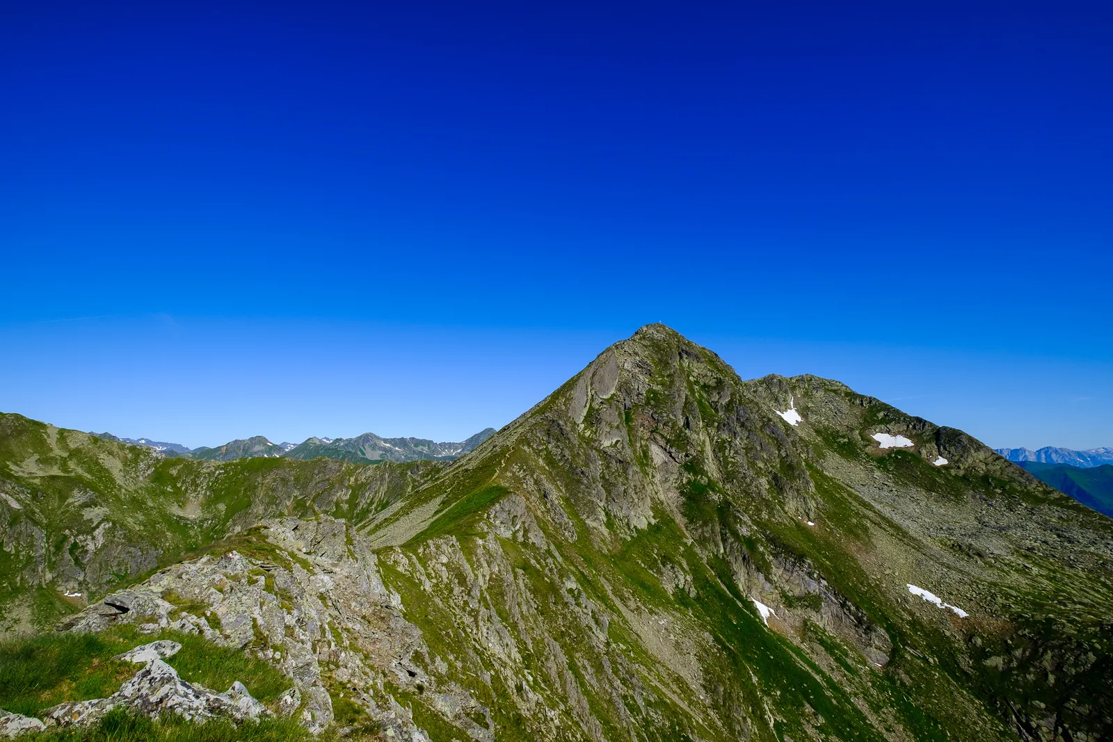
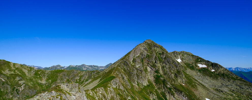
Upon reaching the Schafspitz-Peak we signed the visitors book and then continued right away, eager to finally get to the target of the day. The last section before reaching the cross is once again very rocky and requires hikers to be failry sure-footed.
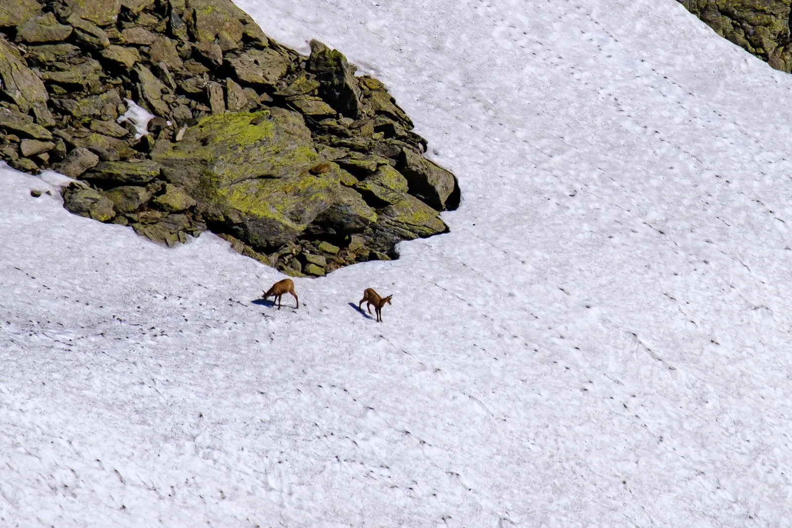
After a total of about two hours of climbing and scrambling from the carpark below we reached the peak. It changed quite a bit since we had last been here, quire a few years ago. The most startling difference was the new, modern cross at the peak. With a fresh breeze the temperature up high was a lot more bearable than on the climb up, so we sat there quite a while, just taking in the beautiful scenery, munching our picnic and breathing the fresh air. We could even see some chamois across the valley, jumping around in snow field.
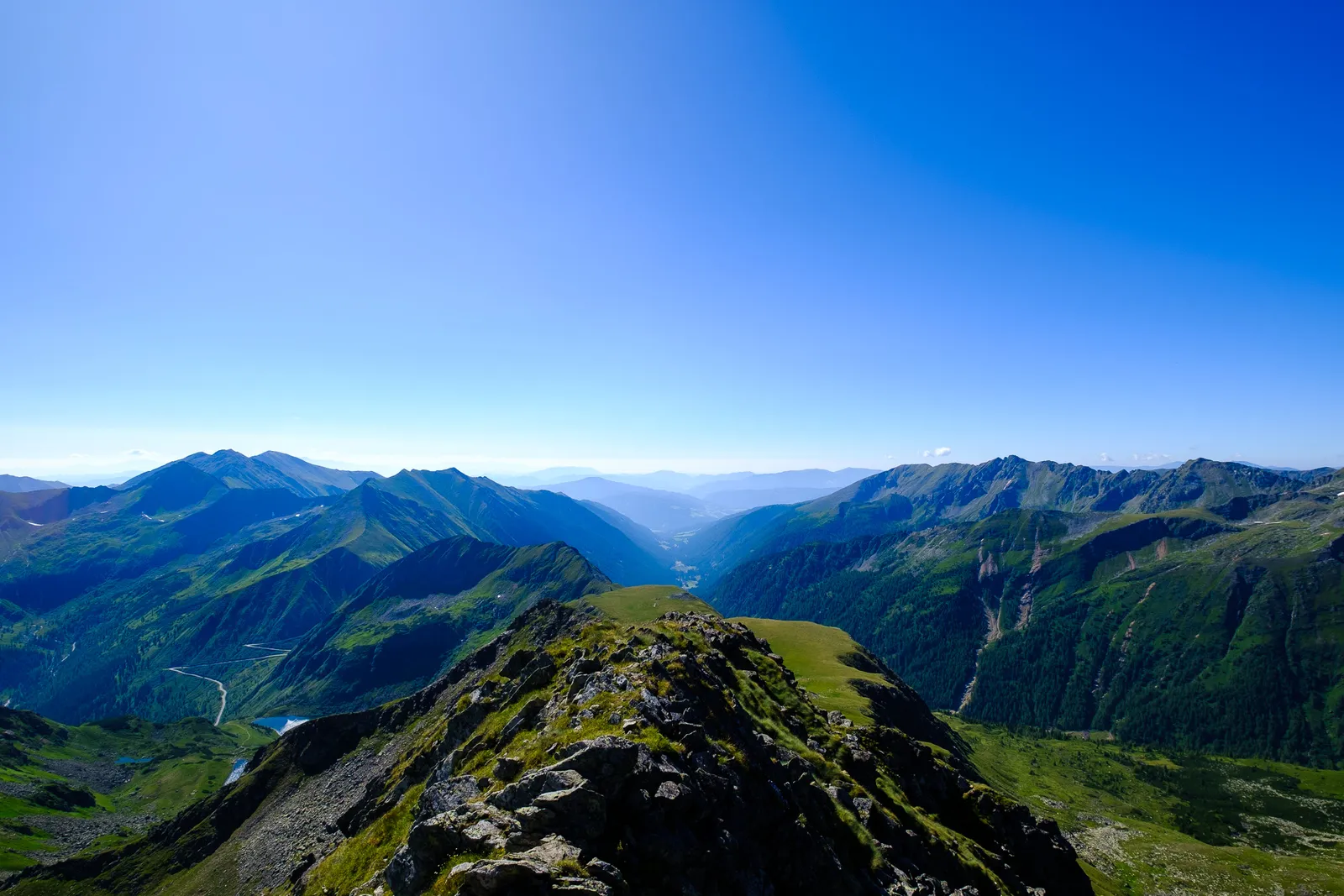
For the way back we chose the less steep way across the Ertrachböden. Here we even passed by a melting snow field and through a wide meadow fully in bloom with wild flowers.

Leave a comment