Waiau Pass Track
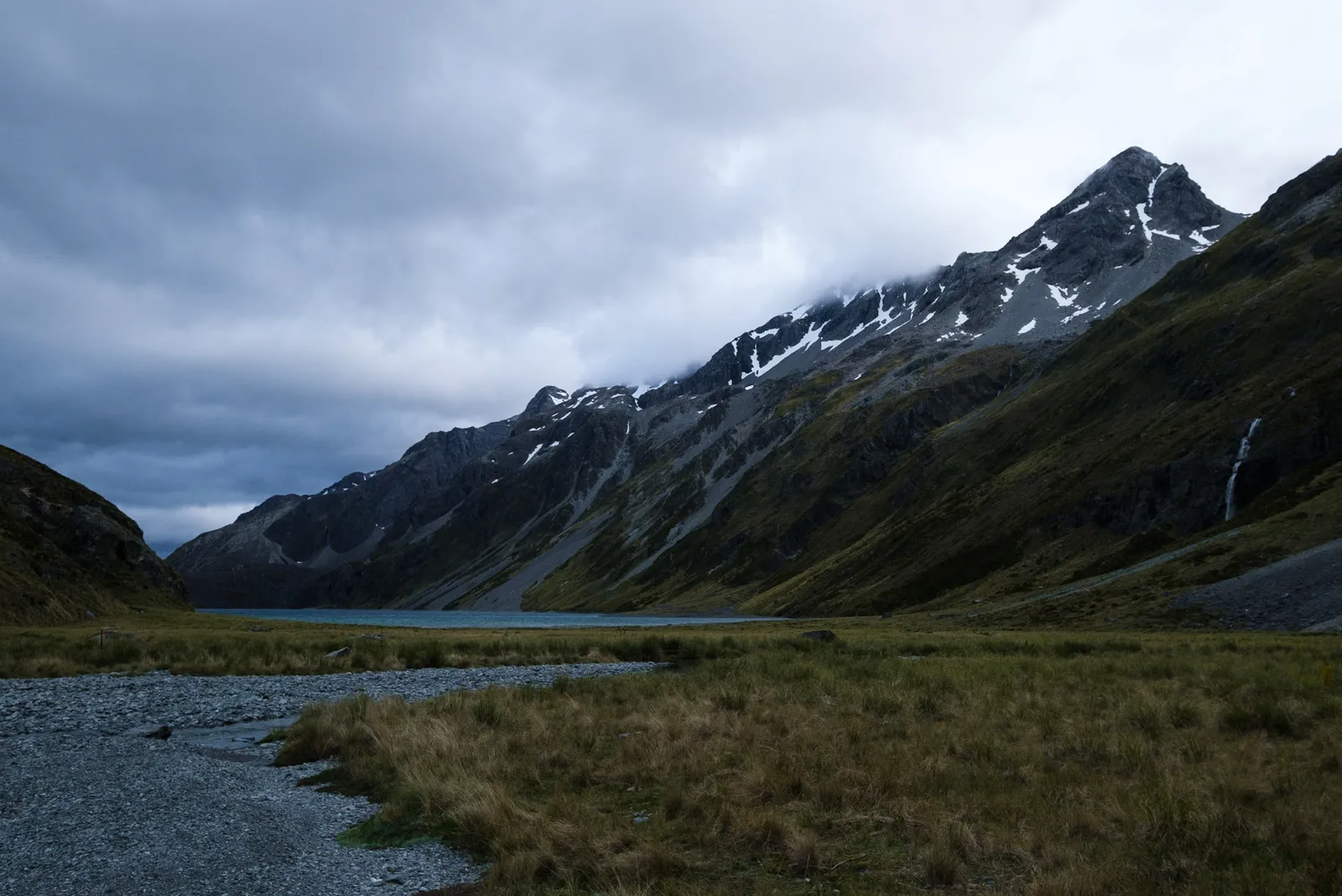
We got up early to get over Waiau Pass while the weather was still fine. It had been forecast to turn pretty bad, possibly with snow, over the next day, so we really had to get moving. And so did all the other TA walkers in the hut. At around 5:30 all of us started waking up, cooking up coffee and breakfast and packing our stuff. We had tried to pack as much as possible the evening before, so after some coffee, tea and porridge for breakfast, we got going around 6:30. It was one of the coolest mornings we had so far when we walked by Blue Lake and then made our way up to Lake Constance. The sun only temporarily peeked through the cover of clouds, and it was already windy.
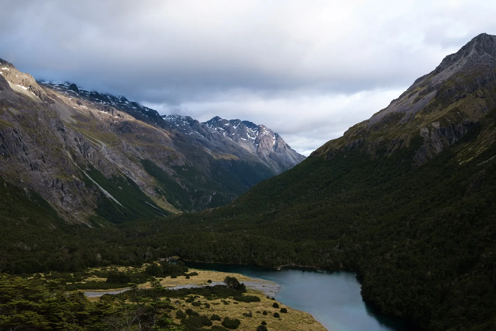
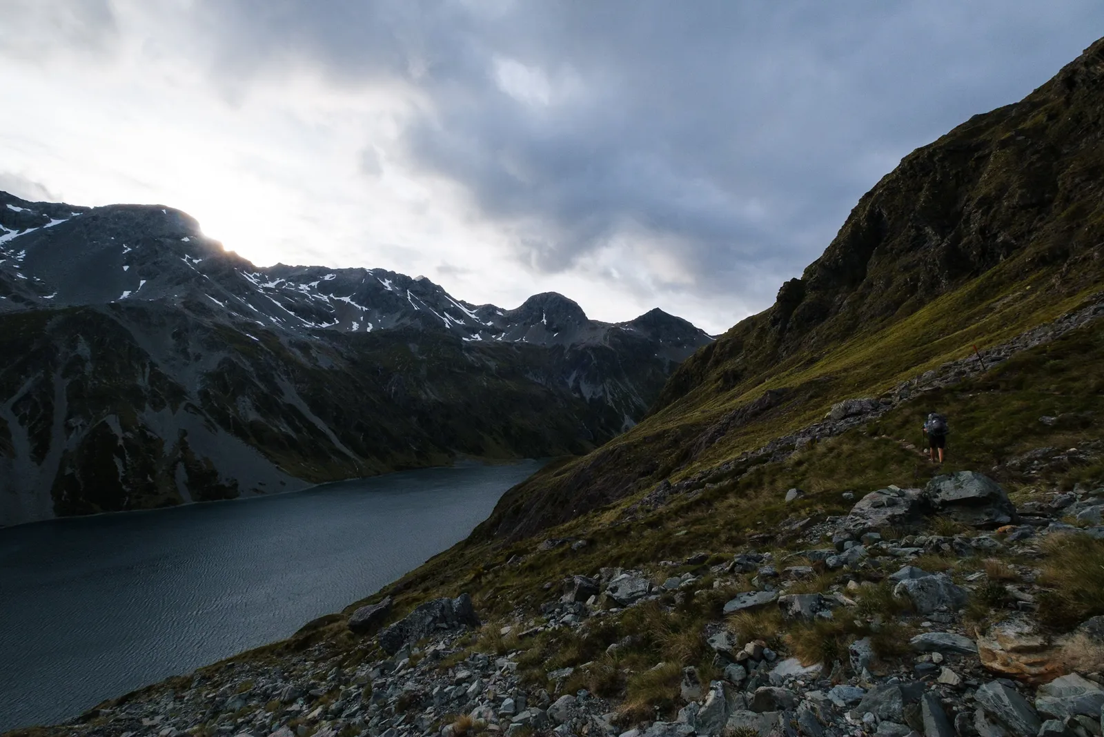
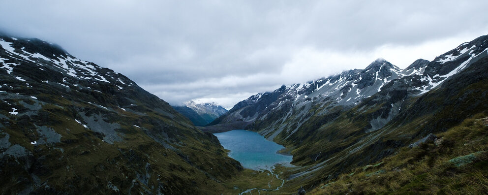
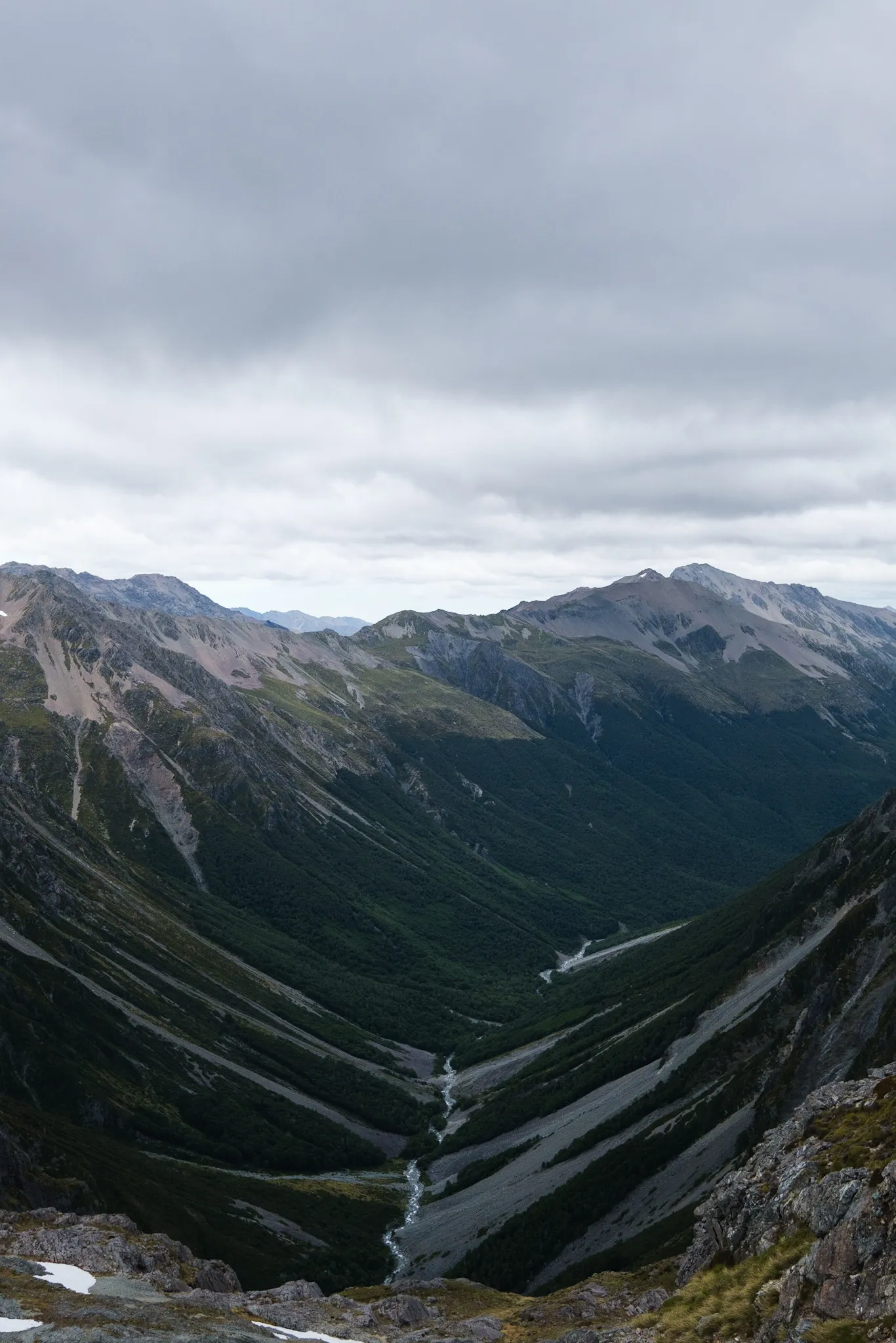
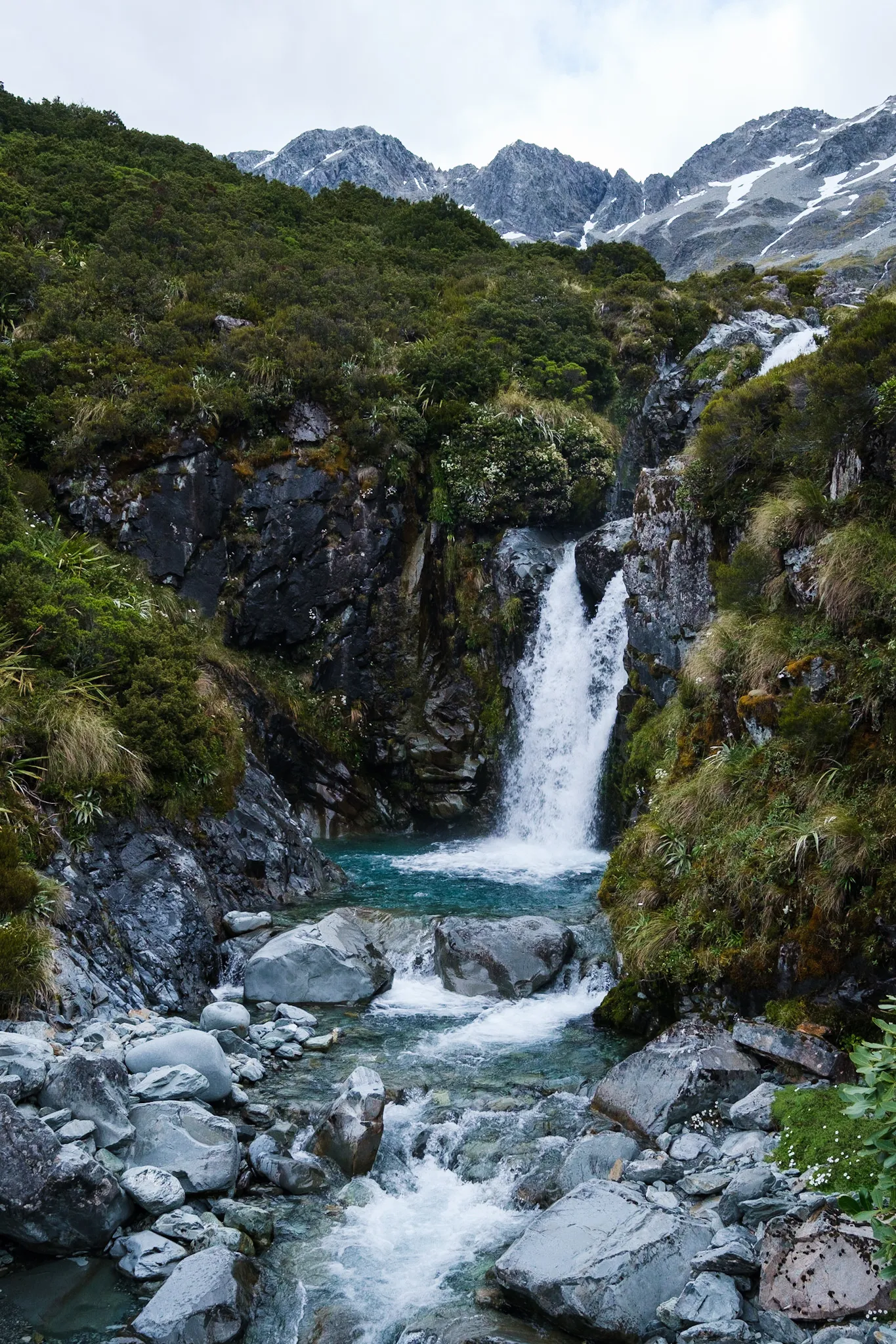
Lake Constance
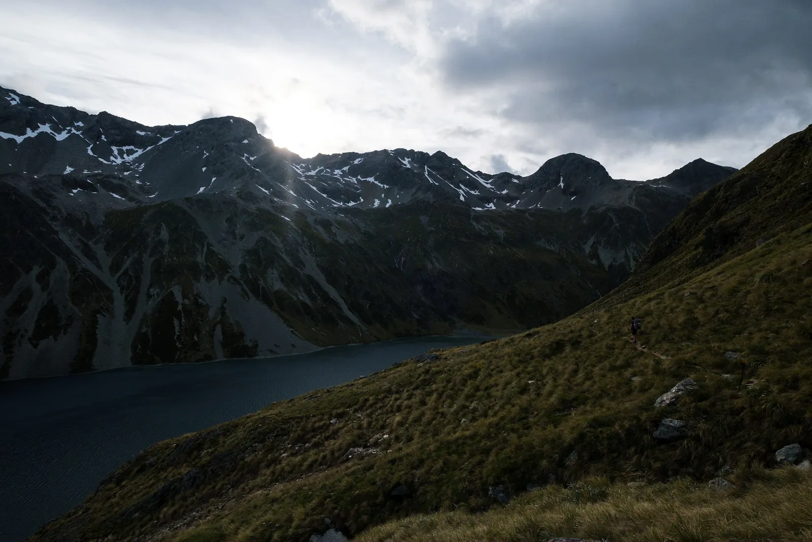
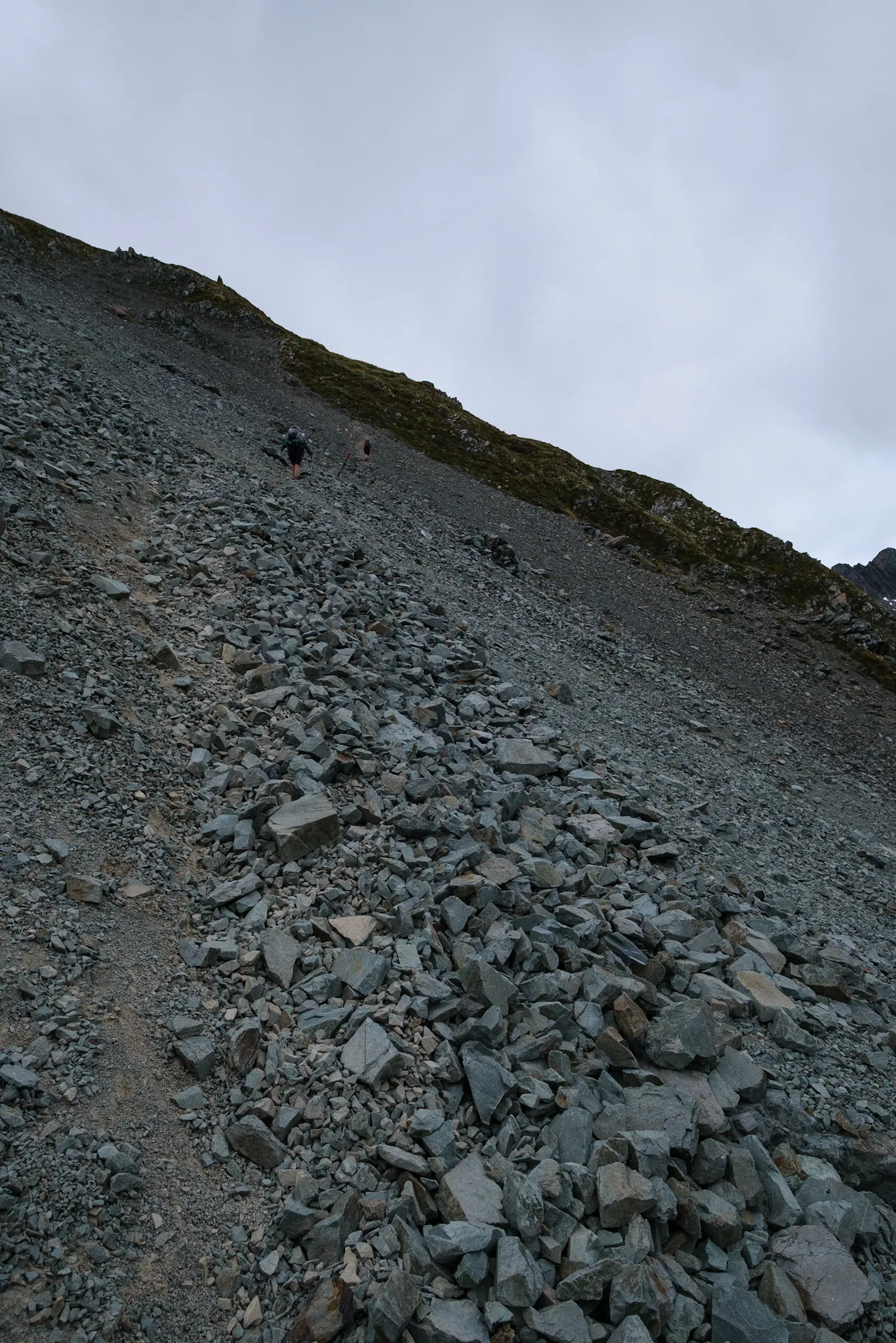
Up at Lake Constance we first had to walk up a steep field of scree. Then we sidled on the flank of the mountains around the Lake. There were some pretty exposed places and the wind shoved us around a bit. Shortly after the climb three hikers walked up to us from the opposite direction - they had wanted to go over Waiau Pass the day before, but one women had slipped in the scree and cut her leg, we could see the bloody bandage, so they ended up turning around and walking back towards St. Arnaud. The leader of the group told us that they weren't equipped to do the pass under the current conditions but some "young and able trampers" like us could probably do it. At that point we got a bit baffled and wondered what kind of equipment we'd need to get over the pass.
Getting around the lake proved not as easy as we had hoped, we had two steep descents through loose scree and some stumbling through high grass where we couldn't find either a path nor see the marker poles anymore. The general direction was clear though so we slowly made our way. Once we were around the lake it was another long grassy field. As we walked through that, suddenly a deer-like animal jumped out of the grass, maybe two meters from us. Had it not moved we probably wouldn't have seen it. Tim tried to take a picture but it jumped out of sight pretty fast. We weren't sure about what the animal was, we think it was mountain goat, german: Gemse. But since we didn't know the english name for it anyways we gave it a new one: Due to the black strips around it's eyes and the deer like shape we call it Ninja-Deer for now.


Waiau Pass
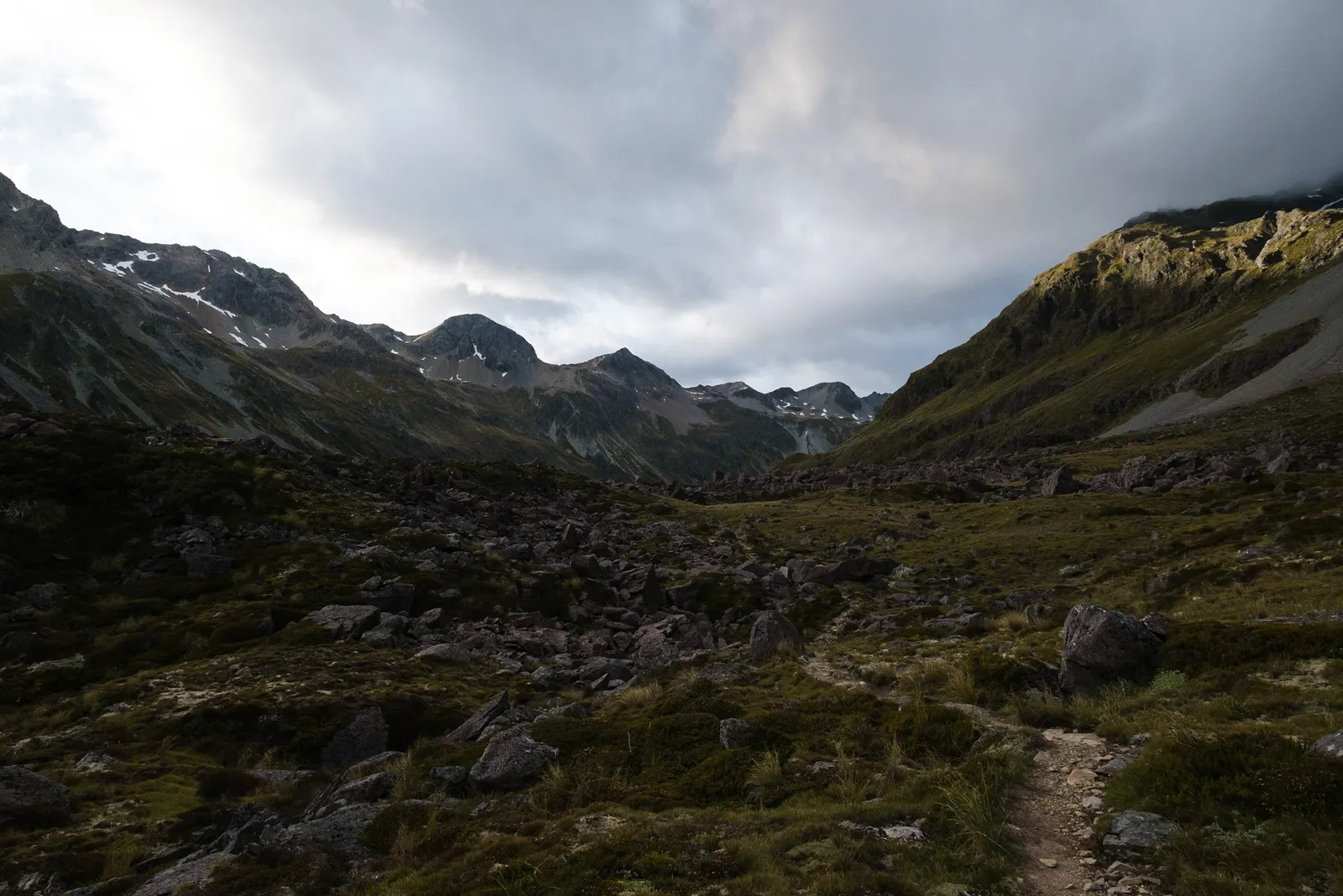
We continued on and by the time we came to the big field of scree that marked the beginning of the ascent to Waiau Pass, we could see all the other TA Walkers walking up the valley.
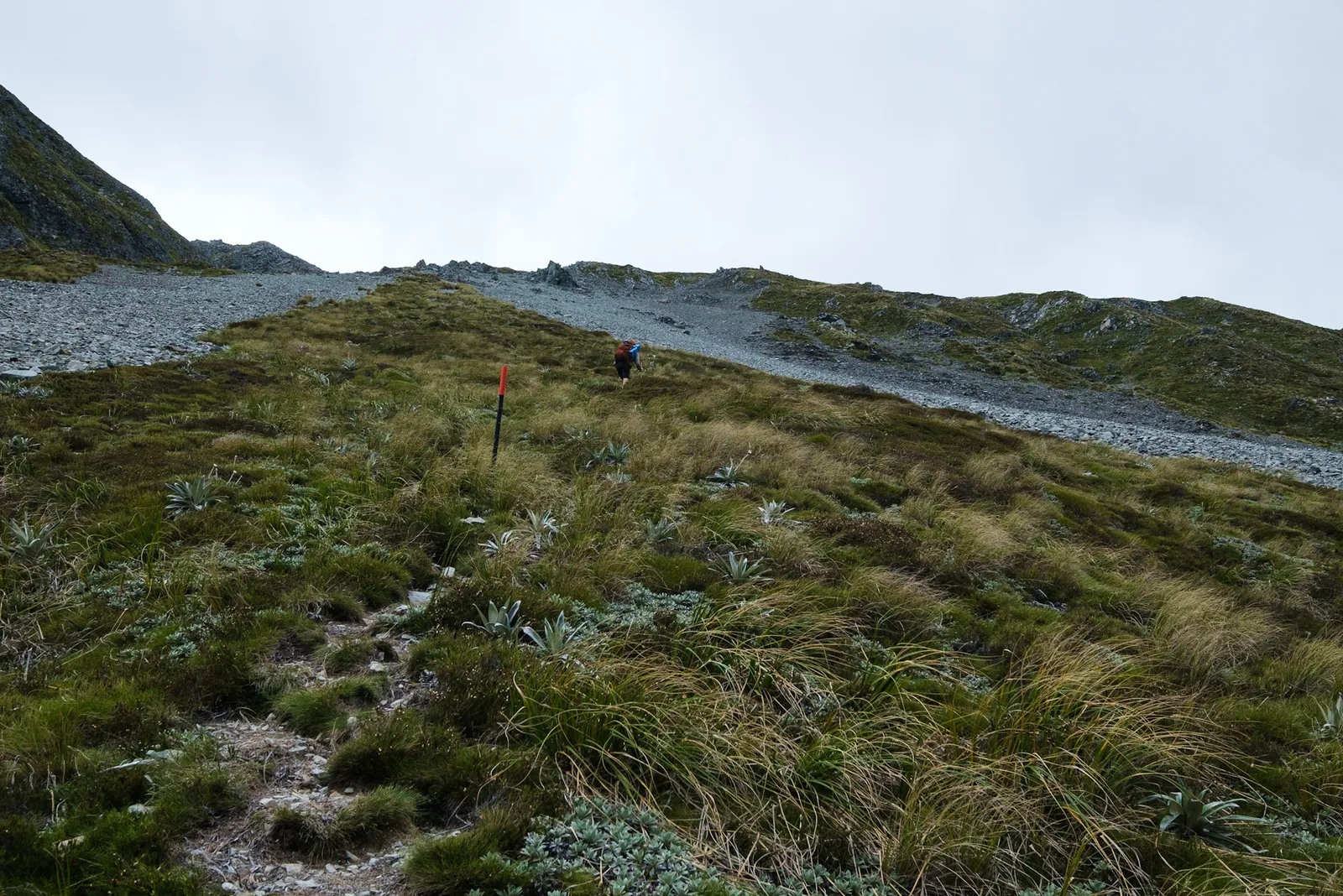
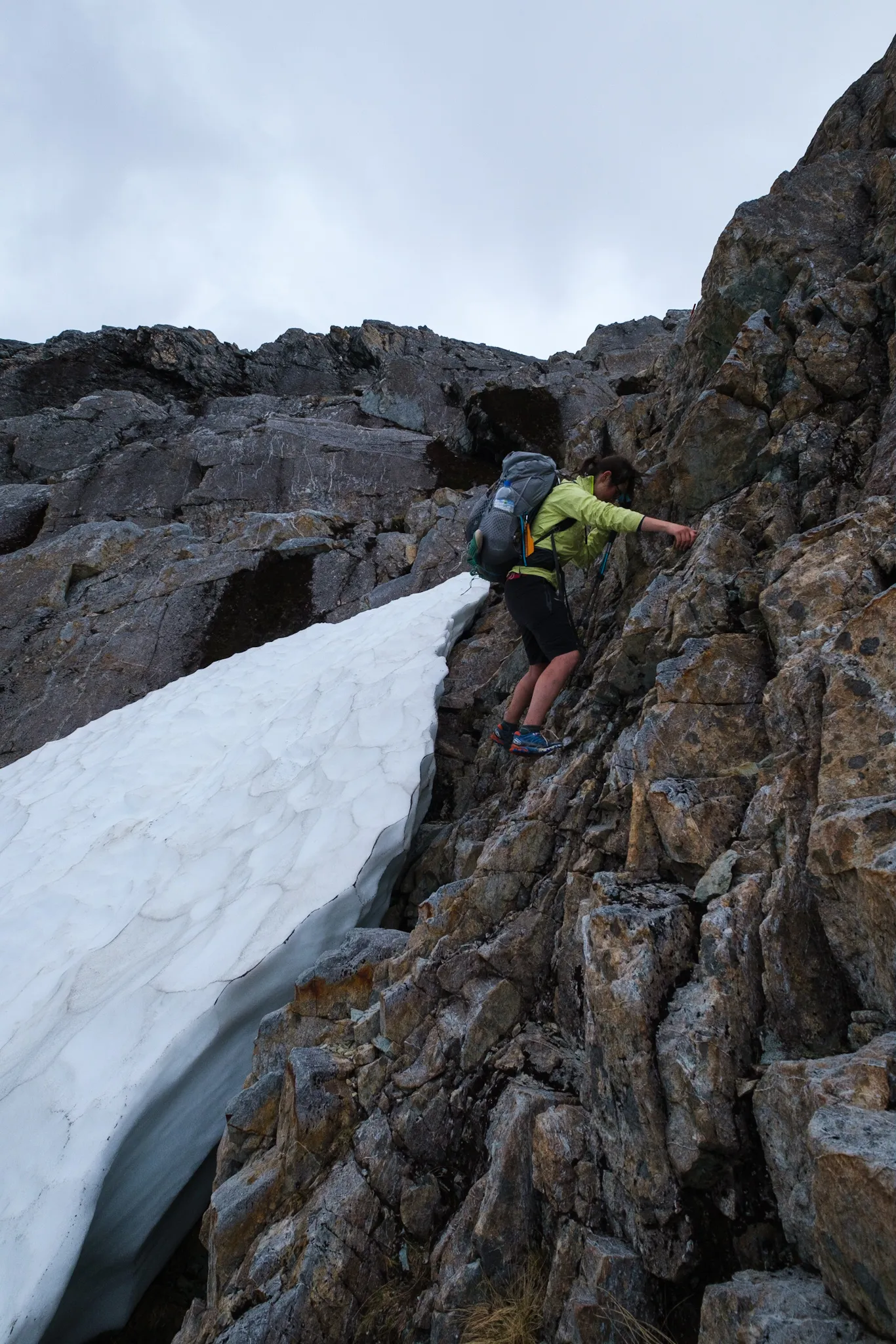
The climb up through the scree was very direct - New Zealanders don't really seem to have a thing for zig-zagging their way up a mountain - but not as hard as we had feared. Going was good and motivation high. And yet another occasion that made us realize how much we appreciate our trekking poles. Climbing up through scree must be twice as hard without poles.
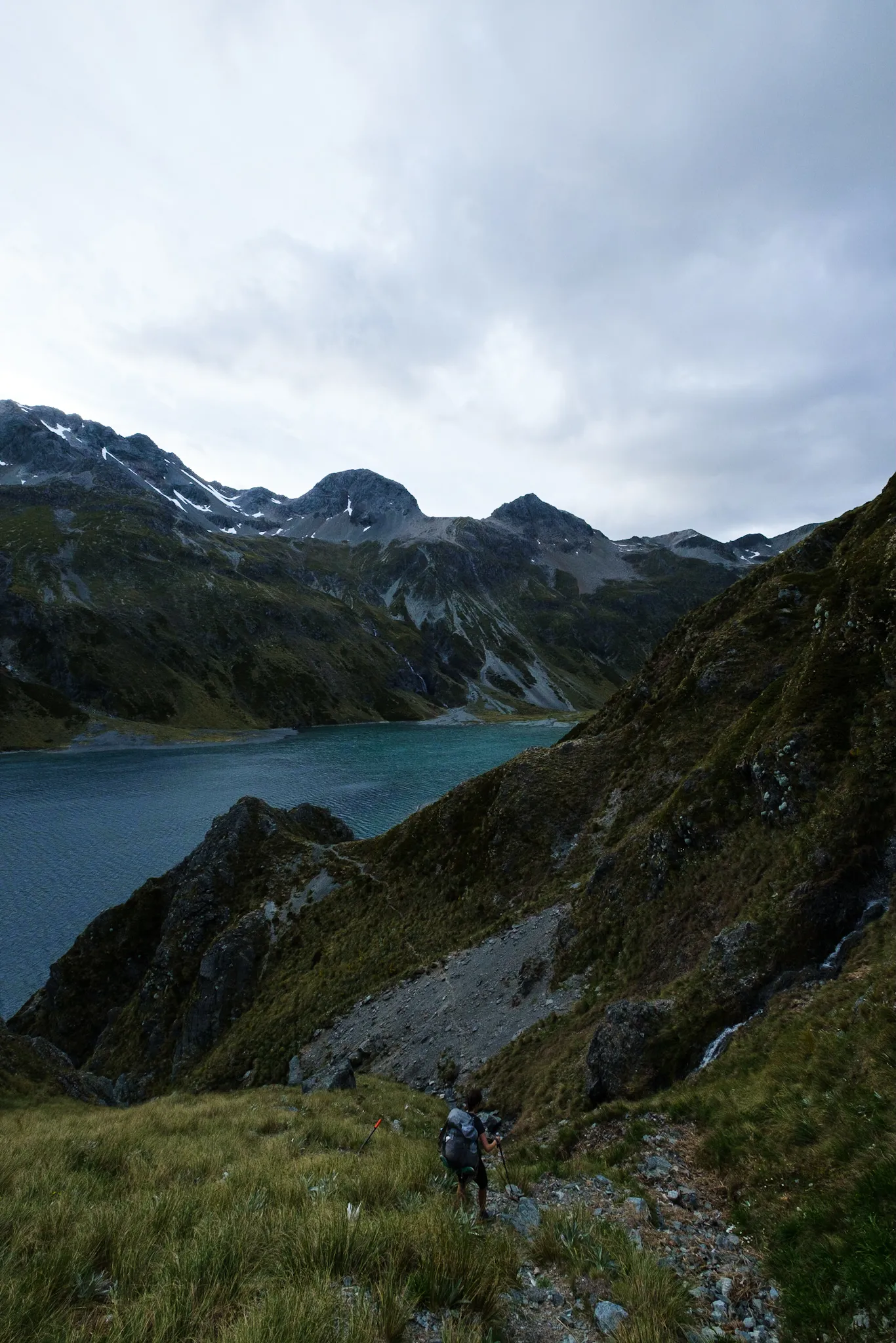
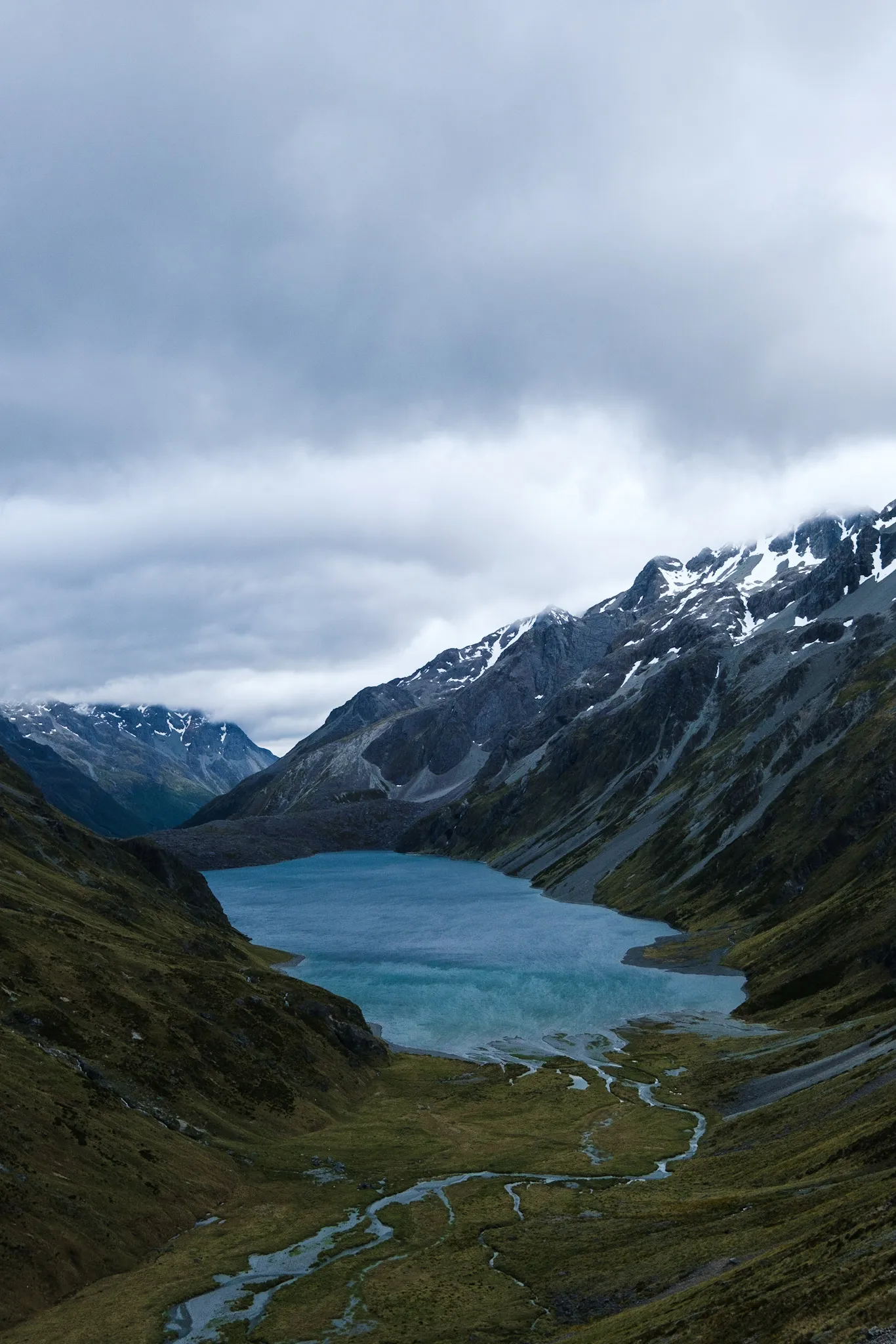
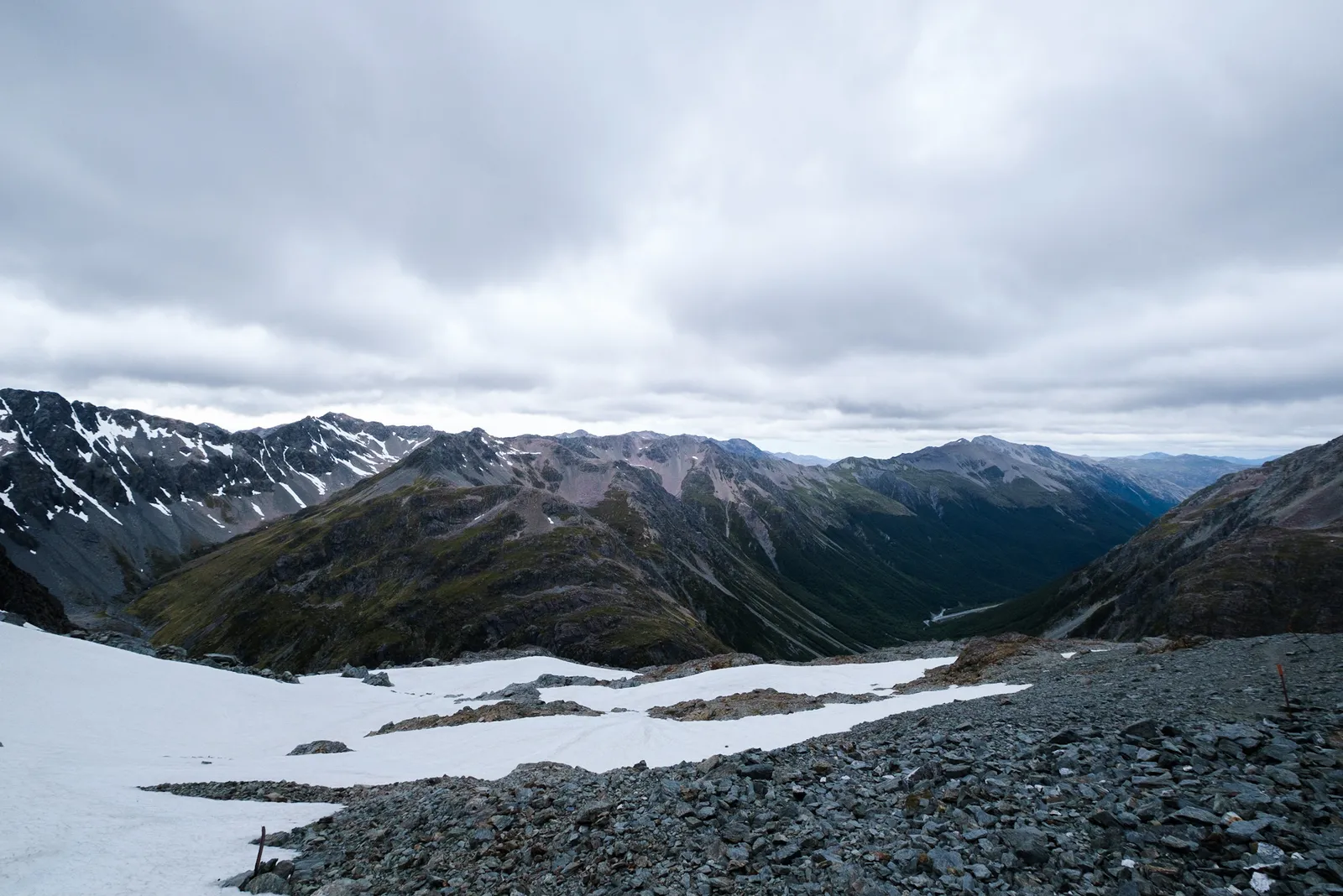
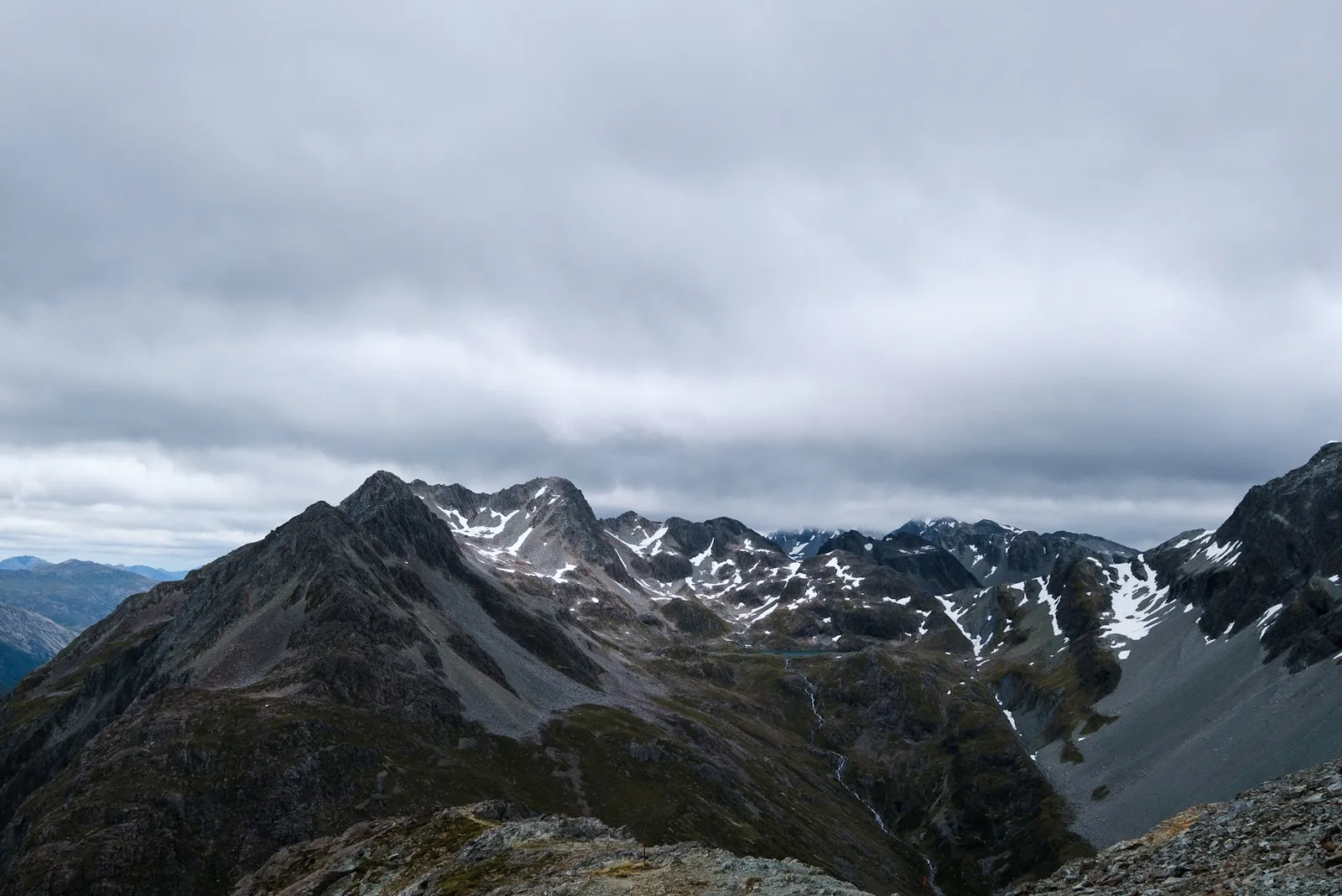
From up here the view of Lake Constance is absolute incredible, and every one of us stopped, to take a picture of the scenery. Every hiker on the Te Araroa Trail must have this exact same picture somewhere, because it's just such a rewarding view after the hard climb up those scree fields.
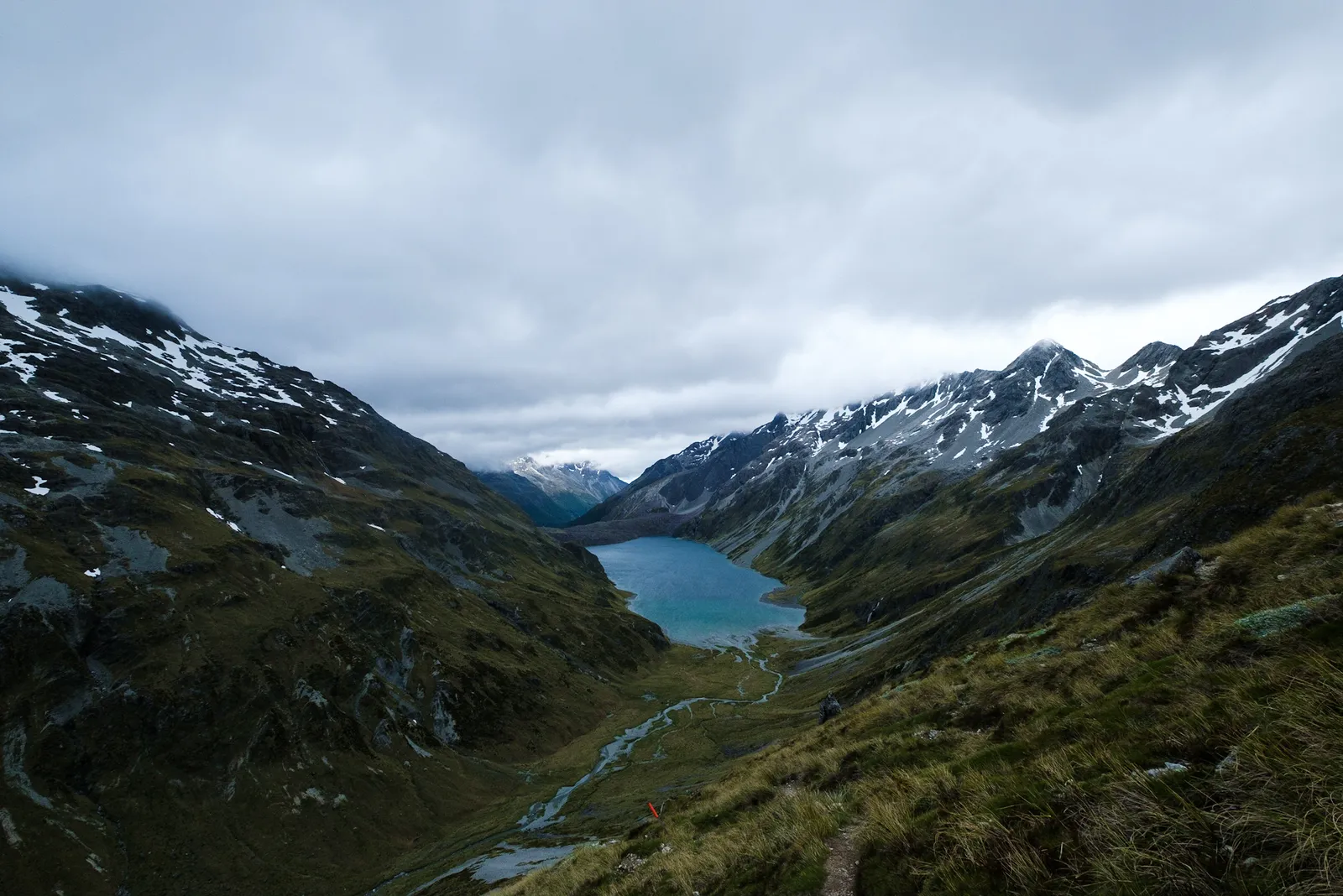
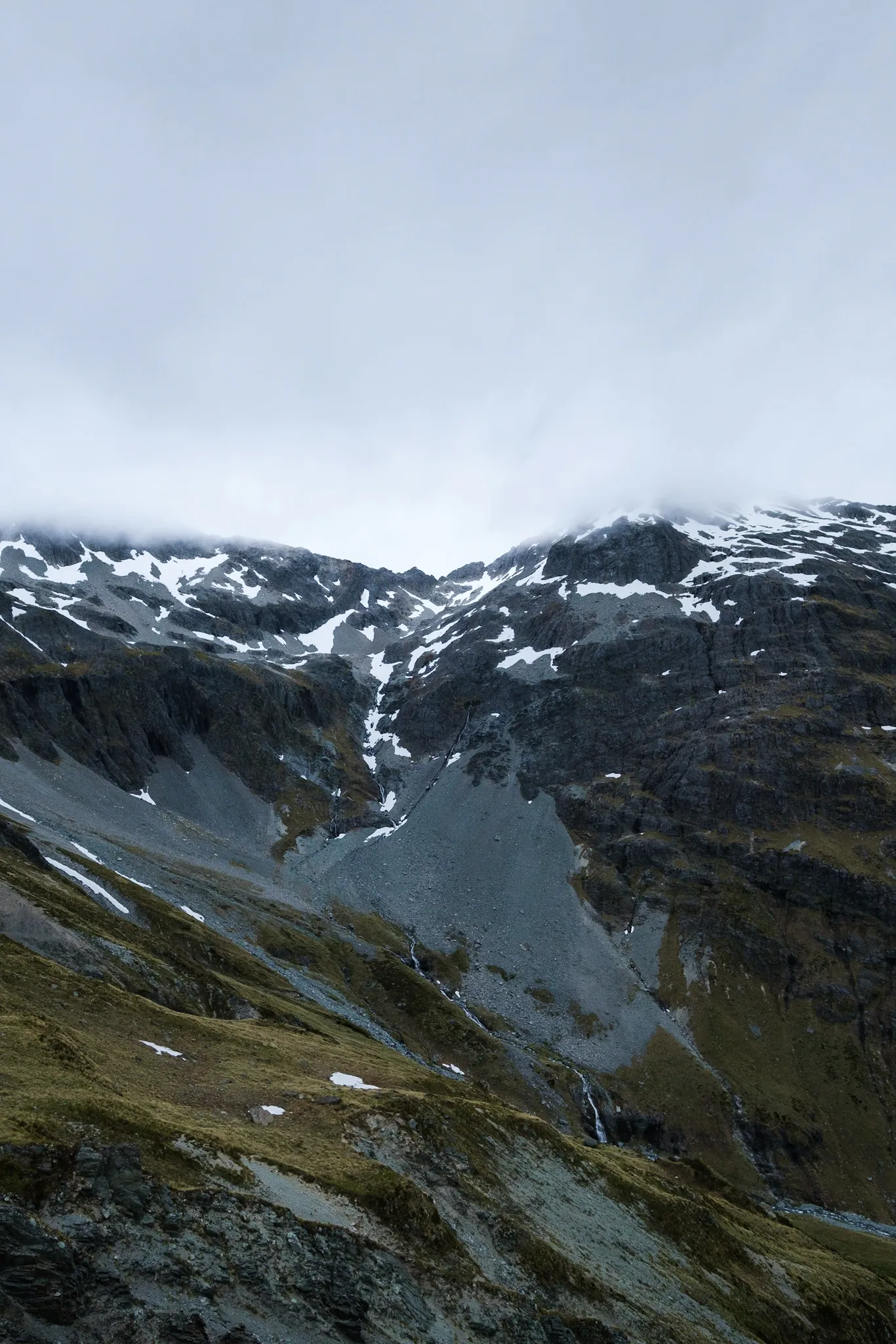
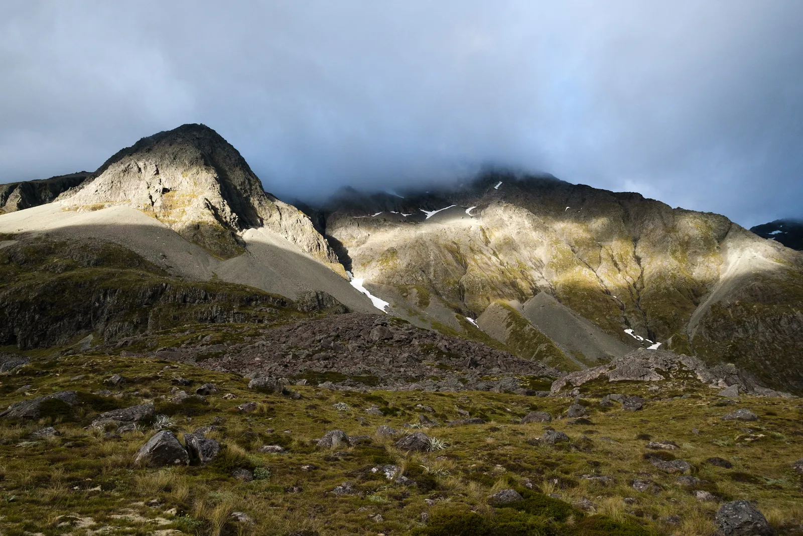
Once we got through the first bit, it started being really windy. The second part of the ascent, through more scree, we were almost pushed up the mountain by the gales that came from the valley. That made the climb a lot easier, but was really scary once we stood on the pass. We didn't even really spend time there for pictures but started the descent right away, because the winds had so much force that it was not enjoyable, and just plain didn't feel very safe.
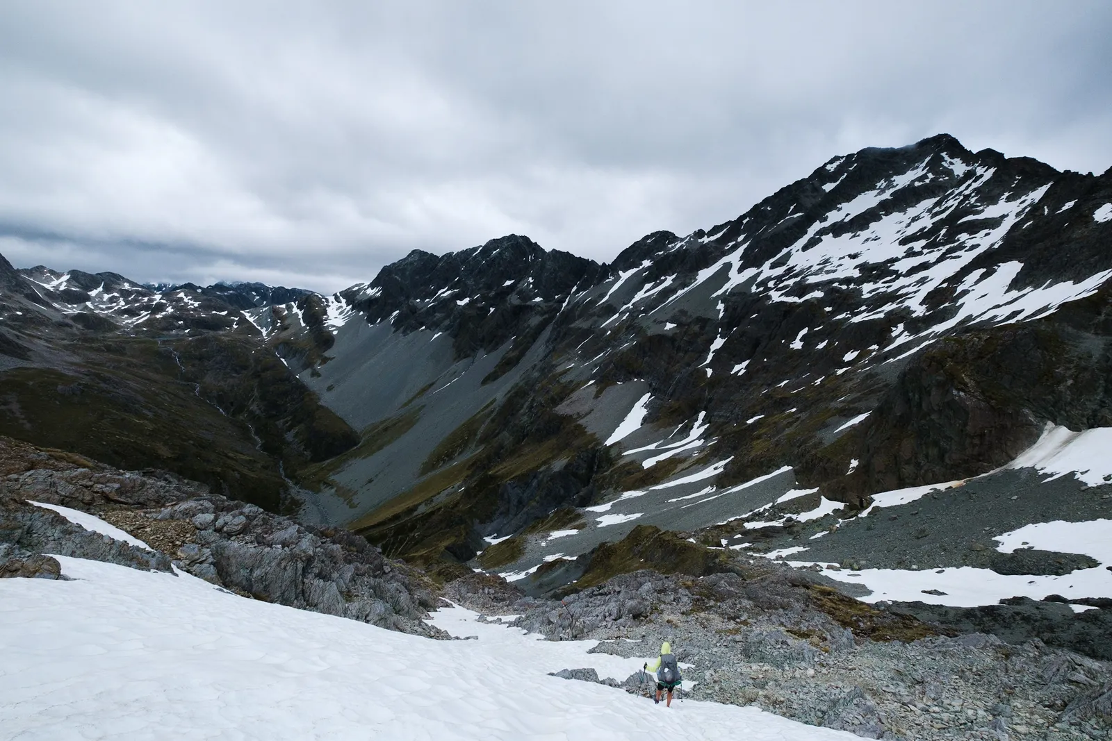
Getting down was completely diffent than up. The path led through small snow fields and a lot of sheer rock, that we more climbed than hiked down. But once again very steep, so we lost altitude pretty fast. Once we were a bit further down and the winds not quite as strong we had a short snack of a cereal bar and then continued downward.
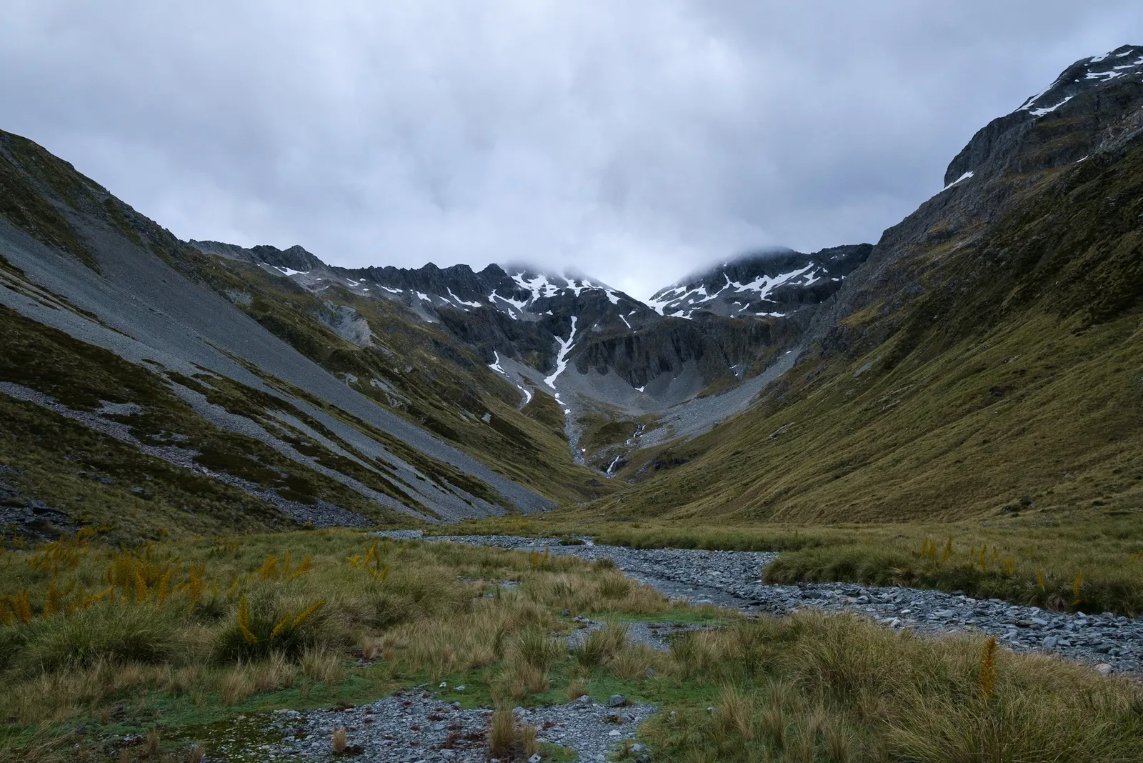
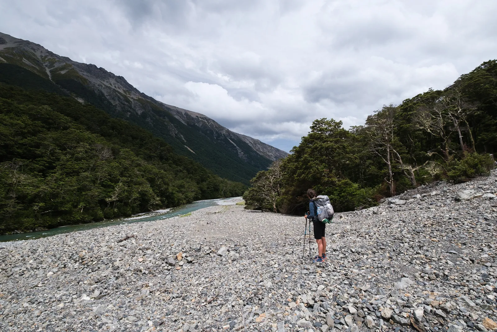
The Waiau River Valley
The way now led through grass, low scrubs and tussocks and it was often impossible to make out the real way. We rather just walked from distant pole to pole, trying not to step into holes or little streams hidden by the long grass.
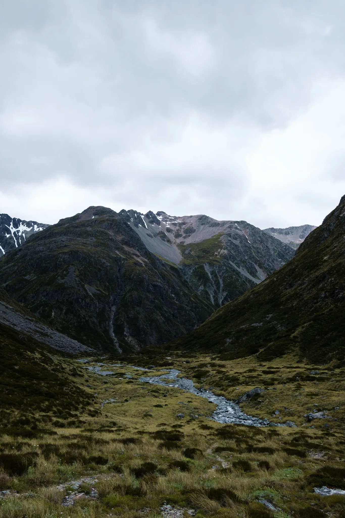
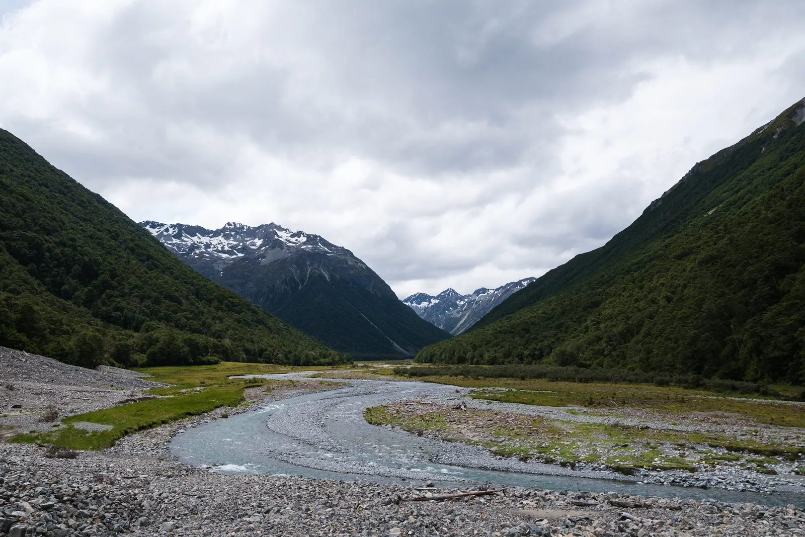
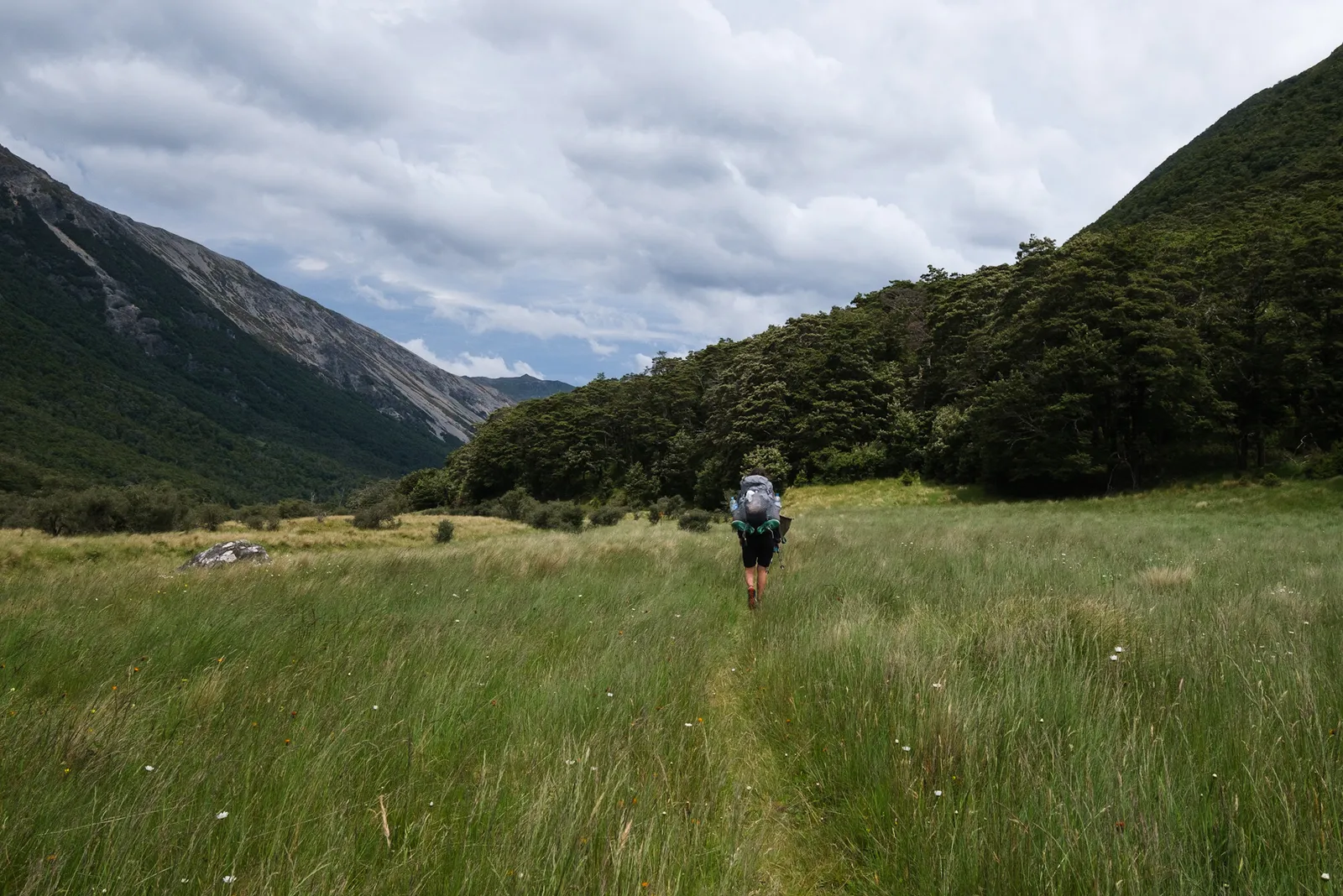
Once we had made it down to the valley floor, going got a bit easier. We still had about 8km to go to the next hut, Waiau Hut, and it led through a variety of different terrains. A lot more scree, some beech woods and a lot of grassy meadows with rivers in between. The many river and steam crossings that were to far apart to walk in our crossing shoe led to us walking through the streams in our regular hiking shoes for the first time. It wasn't so bad, but of course at that time we knew that the distance we had to go that day wasn't that far anymore. And with a bit of luck our shoes would be dry again in the morning.
Between us and the hut there were two other options to stay the night if we had felt that we couldn't make it. A camping spot that is mentioned in the trail notes and maps, shortly after hitting the valley floor at Upper Waiau Forks. We crossed the Waiau River there and saw the spot, but we still felt fine so we continued on. And then there's the Caroline Creek Bivy (check it out on the DOC Website). Once we walked by the Bivy, we knew that there is no way we'd spend the night there - it is tiny, dark and damp, and the prospect of a nice new hut was way more inviting so that we just moved on after signing the bivy's hut book.
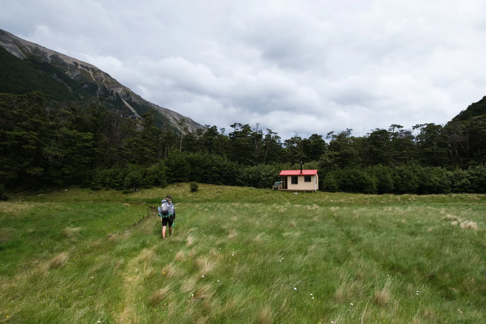
We were the first to arrive at Waiau Hut - a really nice, new hut, only built in 2017. Later Herman, the swedish guy, Bart, the dutch, Simone, also dutch and Rebecca and Ryan, a UK/US couple joined us in the hut. We had met all of them before, and after a while the other hikers feel like a bit of a family. We had a really nice evening with them, everyone sharing their highlights of the days hike. All of us agreed that this section was one of the most impressive and most challenging routes of the Te Araroa that we had seen so far. And we were all extremely happy that we had managed to make it over the pass before the weather took a turn for the worse - unimaginable to do this hike in bad weather conditions. After seeing it we were aware that a turn in the weather would have meant to turn back to St. Arnaud.
The TA hikers we met so far were in general a friendly bunch and it is so nice to have a little group of people around that you meet every now and then.
Related Links
Resources for planning this section of the trail. We highly recommend the Department of Conservation Website and Te Araroa Trail Websites for planning your trek.
Safety on the Waiau Pass Track
The Waiau Pass Track is an Alpine Track that should only be hiked well prepared. The Mountain Safety Council have made a great video giving a general overview of the track and a lof of information on things to consider as well as safety precautions to take before embarking on the journey.

Leave a comment