Two Thumb Track
After almost a week in Christchurch over Christmas we decided not to go back to Boyle River to start the trail where we had left off - instead we'd be skipping the Arthur's Pass Section (which is sad) and both River Hazards with the trail section in between. That meant we'd be back on the trail on the Two Thumbs Track, leading up to the hightest point on the Te Araroa Trail, the Stag Saddle.
The trail head is about 50km from the closest town, so first there was the matter of getting there...
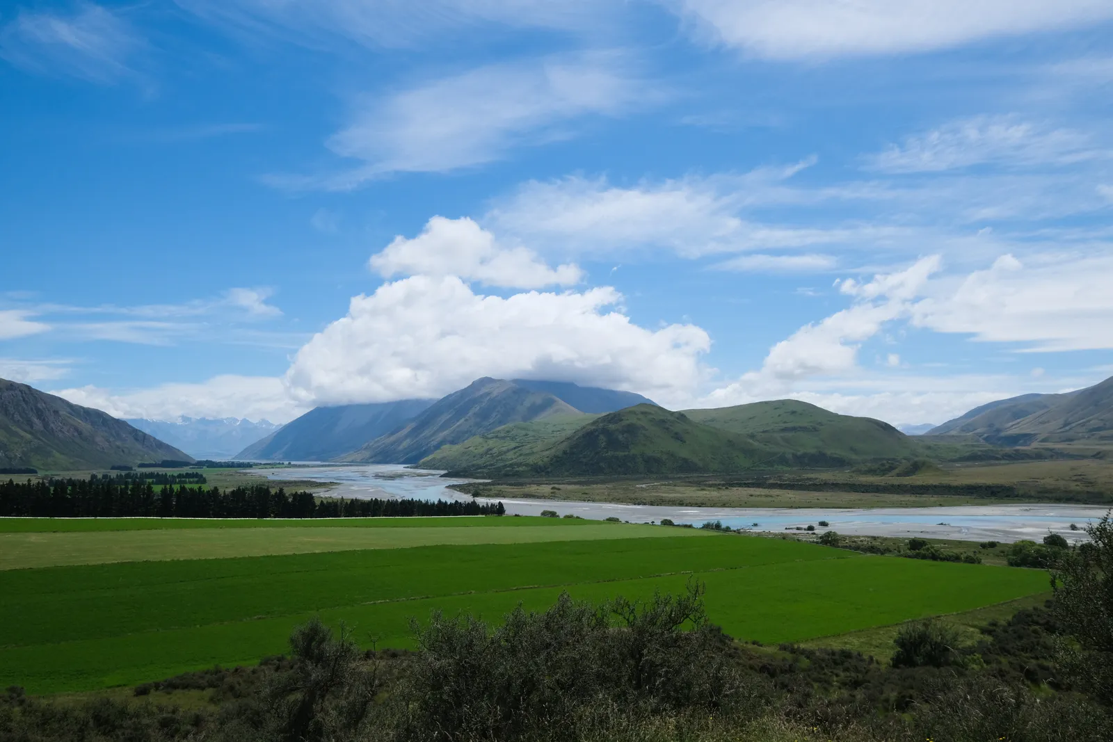
The idea was to get from Christchurch to Geraldine, the get from there to Peel Forest, and then find transportation to the trail head.
And somehow all of that magically worked out. We took a bus to the outskirts of Christchurch and then tried hitching a ride from there. About 20 minutes later a young guy pulled up, telling us he was going by Geraldine and could take us there. His name was Josh and he was on his way to Wanaka to meet up with family over new years. We had a good time during the ride, talking about all kinds of things, but mostly about traveling and what places we were dreaming to visit. Josh ended up dropping us off in Arundel, from there it was just 12km to Peel Forest - which put us there a whole day earlier than expected.
In Peel Forest we visited the Green Man Cafe to enquire about transportation to the trail head. We also enjoyed a nice coffee there and then learned that we could ride up to Mesopotamia Station with the Mail Drop the next day. Perfect when things go that smooth!
We spent the night at the Peel Forest DOC Campground - which was pretty cool, even with hot showers!
Bush Stream Track to Copper Spur Hut
We got up the next morning and first walked back the three kilometers from the Peel Forest Campground into town. There we sat down in the Green Man Cafe and enjoyed some coffee, toast and the free wifi. The mail run ended up being in the afternoon, as we had been told to expect. At around one o clock we got into a car with a magnetic "Rural Post" sign stuck to it and were on our way. On the one hour drive our driver told us all about the different Stations we came by to drop off mail, the region itself and even the different Lord of the Rings filming locations that we drove by. Soon we came by Mesopotamia Station, the last one on the road, and then we were dropped off at Bush Stream Carpark, off to our next adventure.
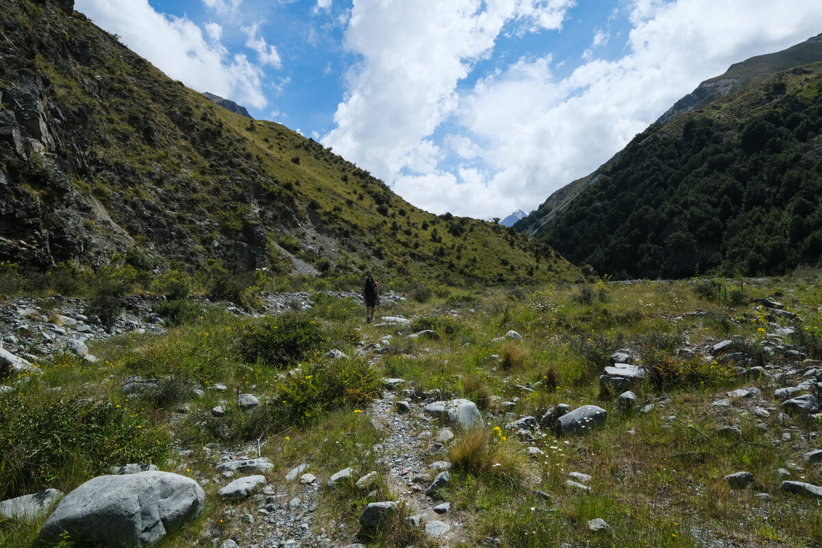
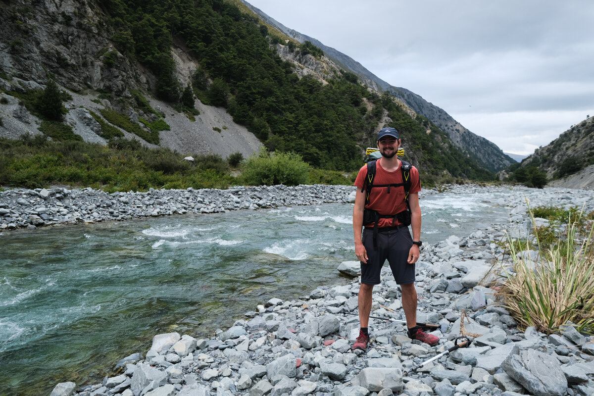
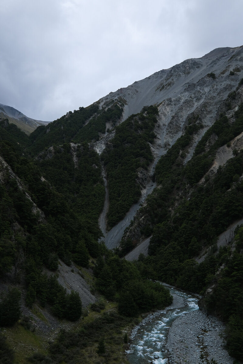
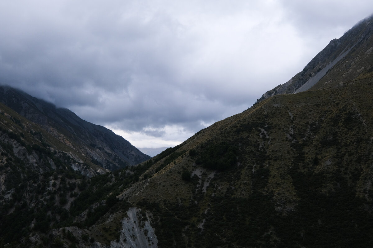
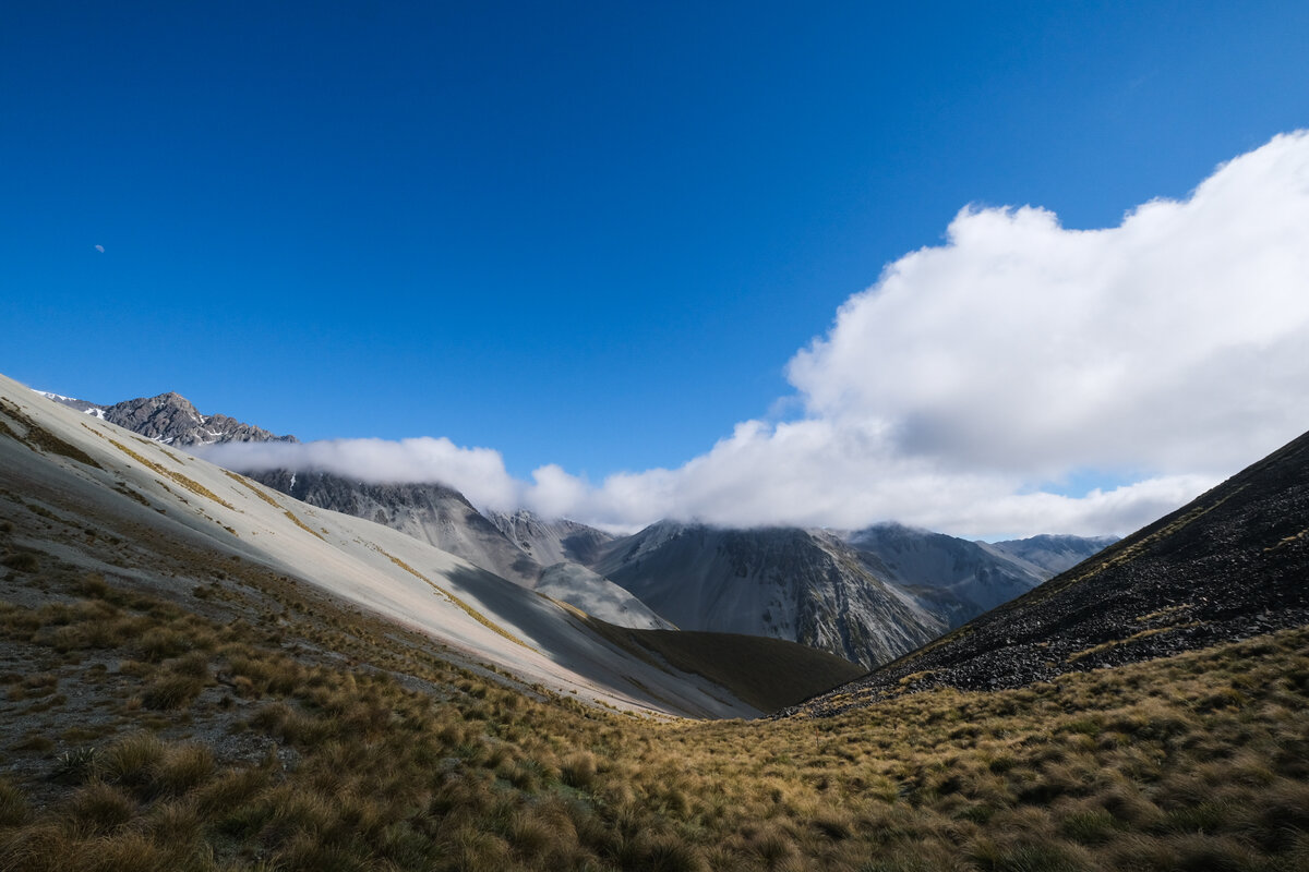
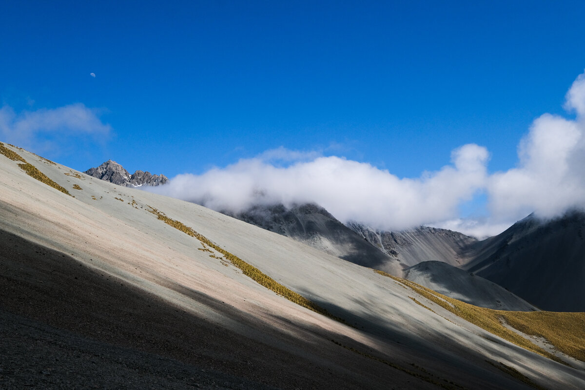
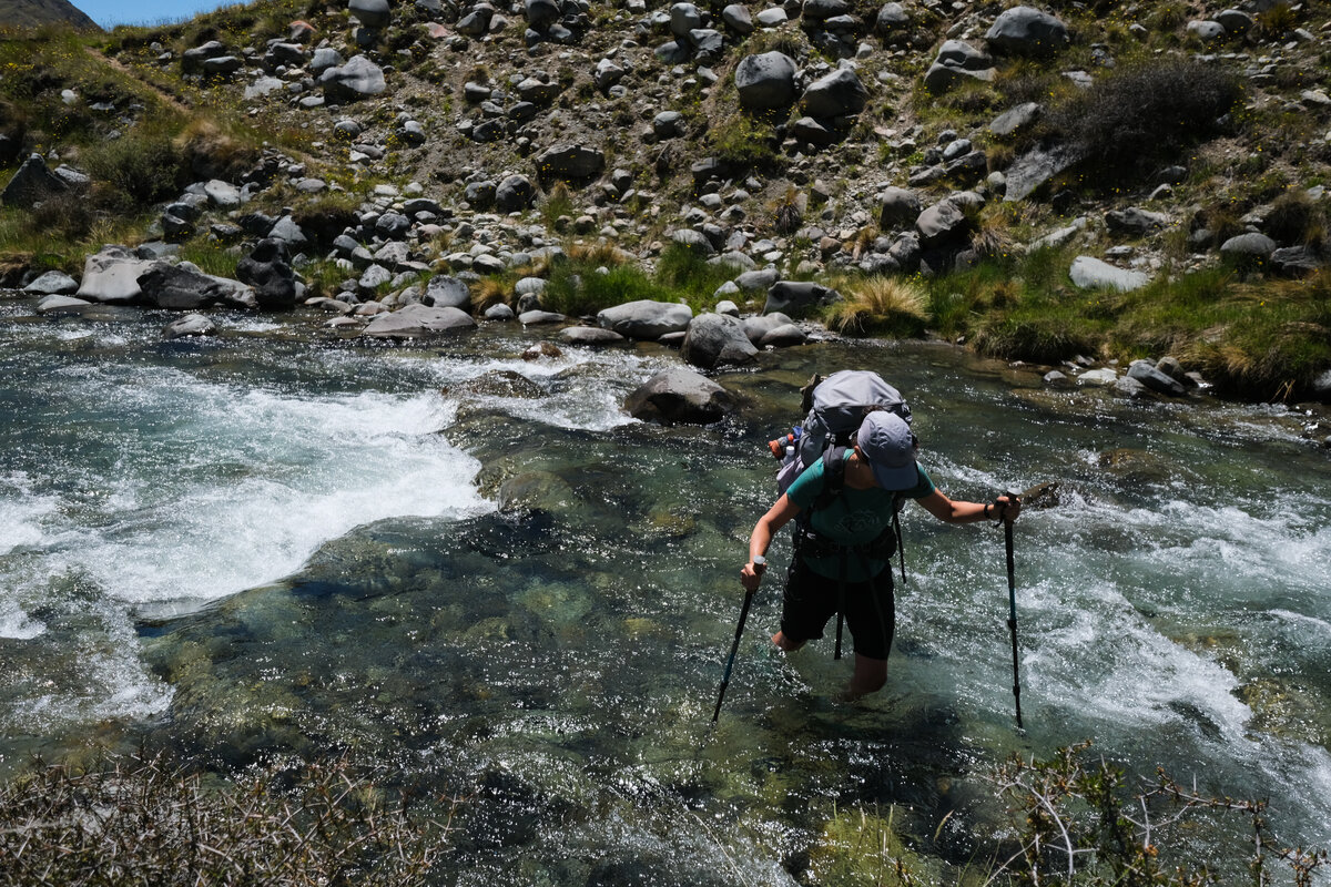
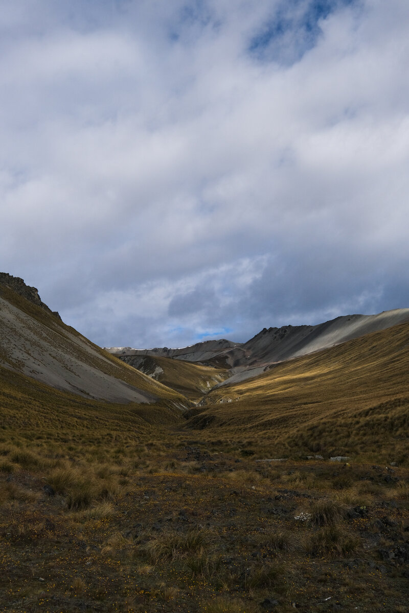
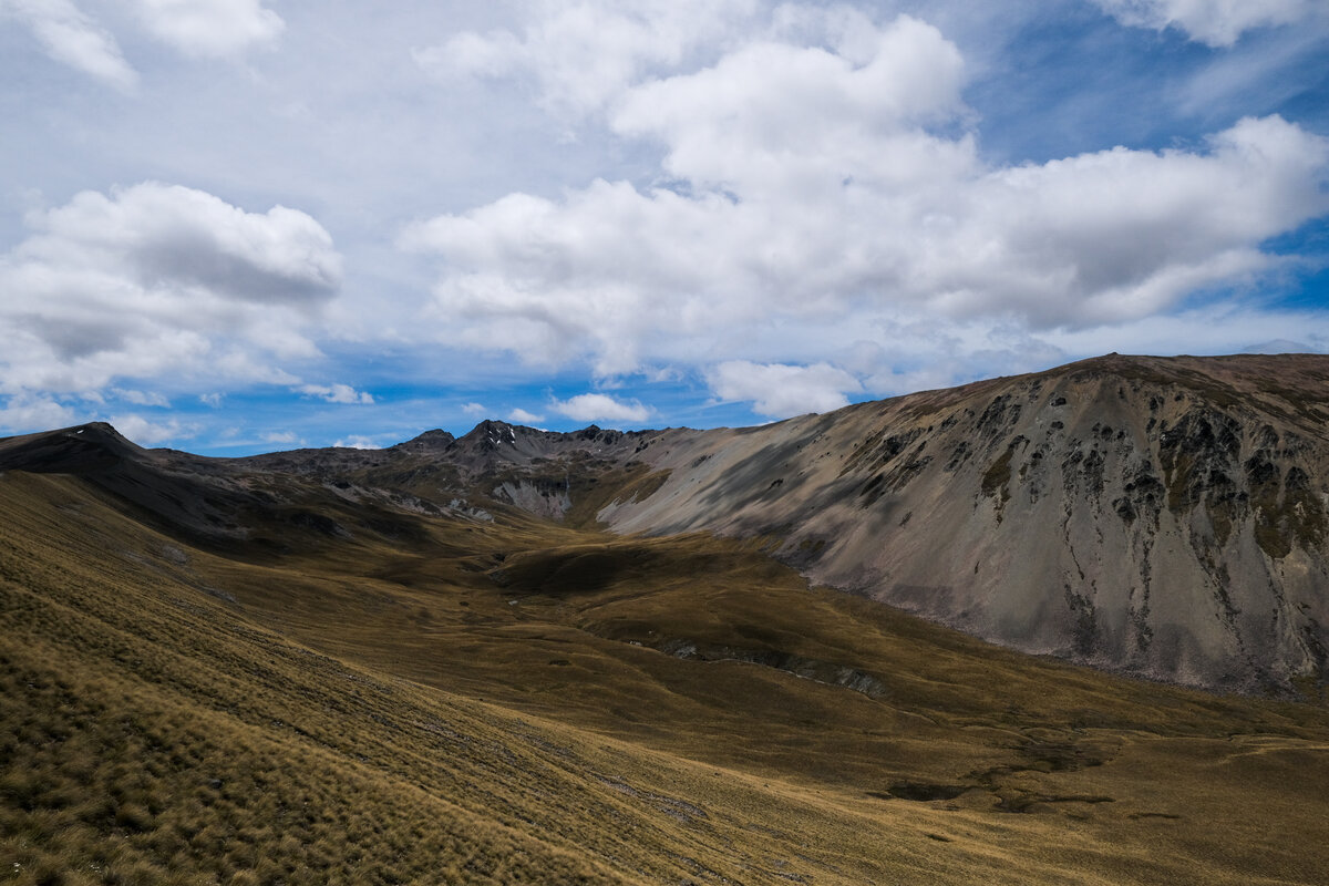
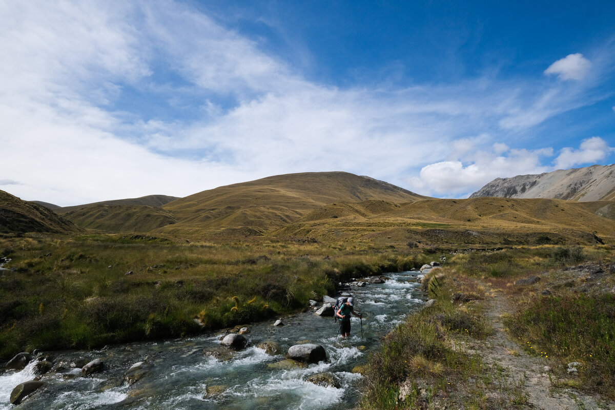
Back on the trail, we had to tackle Bush Stream Track, which meant following the river bed for a few hours. That sounded easy enough but proved to be quite difficult. The track was sparsely marked and in a lot of places there was no trail at all - neither a visible path, nor marker poles. It looked to us like there might have been one, some time ago, but lots of it seemed to have been washed away, or eroded away in slips in places where it used to be above the riverbed.
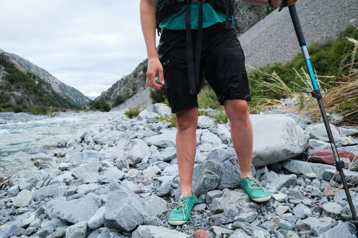
So we stumbled across the rocks in the riverbed, often coming across small cliffs that forced us to switch to the other bank of the river. We went through Bush Stream numerous times. That also meant we walked pretty much the whole day in our river crossing shoes. They are awesome in the water, but aren't all that comfortable walking over the uneven rocks of the riverbed.
While the first few crossing through the wider stream were fairly easy, they kept getting more difficult as the riverbed got more narrow upstream and we came through some gorges. We came to a point where the current was so strong and the stream hip deep for me (Sonja) that I didn't trust myself to ford it on my own with just my trekking poles as support, and for the first time on the trail we used the chain technique, crossing the river together.
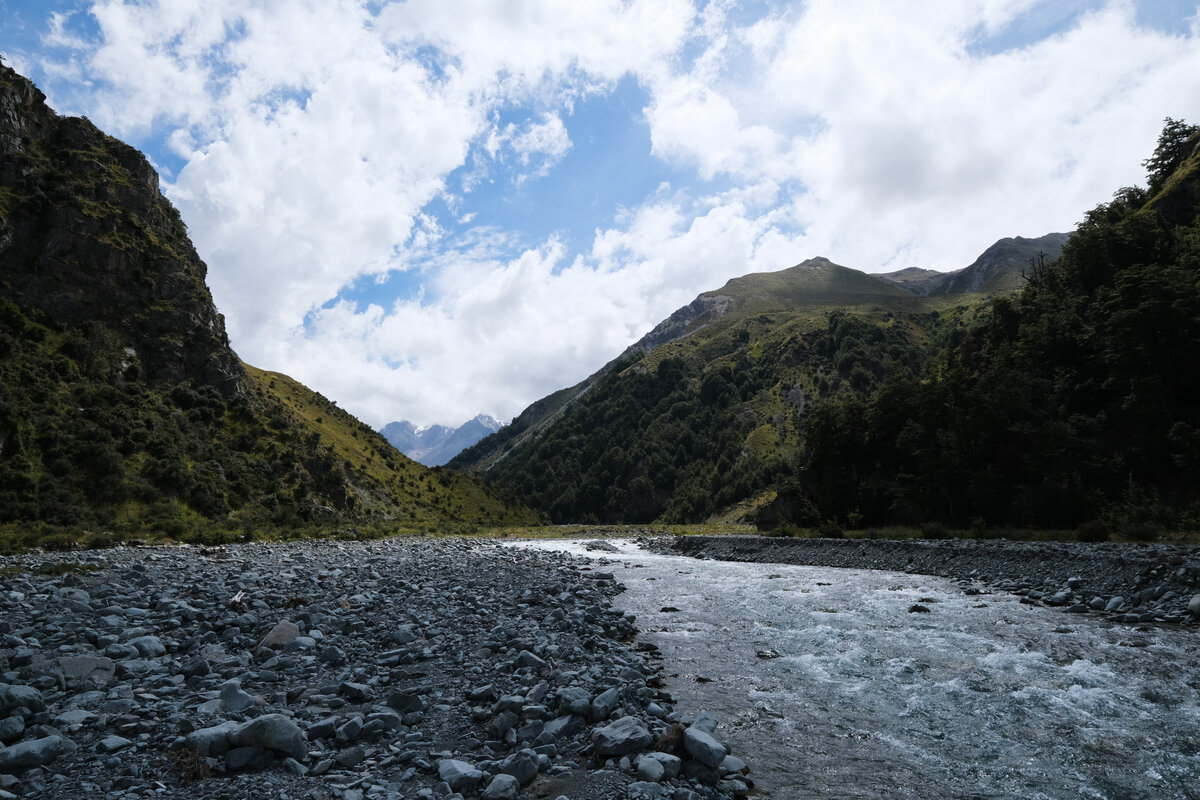

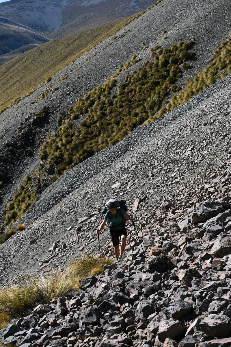
In some places we tried to avoid the crossings, climbing over little bluffs and scrambling around on the rocks, but that was very time consuming, exhausting and partly even more dangerous than fording the river, so that we gave up on trying to get around after a particularly steep scramble around "Sawtooth Bluff".
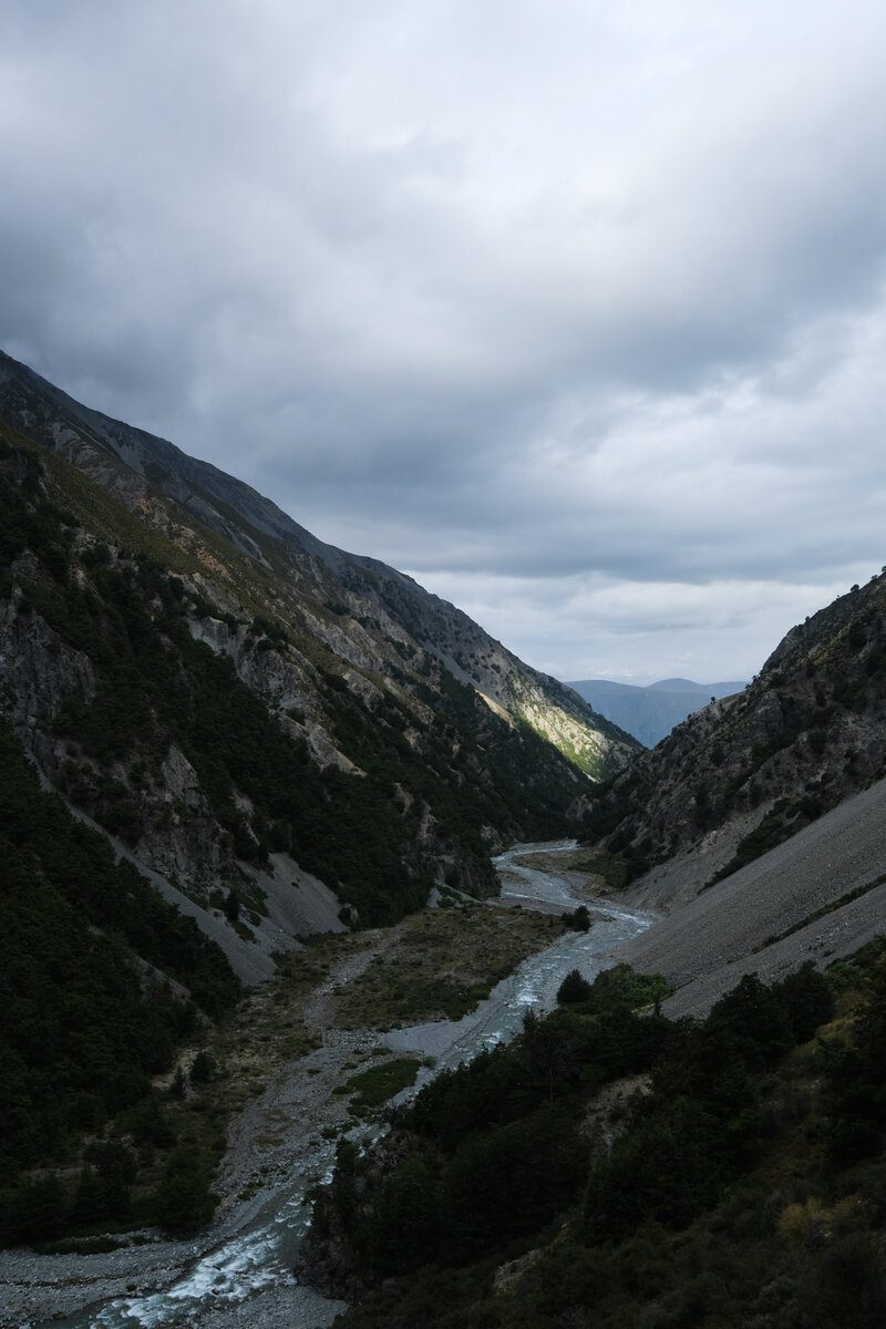
We were glad when finally a bright orange triangle marked the beginning of a visible trail leading up the side of the mountain. After a steep ascent and a few hundred meters of walking we then saw what this trail next had in store for us. The path led back down into the valley, through the river, and then just as steeply back up the other side. But at least we could finally see an end to the river crossings.
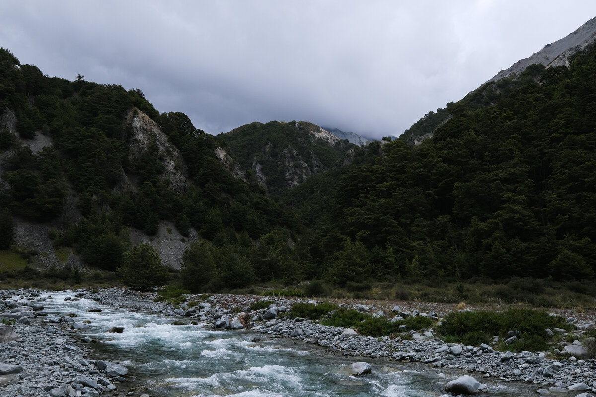
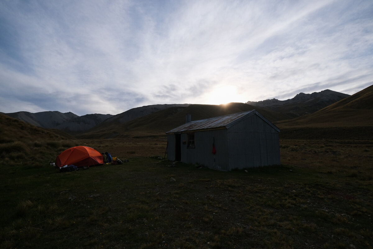
Of course, the last river crossing ended up being a new big challenge. The location for the crossing was far from perfect, even far from merely good. The base of a swingbride that didn't exist anymore showed that obviously DOC didn't really deem this a good spot either, but we had to get through anyways. The current was strong and the river hip deep, some white water foamed up. But together we braved it, and then it was just that long climb up the hill until we could finally see a rusty tin roof peeking out above the hilltop.
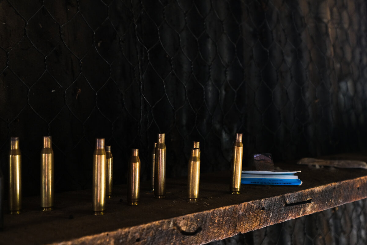
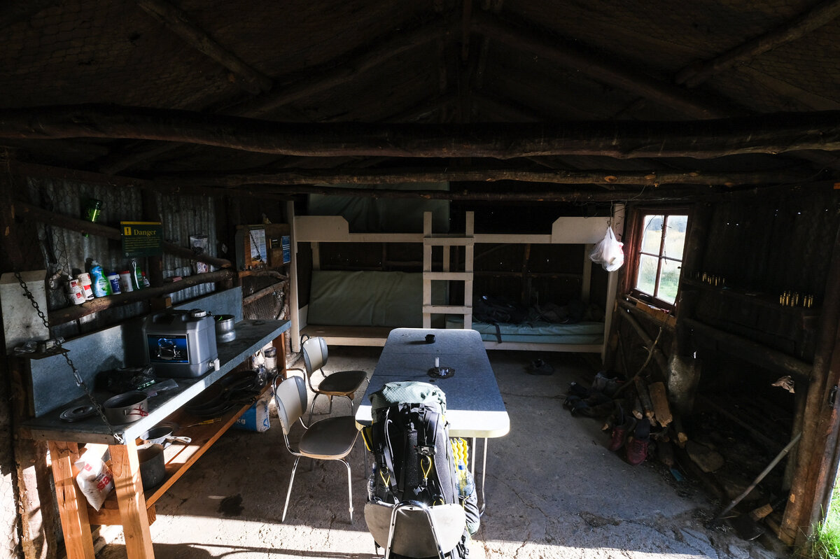
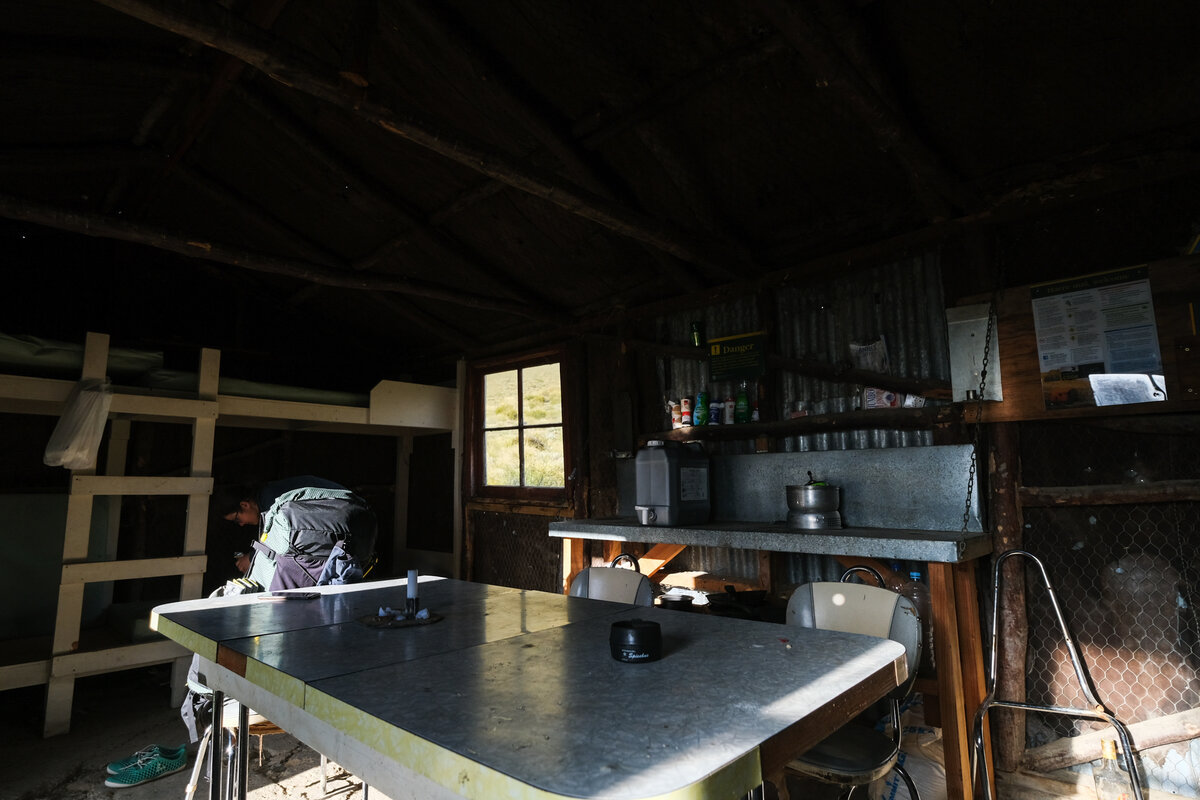
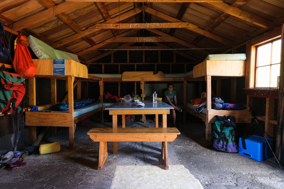
When we arrived at the hut, a hunter and three kiwi trampers (and two dogs) already occupied it, leaving exactly two bunks for the two of us. Yay for that! After getting out of our still soggy clothes we shared stories of the river crossings with the three kiwi weekend trampers, who told us about their dogs being swept away so they had to retrieve them and carry them across.

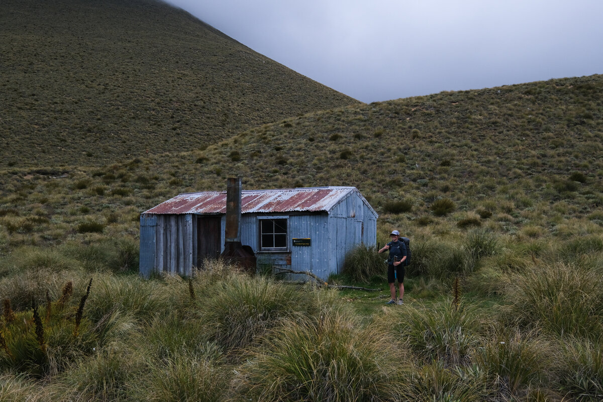

Crooked Spur Hut to Royal Hut
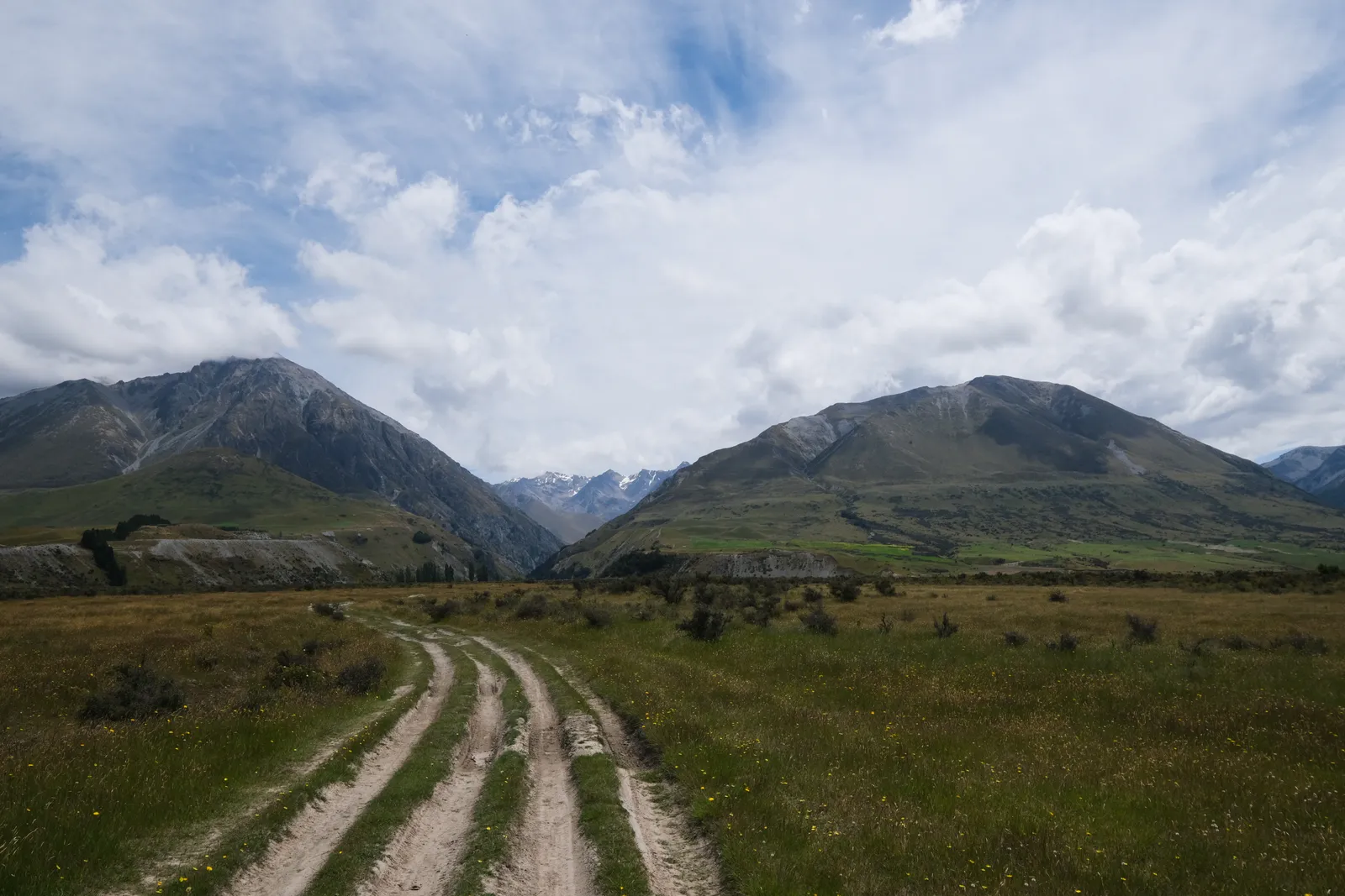
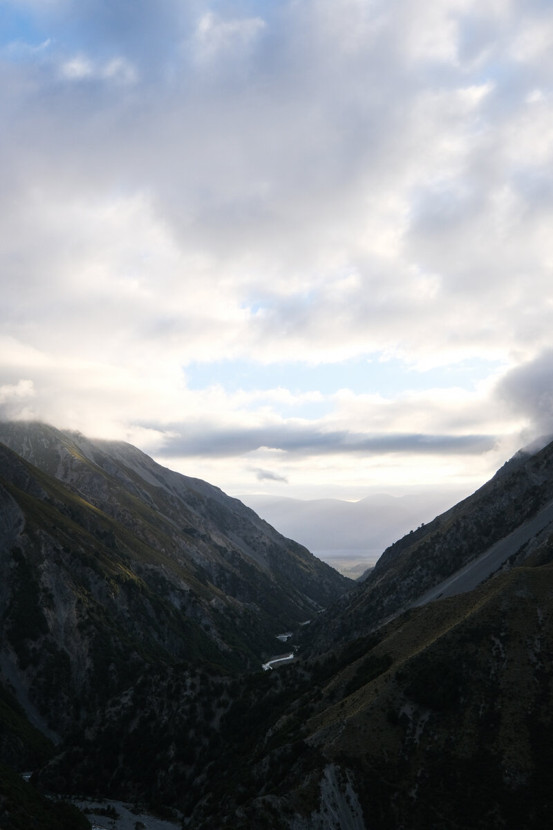
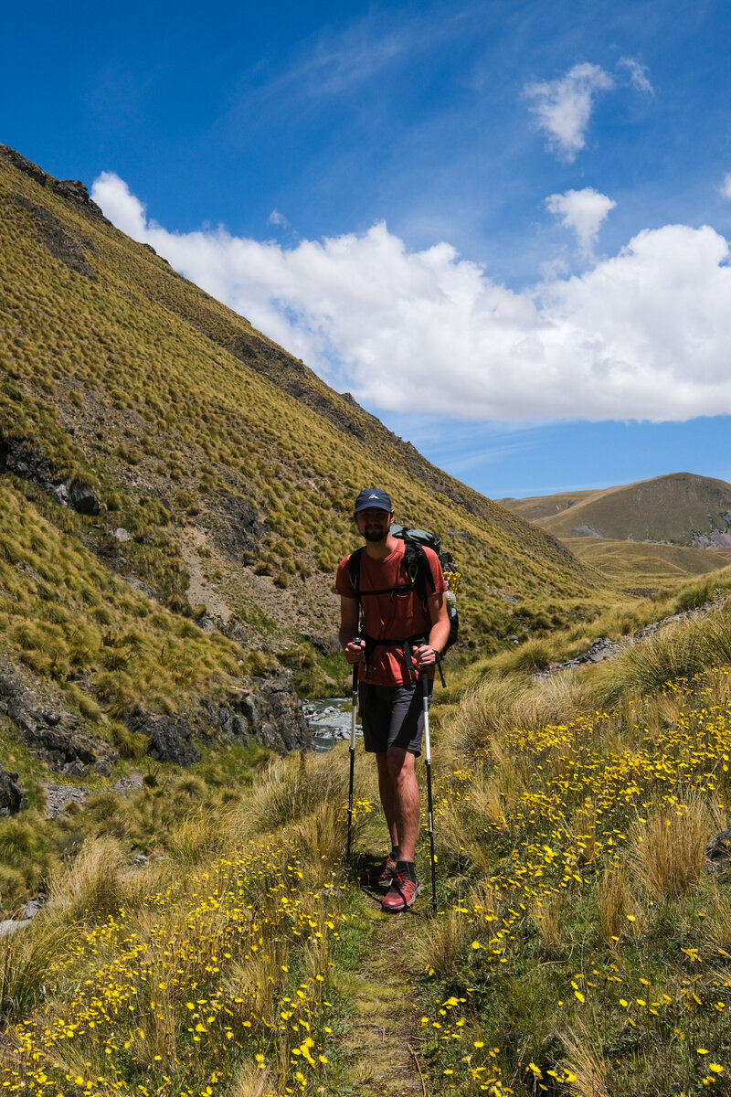
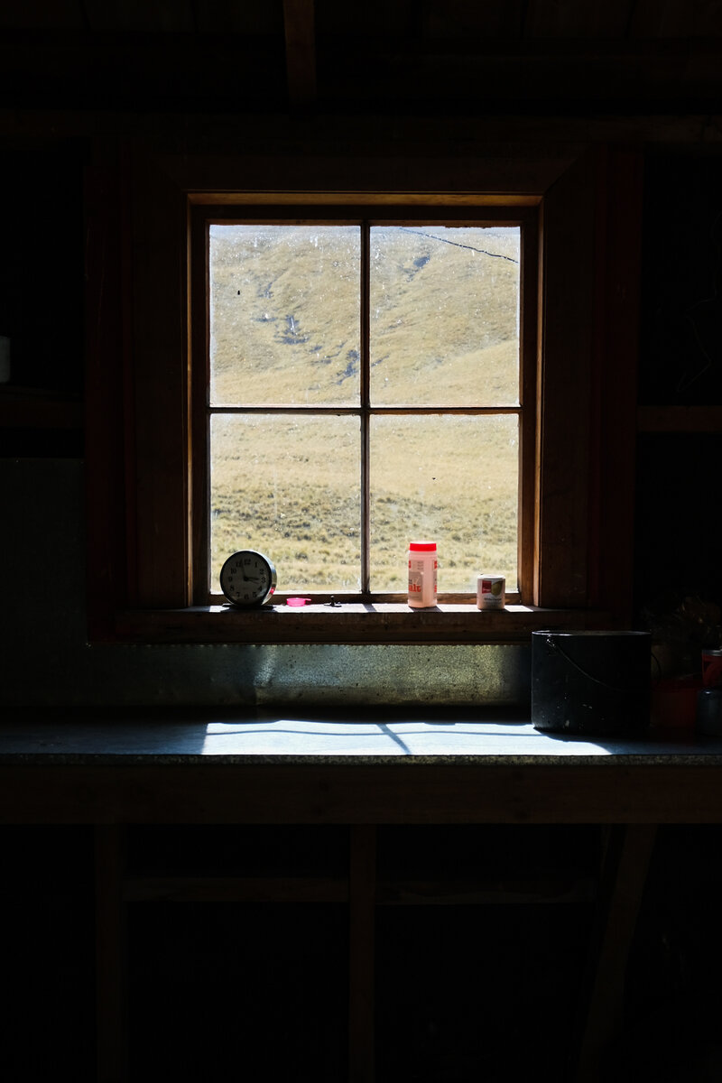
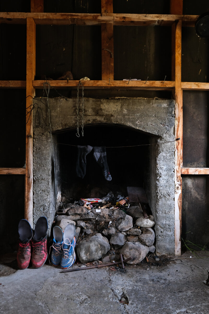
Day 2 luckily didn't involve quite as many crazy river crossings as the first, even though there were a few, but they were also much easier. We had really nice weather and walked through tussock covered hills most of the day, crossing over a few hills and saddles. We had lunch at Stone Hut, a really nice old Hut with a stone fireplace. We shortly considered just staying and calling it a day, but then continued anyways.
The longer we walked the more we got annoyed by the tussocks, as we kept tripping ourselves with the long grass. Also some areas were a bit swampy, but all in all it was a nice day.


Once we got to Royal Hut, we saw two tents pitched outside already. We thought this was the first time we wouldn't get a bunk in the huts, but there was still space inside - the two couples out there just preferred camping in the tent to sleeping in a crowded hut. Which was good for us.
We enjoyed a short wash in the river before making dinner and then dropping onto our bunks.

Royal Hut to Stag Saddle
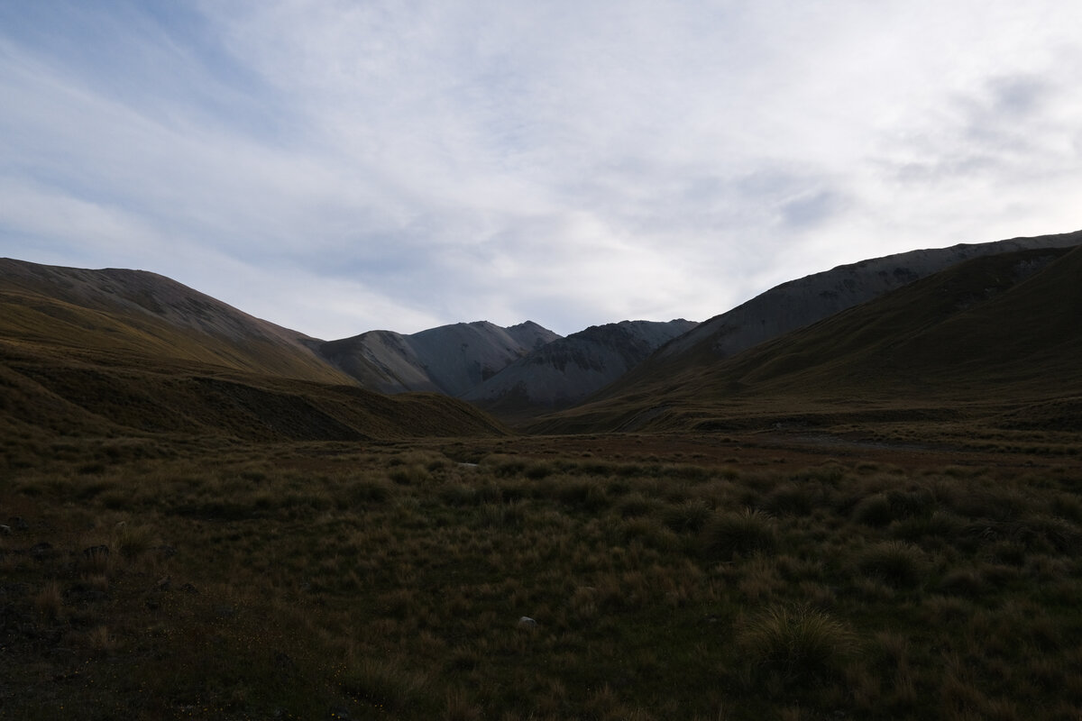
Royal Hut to somewhere in the middle of nowhere
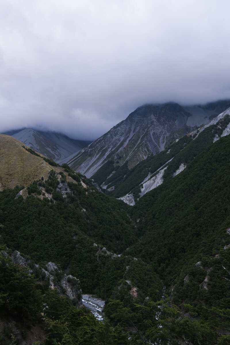
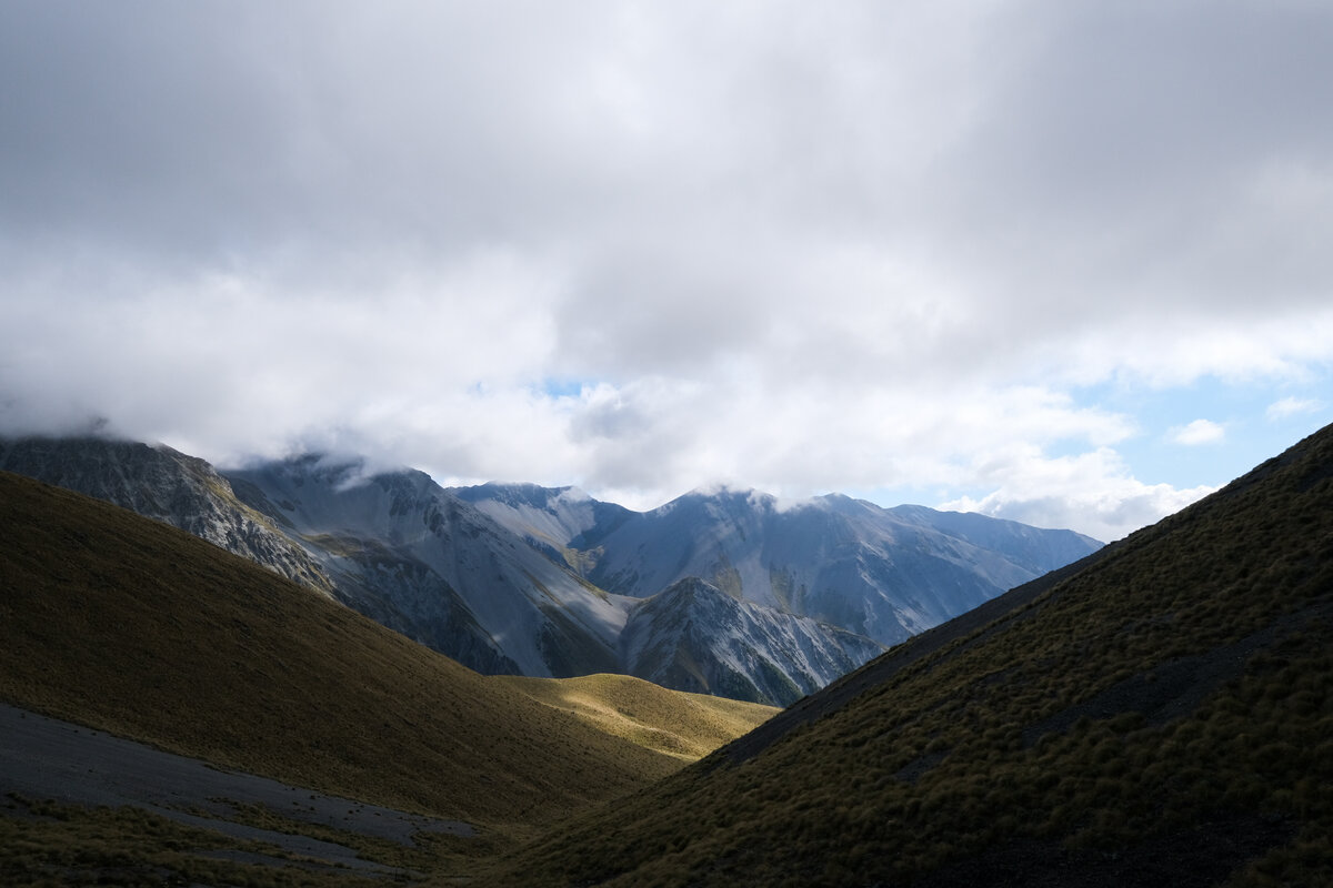
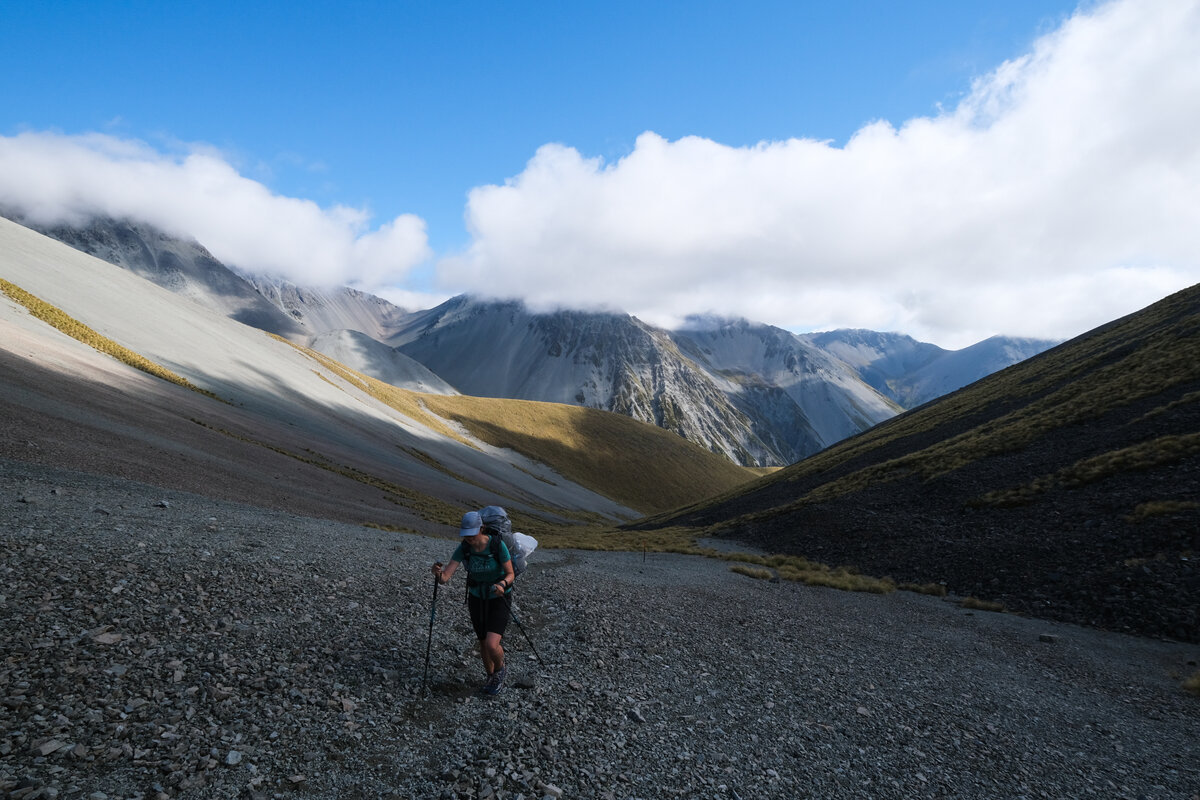
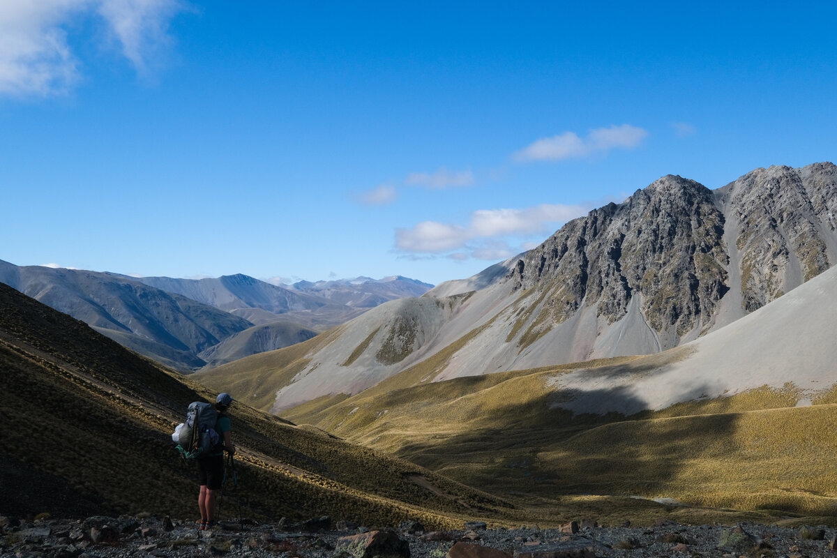
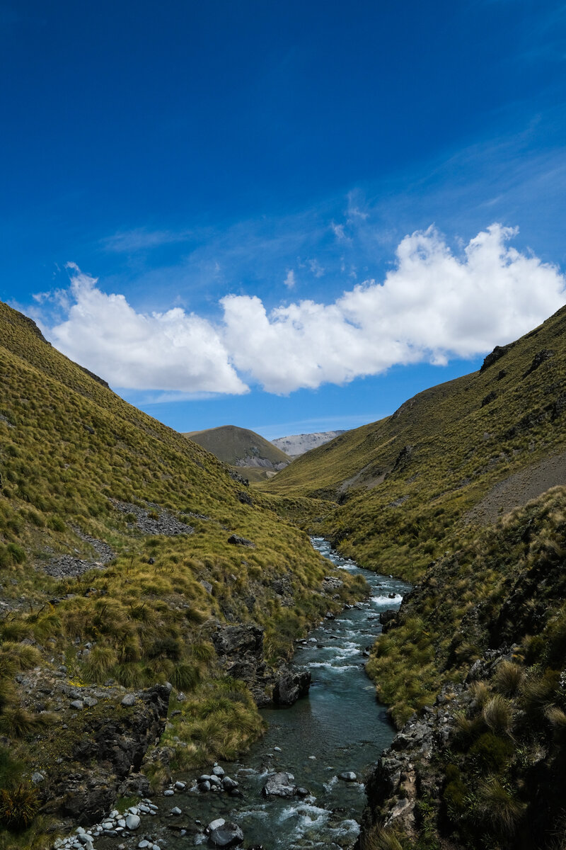
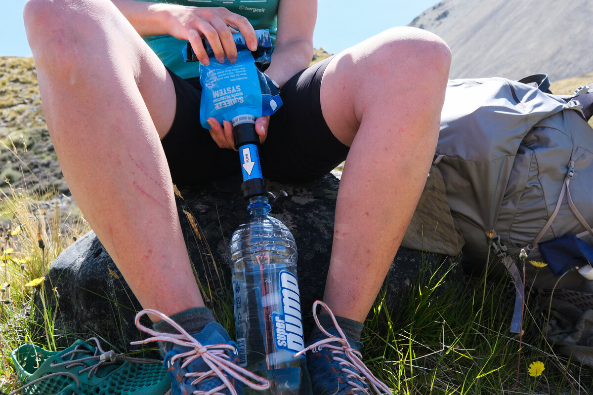
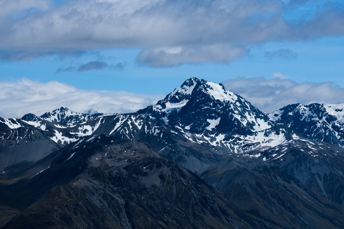
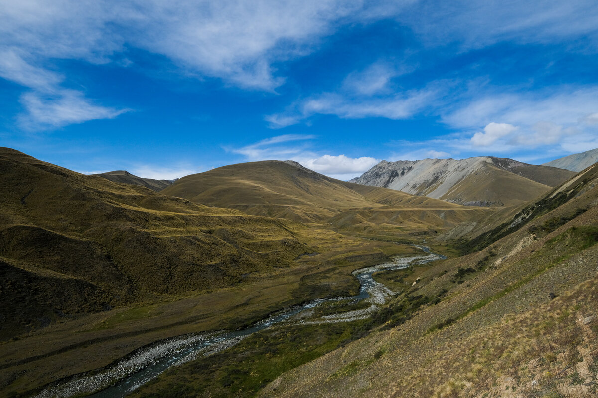
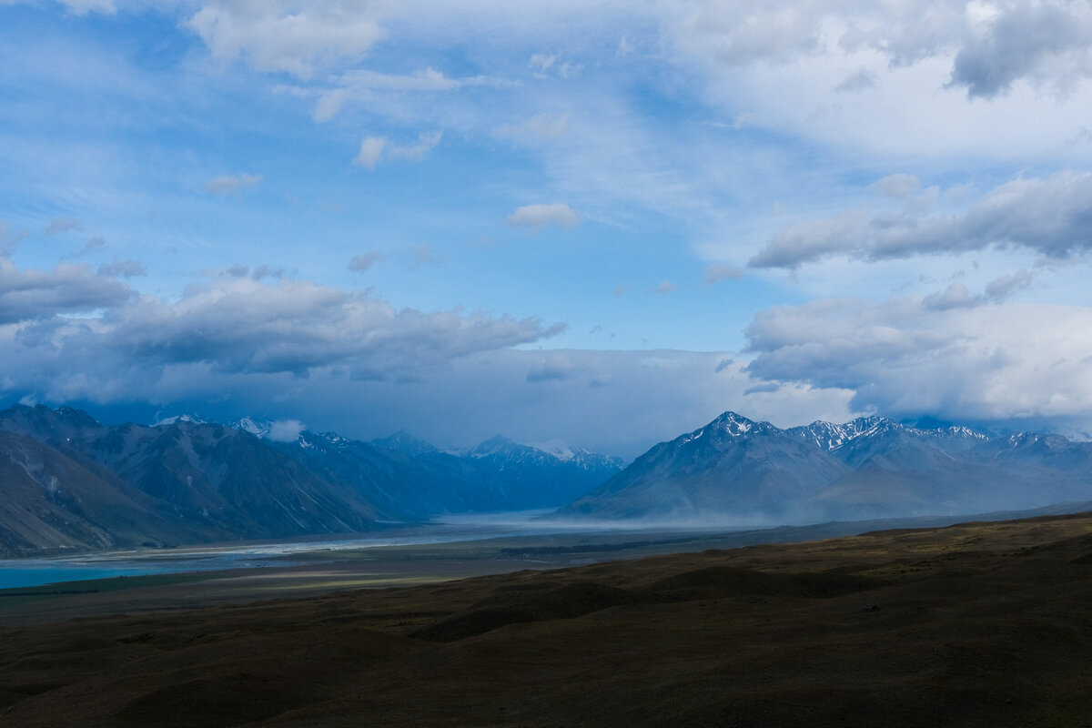
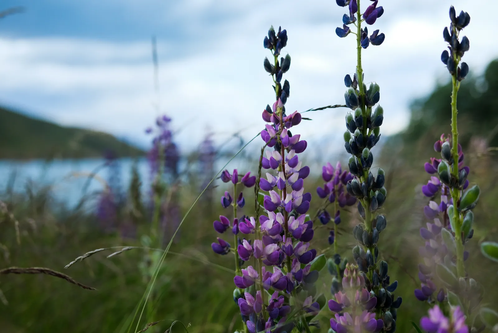
Today had something special in store for us: it would lead us to the highest point on the Te Araroa Trail, Stag Saddle. First we had to get to it though, which involved a bunch of crossings of Bush Stream - which luckily really just was a tiny stream up here and all the fording was easy. Then a climb on a tussock covered slope, a walk through a boggy valley floor, and then another bit of a climb across a field of scree.
And then all of a sudden we were there, up on the highest point of the TA, and somehow it hadn't even been that hard.

We rewarded ourselves with some Bumper Bars anyways, and then used the cellphone reception on the saddle to order rental bikes for the stretch of trail between Lake Tekapo, which we planned to reach the next day, and Lake Ohau.
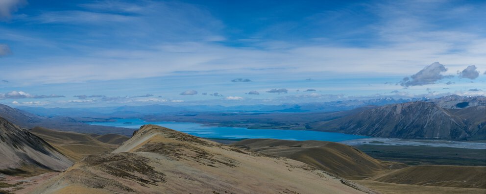
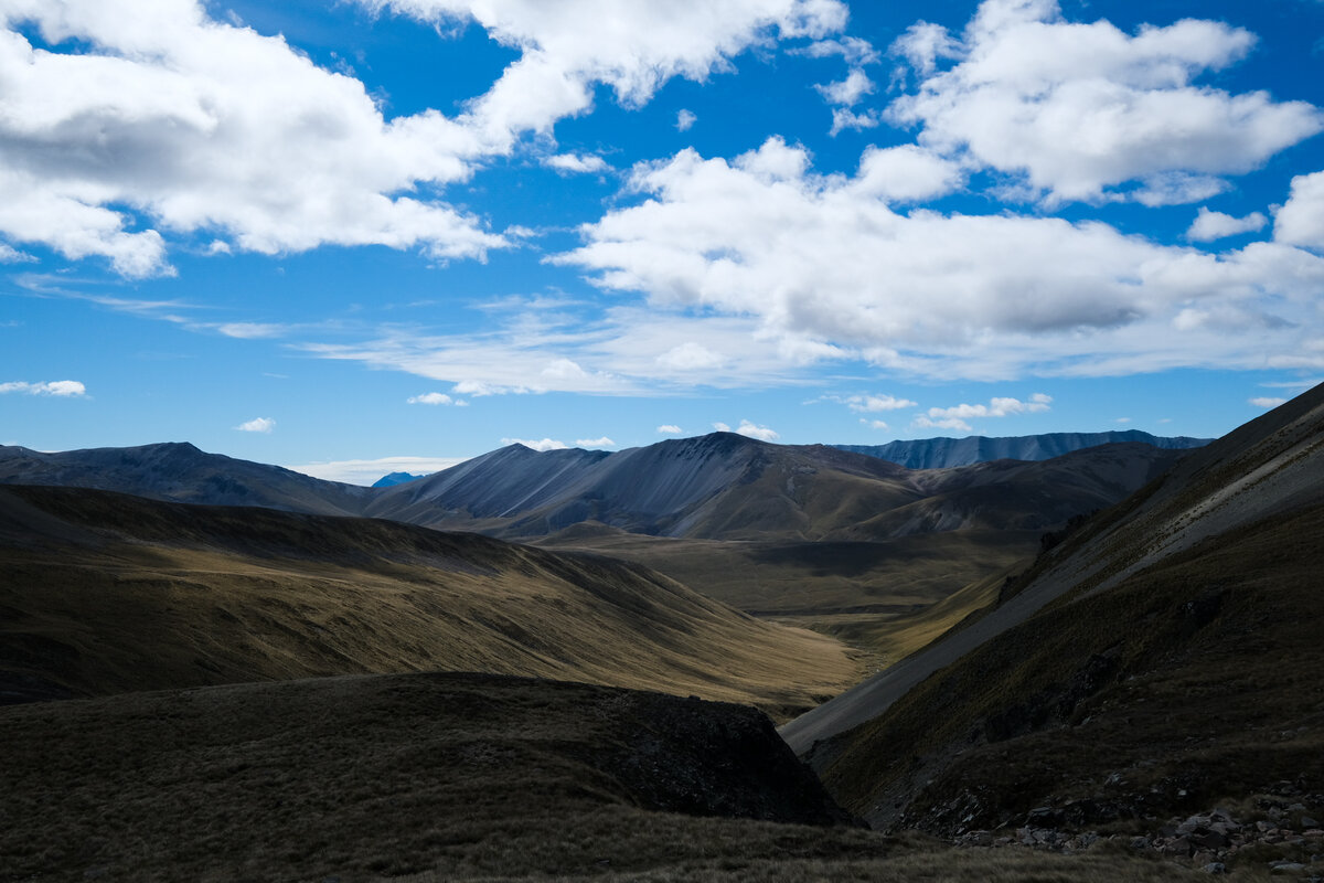
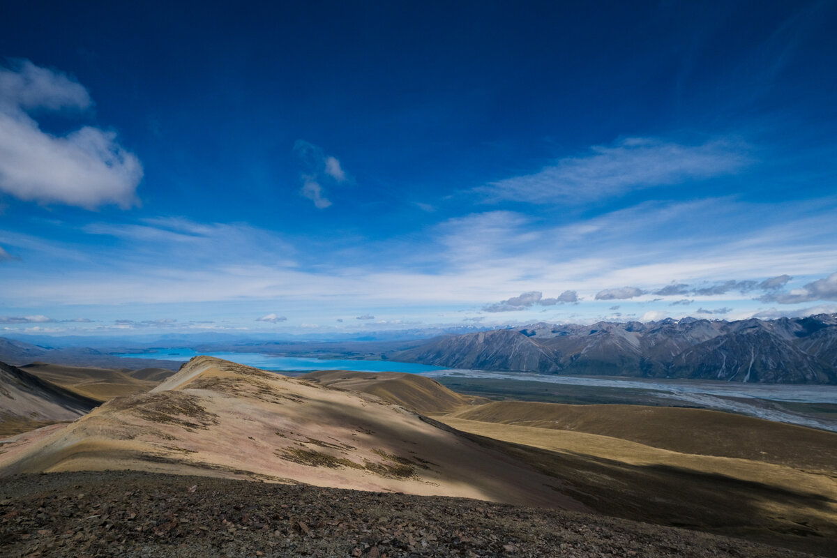
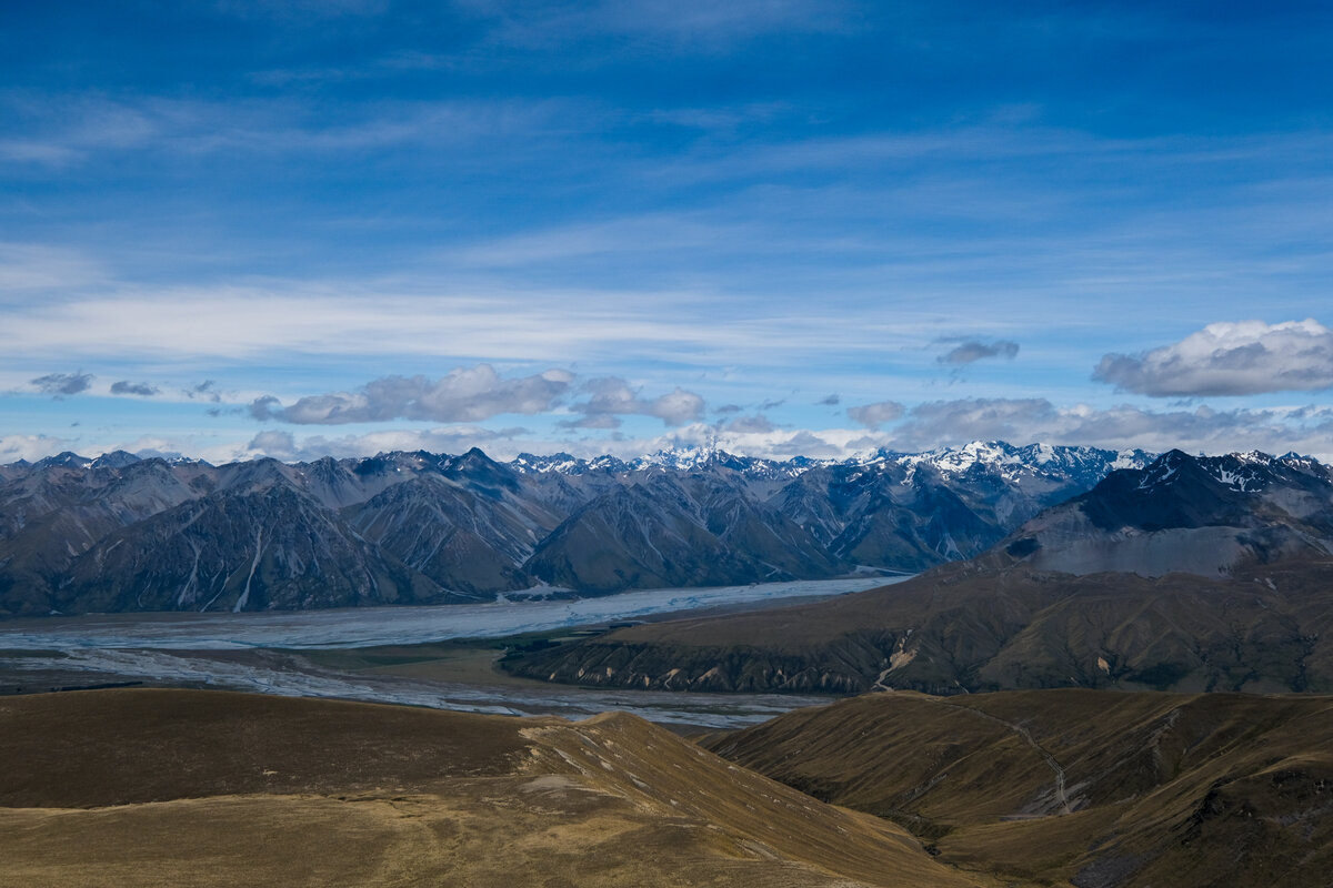
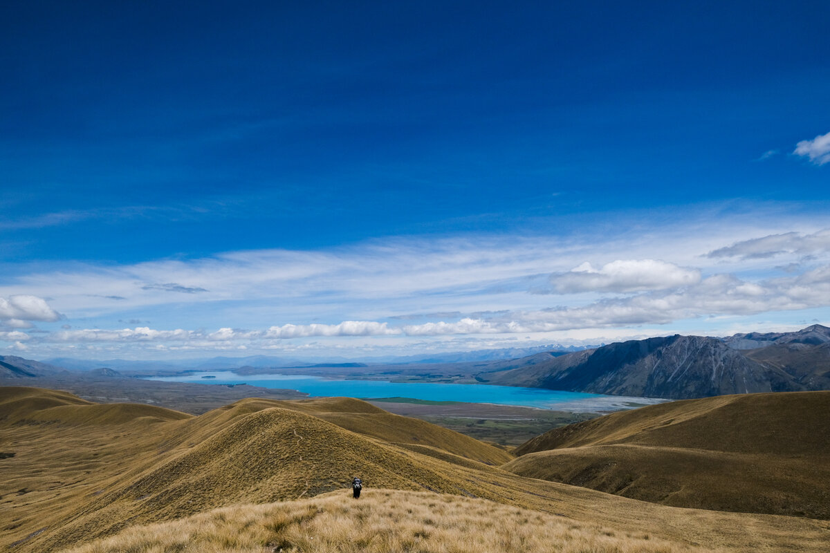
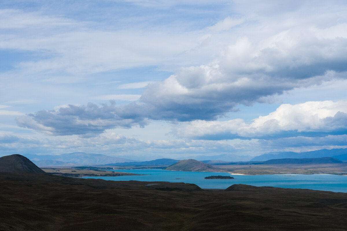
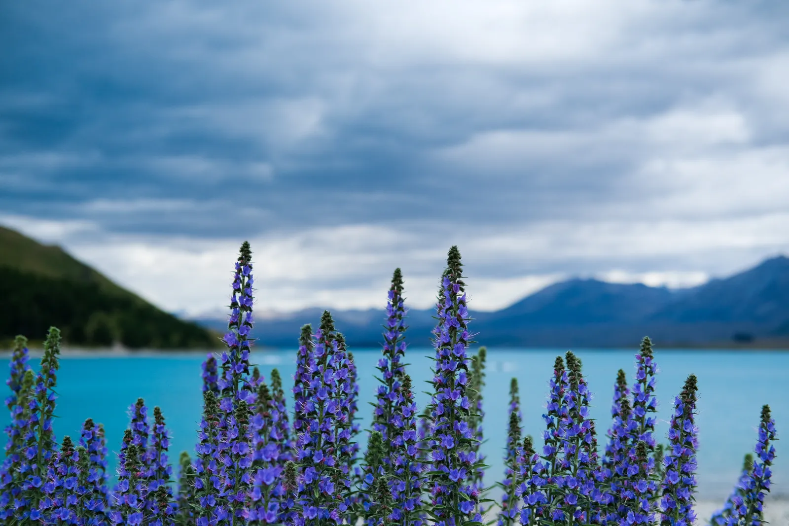
After our little break we had to decide how to continue. The trail notes suggested a track across the ridgeline of the mountain to our right, instead of walking down in the valley floor as show on the maps. We just weren't sure how to get up there. So we grabbed our trekking poles and scrambled our way up to the ridge through a huge field of scree - and the view from up there was really all the reward one needs for climbing up a mountain. We had a beautiful view of Lake Tekapo from above and im the distance we could even see Mount Cook.


Walking from Stag Saddle to a camp in the middle of nowhere
The wonderful weather of course helped make this a perfect experience and we used the great atmosphere to have a lunch if tortillas with peanut butter and chocolate spread. It never tastes as good as it does with an amazing view and after bit of tramping.
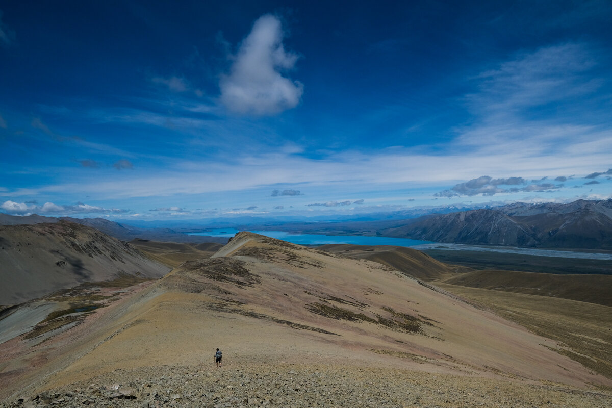
Walking on the ridge was easy, there was a well formed track and going was a lot better than it probably would have been down in the valley floor through all the swamp and tussock.
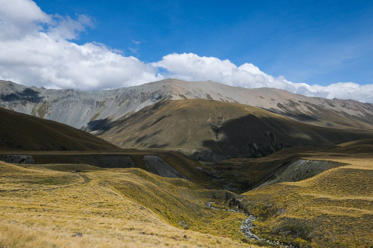
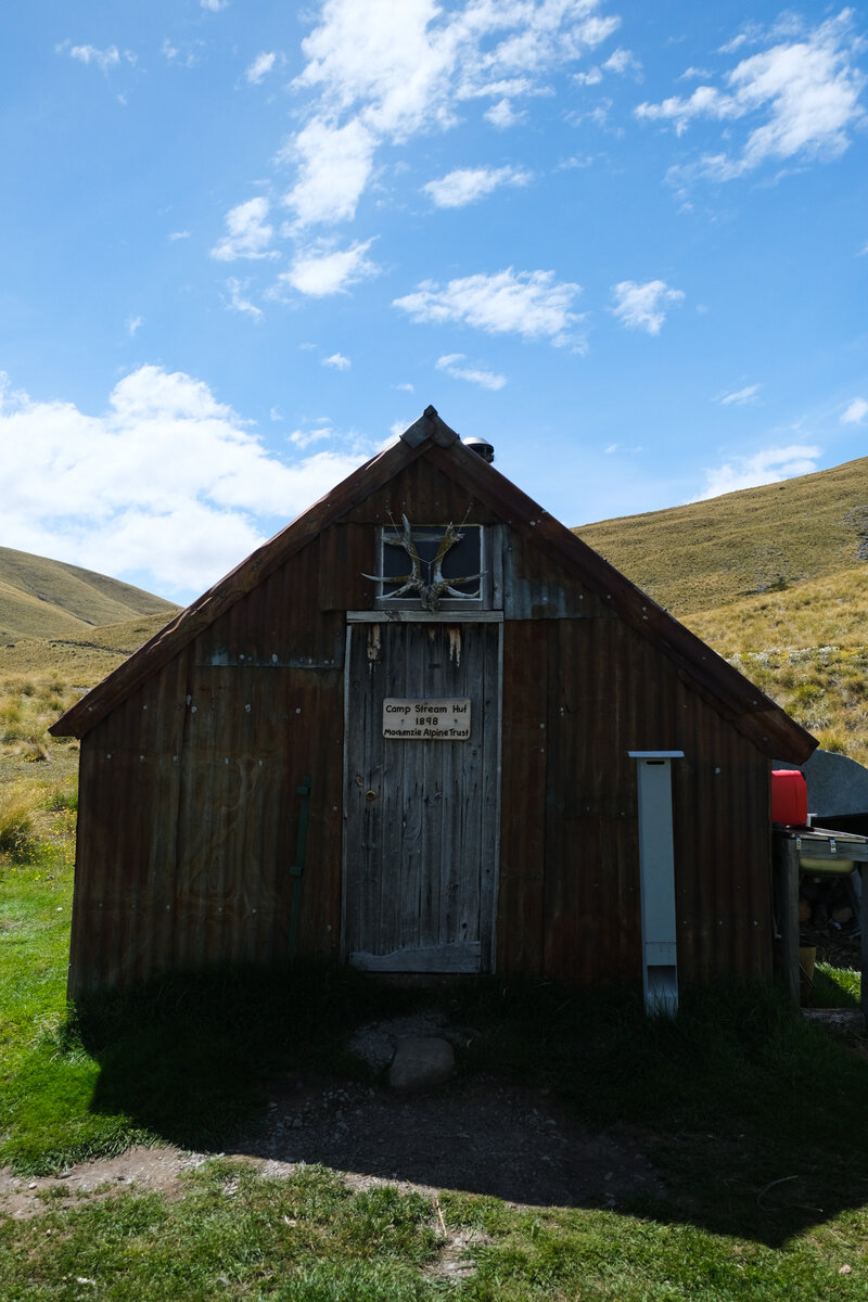
After the ridge we came by Camp Stream Hut, where we initially planned to stay, but then decided to walk on so tomorrow wouldn't be such a long day - after all we had to reach Tekapo to pick up our bikes.
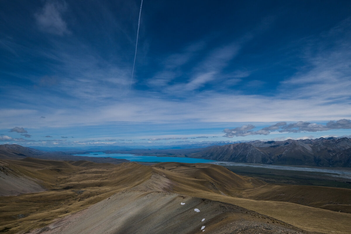
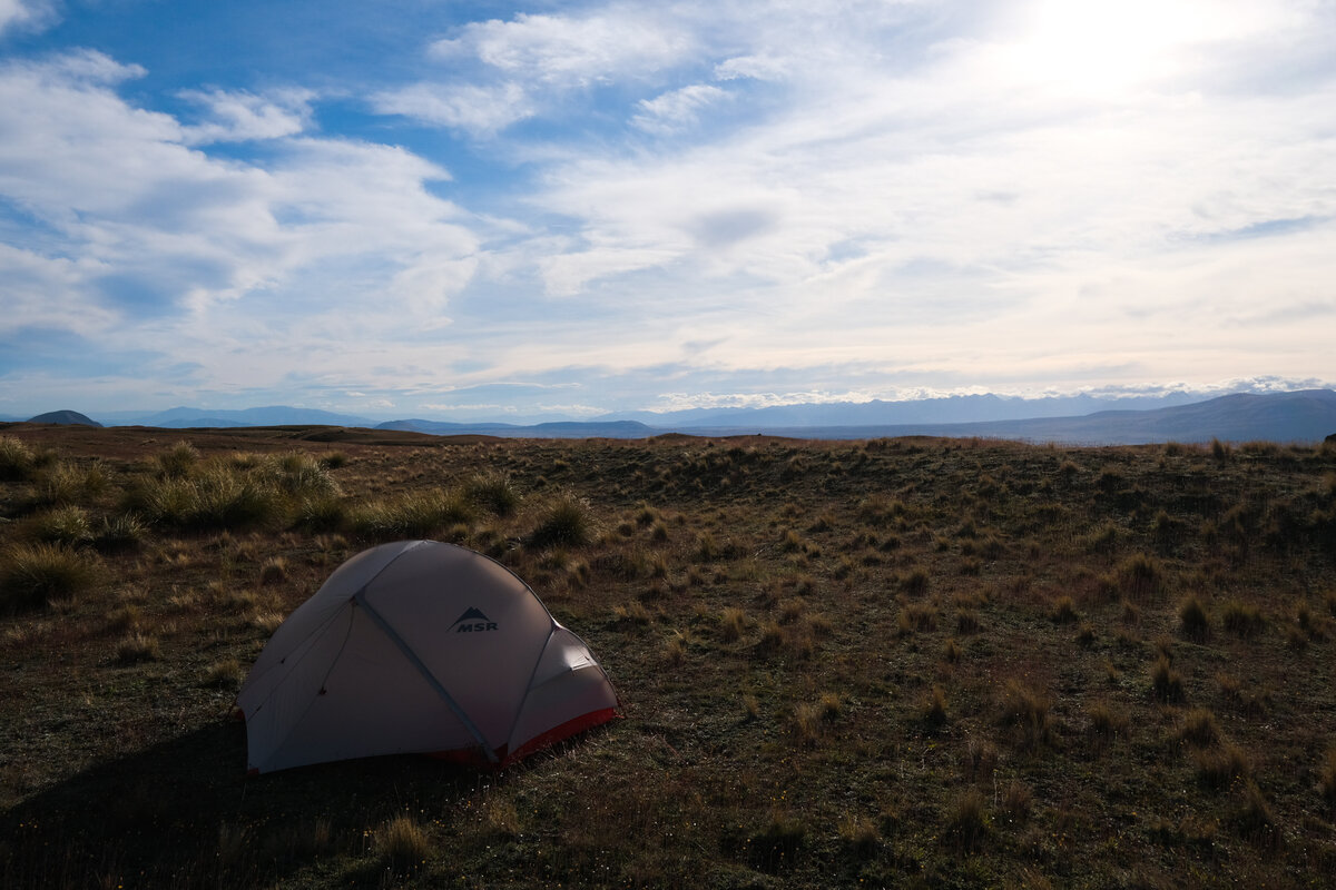
Instead we spent the night on a plateau shortly after starting on the "Richmond Track", which would eventually lead us to Lake Tekapo. It was our first night camping since the Queen Charlotte Trail, and the first night "Freedom Camping". We did enjoy finally camping again, but unfortunately the night was a bit windy, and the sounds of the wind rattling our tent woke us up a few times.


Walking out to Lake Tekapo
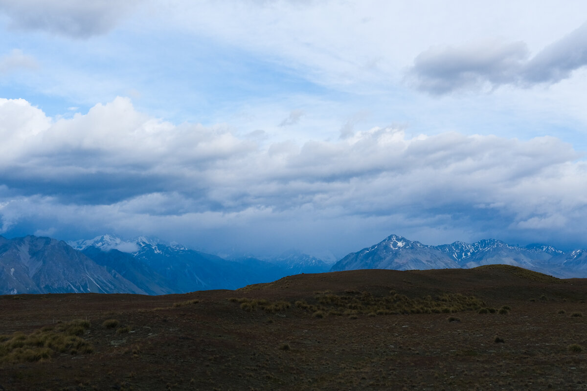
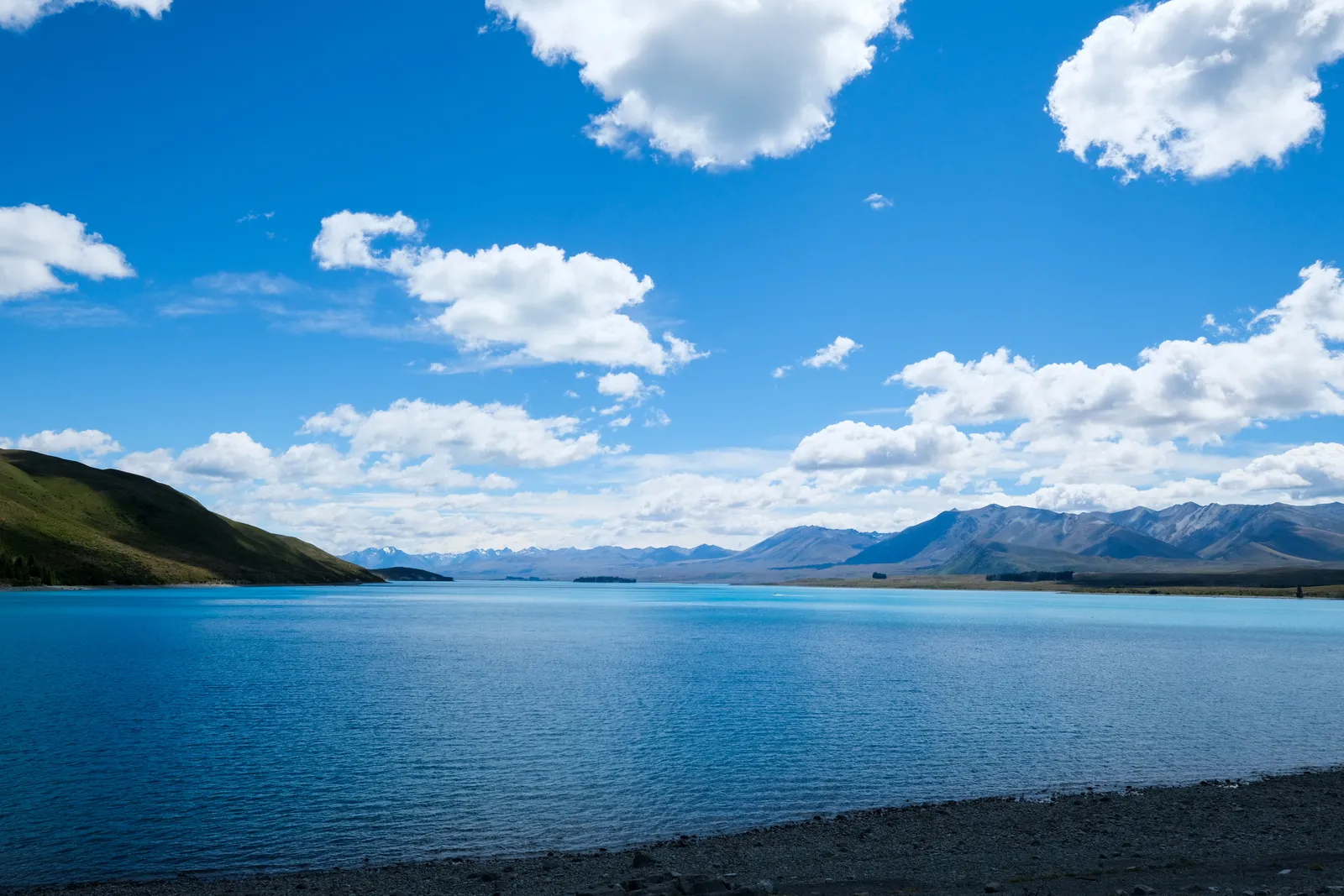
After our windy night camping in the wilderness we got up early since we had to walk about 28km to Tekapo. We walked across the plateau, having nice views of the Lake along the way. The path slowly wound its way down through tussock covered hills to the Carpark and shortly before we got there we had another picnic lunch with a view.
By then the sun was once again burning down on us - we have been so lucky with the weather so far, sometimes almost too lucky - and we dreaded the 16km road walk from the car park into town. We decided to hitch it if we could and in the end we were lucky and got a hitch after just a few kilometers on the road. With the sun out like it was, the road walk probably would have been very long and exhausting.
Unfortunately we had to realize quickly that Tekapo was busy, very busy and literally all accommodation was booked out. We walked to the edge of town to see about a camping spot in the Holiday Park and even there, the signs outside declared "no vacancy" for every possible type of accommodation. Lucky for us, in regard to unpowered campsites it only meant there were no drive-in tent sites left, but they did have a spot for us and our tiny tent, since we came without a car. But even those were almost gone - which got us just a tad bit worried about the coming days and where we would sleep then, if things stayed that busy.
Tekapo overwhelmed us - so many people, lots of Asian tourists. It was hard to take after a few weeks of mountain solitude where we literally only met about ten people a day, and often even less.
Later in the day our rental bikes with trailers for the backpacks were dropped off, basically a day early - which was great for us because that way we didn't have to worry about picking them up somewhere in the morning.
Leave a comment